Ents,
My wife & spent two incredible days at Letchworth State Park,
located in
Western New York from 9/29-30/08. My wife had been there once
when she was
a very young girl, and this was my first time there. We decided
to stay at
the Glen Iris Inn:
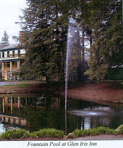
http://www.glenirisinn.com/
I highly recommend this very nice Bed & Breakfast for all
Ents who wish to
spend some serious time in this area. Expect to pay ~$100 a
night, a bit
pricey, but you'd pay close to that for a chain hotel anyway.
They have a
nice dining room downstairs and a large common room with old
furnishings on
the 3rd floor. Remember to take a look at the old pics of old
growth forest
in the ravine located on the walls here. The oaks and tulips
must have been
incredible here before the logging operations of the 1800's.
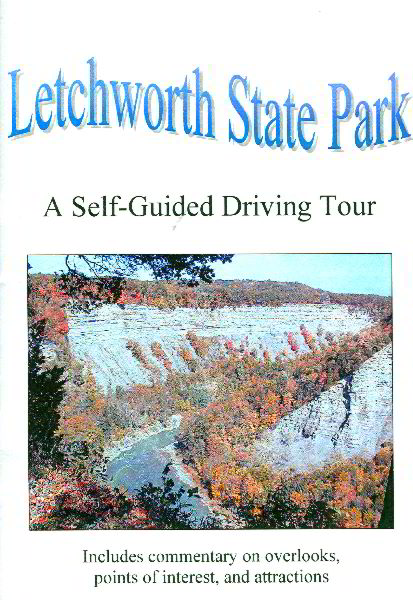 While at the Inn, we purchased a small pamphlet/book entitled
'Letchworth
State Park: A Self-Guided Driving Tour'. It includes commentary
on
overlooks, points of interest, and attractions for a nominal
price that
benefits the Friends of Letchworth State Park. For someone
who's never been
there before and wants to streamline there time at the hotspots,
it is a
MUST purchase. I will be taking several excerpts from this
pamphlet
throughout the post. So, here's the first excerpt about the
Glen Iris Inn:
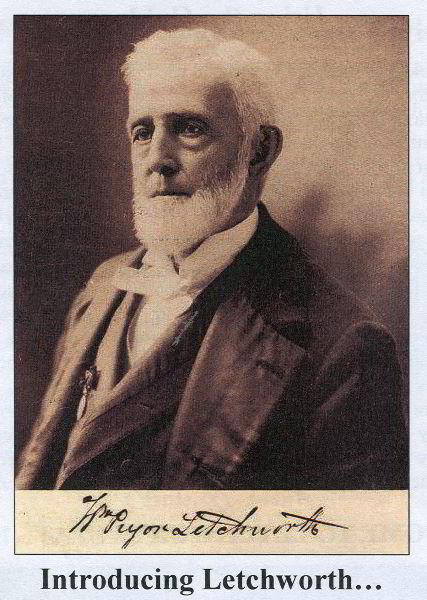 "The Glen Iris was the home for many years of Mr. William
Pryor Letchworth,
the Buffalo businessman and philanthropist responsible for
creating
Letchworth State Park. In the years before the Civil War. Mr.
Letchworth
became wealthy as a partner in the Malleable Iron Works, but was
damaging
his health with his workaholic habits. He was looking for a
rural retreat
to use as a summer home. He traveled to the Genesee Valley and
rode the
train across the High Bridge. From there, he could see the
Upper and Middle
Waterfalls and the tavern that was to become the Glen Iris. The
area by the
river was a booming industrial spot. The hills had all been
logged to
provide lumber to build the wooden railroad bridge and cabins
and shacks for
the workers. On the eastern bank, a canal was being
constructed. The
Genesee Valley Canal was intended to connect the Erie Canal, in
Rochester,
with the Alleghany River near Olean so canal boats could reach
the Gulf of
Mexico. There were mills on the river and side streams, and
stores and
hotels for the residents and travelers on canal and railroad. A
painting of
the area in those days is on display in the W.P.L. Museum.
Mr. Letchworth saw the beauty that was not hidden by the
clutter and
bustle. He purchased land, and continued to buy until he had
1,000 acres,
including all three of the waterfalls on the Genesee. The Glen
Iris was
remodeled and the 3rd story added. He had the shacks and mills
along the
river removed, and planted trees and gardens. Other trees were
planted as
gifts from friends or to mark special occasions. Several of
these Memorial
Trees remain on the Glen Iris lawns and some are marked with
signs.
Mr. Letchworth, who never married, was generous with his
estate. People
came from the cities to spend weekend days walking in the woods.
When his
estate was threatened with the prospect of a dam being built at
Portageville
that would have silenced the waterfalls and recreated an
industrial scene in
his sylvan paradise, Mr. Letchworth turned to the State. He
deeded his
property to the people of New York to become a Park, with the
provision that
such a dam would never be allowed. When MR. Letchworth died, in
1910,
Letchworth State Park was created.
After Mr. Letchworth's death, his home was used as the first
administrative
office for the park, and was remodeled into an inn that park
visitors could
stay in.
The Glen Iris has been remodeled many times since its
building in the
1830's. Late in this series is the extensive work done in 1991
to hide as
much as possible the necessary modernization, to restore the Inn
to its turn
of the century appearance.
The name "Glen Iris" has a couple of possible sources. One,
and the most
likely, is that Mr. Letchworth, well versed in mythology,
combined the name
of the Greek Goddess of the Rainbow, Iris, with the Welch term
for a secret
and mysterious valley, glen, into an appropriate name. Another
possibility
is that he was courting and trying to impress a lady named Iris
Glenny. If
this is the case, his effort was unsuccessful........"
 The Inn is located right at the apex of the Middle Falls.
The view is
spectacular. The Middle Falls very much reminded me of a "mini"
Niagara
Falls. I must stress that there is just so much to see here,
the park is
over 14,000 acres, that there's no way you can see it all in a
day, let
alone two, but my wife & I gave it a pretty good try.
I've been wanting to hit Letchworth State Park for years,
ever since Bruce
Kershner gave me the bug to visit ALL of Western New York's
special places
and old growth forests. I haven't hit them all yet, but this
trip certainly
will give future Ents a good place to start to further document
big/tall/old
tree sites within this gorge system.
In short, it's like a large scale Zoar Valley. Absolutely
gorgeous, and
only accessible for the newcomer by a well established trail
system.
Matthew Hannum and Doug Bidlack briefly spoke of their past
trips here, but
neither had yet collected any hard tree height data:
http://www.nativetreesociety.org/fieldtrips/new_york/letchworth.htm
Their comments sparked interest, and so my wife & I decided
to go there for
our yearly vacation instead of the general Lake Placid area in
the
Adirondacks.
Just the geology of this river gorge system is worth the trip
alone. The
pamphlet states:
"The canyon of the park came into being long before Mr.
Letchworth
discovered it, though in a geological sense, it's quite young.
About 11,000
years ago, the last of the great Pleistocene glaciers melted
from the land
leaving the ancient valley of the Genesee River blocked with
rocks and
debirs. A lake formed, and when the water rose high enough, the
river
escaped, to find a new course around the end of the blockade.
As the river
flowed north again, it carved the hills and canyons we now
admire. The
process of the river being dammed by glacial debris and then
escaping
repeated itself several times, thereby cutting three separate
canyons that
now distinguish Letchworth State Park.
Around 350,000,000 years ago, in the Devonian era, there were
great
mountains far to the east. These mountains are known as the
Appalachians
today. Fine sand and clay mud washed westward from the
mountains into a
tropical ocean. The ocean filled with sediments and the rock
layers now
visible as the cliffs of the canyon were compressed from those
particles.
Because these outwashed materials were fine sands and clays,
the rocks that
make up the gorge are soft, and erode easily. Even with soft
rocks, it can
be hard to imagine the river below carving such a space, but
erosion is more
event-based than a steady process. The great changes occur in
floods and
cloudbursts. When you see the Genesee River in spring flood,
you gain a
different image of its power than from watching it gently ripple
along in
the summer. Visit the William Pyror Letchworth Museum and ask
to see the
video of the Flood of 1972 to see the river at its most
powerful.
Now, the canyon changes mostly by growing wider, as rocks and
earth fall
from the cliffs, and side streams cut their own channels..."
Here's some basic facts about the park:
"Size: Letchworth State Park is about 17 miles long and
averages a mile in
width. It contains 14,342 acres and is the 5th largest of New
York State's
more than 150 Parks....
Location: The Park is about 35 miles SW of Rochester and 45
miles SE of
Buffalo and sits on the border between Livingston and Wyoming
Counties...."
Once my wife & I had a hearty breakfast, we set off for a day
of exploration
of the park. First stop was to check out the Lower Falls
Terrace Woods
mentioned in 'The Sierra Club Guide to the Ancient Forests of
the
Northeast', by Bob Leverett and Bruce Kershner:
"At 550 feet, the Genesee Gorge in Letchworth State Park is
the deepest
vertical-walled canyon in the Northeast. Like Niagara Falls,
it's also a
good place to see communities of ancient trees growing on its
cliffs and
ravines.
Perhaps the easiest place to visit is Lower Falls Terrace
Woods, a 7-acre
parcel of impressive ancient hemlock and sugar maple near the
110-foot Lower
Falls. Many trees are taller than the huge falls, with one
white ash
reported to be more than 130 feet.
The cliffs harbor the most ancient trees. At the Great Bend
vista along the
west rim, people have marveled for decades at the yawing abyss
and great
curving layers of canyon walls. Use binoculars to see
500-year-old red
cedars attached to those walls..."
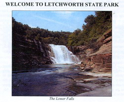
The following is quoted from the pamphlet about the Lower
Falls:
"The Lower Falls is not visible from a roadside overlook.
One must earn a
glimpse at it. A peek may be obtained from beyond the picnic
shelter, but
to see more, one must follow the Footbridge Trail. Many steps
down lead one
into the gorge that was once the riverbed. At the bottom of the
steps, to
the right, is a groove in the forest floor that is the remnant
riverbed of
thousands of years ago. The forest here, above the river, is an
old growth
forest. A half-dozen hemlocks exceed 250 years in age. A
tuliptree that
died in the 1950's was more than 400 years in age. The stairs
that brought
one down the bank were rebuilt in the 1993 and are a close
replica of those
built by the CCC. The Footbridge was also rebuilt at that time,
following
original designs and with concrete formed to resemble the
layered rocks.
Continuing to the left and down a few more stairs leads to an
expanse of
rock known as Table Rock. Upstream is a view of the Lower
Falls, the
fastest changing of river's three major drops. Sketches from
the 1840's
show its lower portion downstream from the footbridge site.
This lower
river continues to cut the downstream sections of the Lower
Falls, which
lack the layer of resistant sandstone that caps the upper drop.
Though not
eroding upstream much in the last century, this lip is wearing
thin. The
river will eventually erode the Lower Falls upstream, out of
view from the
Footbridge. Table Rock is this same layer of sandstone, and
preserves
fossil waves from when it was ocean floor.
Table Rock slopes slightly towards the south bank, so the
flow was
concentrated there and cut through the sandstone and into the
soft shale
exposed on the path to the Footbridge. The narrow channel, or
Flume was
quickly carved. The promontory across the river, below the
Footbridge, is
called Cathedral Rock. Below it, the river swirls into a large
eddy pool."
Sorry about all these quotes, I'm sure many of you are having
flashbacks to
"Leverett's Lounge" of never ending diatribes about his trips
out west,
triple mocha lattes and the like... but, I figured it would give
folks a
good idea about the general background of the site put together
by folks
with many years of intimate experience at the park. Yeh, Bob's
been rubbin'
off on me...
So, for all the tree stat nuts out there... we did get some
measurements. I
found the reported "130+ foot" white ash... I put it at 9.1ft
CBH x 119.4ft
high. It had a dead top, and is on its way out. It probably
was in its low
to mid 120's at best before dieback. There IS a little old
growth forest
here though as reported. My wife & I went to work trying to get
some
heights on what appeared to be the tallest hemlock and other
tree species in
the area:
*Species
CBH Height*
Am. basswood 6
103.8
Am. beech 4.2
72.1+
E. hemlock 8.4
117.2
E. hemlock 8.9
119.1
E. white pine N/A
90.1
E. white pine N/A
94
N. red oak
7.1 84.1+
shagbark hickory 4.9 102.1+
shagbark hickory 5 102.1+
sugar maple 8.5
105.6
tuliptree
5.6 117
white ash
9.1 119.4
white oak
7.2 78.1+
white oak
9.1 87.1+
I made the following mental notes for eyeball age guestimates
of trees here:
*Species
Estimated Age on the low end*
E. hemlock
200
white oak
200
sugar maple
150
Other species present but not measured:
American yew! Wow, I never get to see these growing
naturally in PA. They
were growing on steep banks though were the deer couldn't get to
them
Also, black birch, yellow birch, cucumbertree, E. hophornbeam,
black locust,
quaking aspen, black walnut, big tooth aspen, E. red cedar,
witch hazel,
staghorn sumac, and chestnut oak.
I believe the old growth area was infested with non native
earthworms... no
duff and infested with garlic mustard
Well, I figure that plenty of typing for one post. That
ought to be enough
to put most of you to sleep for the night.
Dale
Continued at:
http://groups.google.com/group/entstrees/msg/6d6ac4b907a49bfb?hl=en&
ENTS,
Continuing the thread on Letchworth State Park...
Once my wife & I had had some basic tree measurements, we started
exploring
the various trails in the vicinity of the Lower Falls. In
particular, we
took the trail from Table Rock down to the river, crossed over the
footbridge and proceeded to Cathedral Rock. While admiring the view
from
the bridge, my wife & picked up the unmistakable order of *Mephitis
mephitis
*, A.K.A. striped skunk. As we crossed the bridge, the trail hugs
the steep
wall ravine. It reminded me of a smaller version of the trail near
the
'Groundhog Slide' at Chimney Rock Park in North Carolina. Anyway,
as we
walked down the steps about half-way down the cliff, we found were
all the
stench was coming from. A striped skunk had fallen off the high
cliff from
above and landed on the trail. Since there weren't going to be any
park
rangers around for awhile, I thought I'd do everyone a "community
service"
by giving the skunk a "burial at sea". The skunk only missed
falling the
next 40 vertical feet into the river by about 1horizontal foot. So,
I
picked it up with a nearby lambs ear leaf and dropped it over the
edge. For
some reason, my wife wouldn't hold my hand after that... I tell ya.
Do a
good deed and see how you're treated?
We continued along trail, passed Cathedral Rock and worked our
way up to the
next flat about 75 more vertical feet. It was here that the
American yew
were growing along the cliff edge. We decided to backtrack from
here and
head back to the vehicle. I wanted to check out Dehgayasoh Creek,
adjacent
to the Mary Jemison Monument.
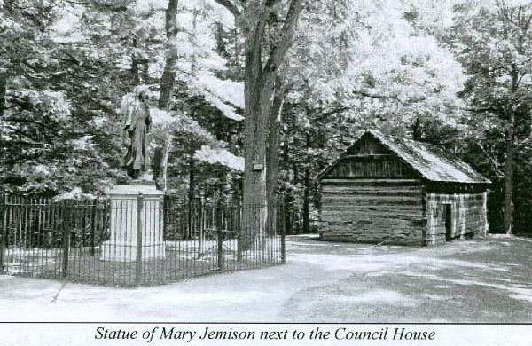
The story of Mary Jemison is well known during the French &
Indian War era.
It is quite noteworthy that Letchworth State Park is where she
decided to
spend a great part of her life, as well as it being her final
resting
place. The pamphlet states:
"One of the primary stories of Letchworth State Park is that of
Mary
Jemison. Subject of historic treatise and popular novel, Mary's
story is
that of a born survivor.
Mary was one of a family of Irish immigrants who settled in the
wilderness
near Gettysburg, Pennsylvania. When she was about 14 years old,
during the
French and Indian wars, when France and Great Britain fought for
control of
North America, a combined French/Indian raiding party attacked the
family
homestead. All the family members except Mary and two of her
brothers who
were not at home were killed. Mary was made captive, taken to the
French
stronghold at Fort Duquesne and was eventually given to two Seneca
women to
replace a relative they had lost in the War.
As such a replacement, Mary could have been tortured, used as a
slave, or
sold to another tribe. Instead she was adopted as a family member,
taught
the language and given such courtesies as existed in the hard life
of a
Seneca woman during war. She was named Degewanus, meaning two
voices
falling, or mingling, to symbolize her speaking both the English and
Seneca
languages, and the end of the two Seneca sisters' mourning when she
joined
their family.
Mary adapted to the Indian lifestyle and married a Young Delaware
warrior.
She bore him a son whom she named Thomas, for her father. In the
matriarchal Seneca society, women had more status than in white
society at
the time, and Mary, speaking English and Seneca, became a noted
member of
the community.
The Seneca sisters moved north-east to a village on the Genesee,
near
present day Cuylerville, called Little Beard's Town, for the Chief,
Little
Beard. Mary, carrying all she owned, walked about six hundred miles
to
joining them from where she was living along the Ohio River. It is
this
trek, with her son and her supplies, that is depicted in the statue
at the
Council Grounds.
Mary, waited at Little Beard's Town for her husband to come, but
word
arrived that he had died during the winter. After living alone
several
years, Mary took a second husband, the warrior Hiakatoo. A Seneca
leader
famous for his strength in battle and his cruelty to captives, he
was always
gentle to Mary, and to the end of her life, she did not speak ill of
him.
In the Revolutionary War, Colonial forces were sent to combat the
Seneca,
who were allied with the British. Troops lead by General Sullivan
burned
many Seneca villages, including Little Beard's town, and destroyed
the food
stored for winter. Most of the villages moved to the British
stronghold at
Fort Niagara to seek help from their allies. Had Mary done this,
she would
have been forced to leave her family and join white society as a
pauper,
becoming a servant. Instead, Mary took her family, now numbering
seven
children, and went to a cabin she remembered from her travels on the
banks
of the Genesee, at Gardeau. There she settled and lived most of her
long
life. When Seneca properties were divided at the Treaty of Big Tree
in
1797, Mary was awarded the Gardeau Tract, as told under the
"Gardeau" entry.
Mary chose to live the Seneca lifestyle, watching and helping the
white
settlers who came in increasing numbers, but never entirely
understanding or
trusting them. The whiskey the pioneers brought contributed to the
tragedies that marred her old age. Mary's son John killed his
half-brother
Thomas and his brother Jesse in drunken battles and later was
himself killed
in a fight with some Squawkie Hill Indians, after all had been
drinking.
Saddened by the deaths of her sons, and burdened by age, Mary
wished to live
with the native people she understood. She had been leasing land to
settlers. In 1823, she sold all but a two mile square piece to land
agents. This sale required an Act of Congress to be legal, since
Mary, as a
non-citizen, born mid-ocean, and as a Seneca woman, had no legal
identity to
hold the land she was selling.
In 1831 Mary sold the remainder of her property and moved to the
Buffalo
Creek Reservation, inside the present boundaries of the City of
Buffalo.
Before she moved, she told her life story to Dr. James Seaver, who
wrote a
book that Mr. Letchworth later read. She died in 1833 and was
buried in a
little cemetery on the Reservation. The growing city engulfed the
forgotten
cemetery on the no longer existent reservation. Souvenir hunters
chipped
away at her gravestone, and her resting place was nearly lost, until
Mr.
Letchworth, learning her story, brought her home to the Genesee.
Mary's
original tombstone is preserved in the William Pryor Letchworth
Museum, as
part of a display about her."
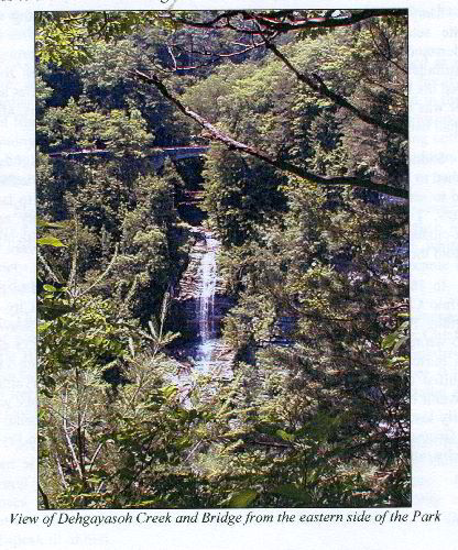
Dehgayasoh Creek runs adjacent to the Mary Jemison memorial. The
pamphlet
states:
"The stream that flows by the Council Grounds before leaping into
the river
was named by Mr. Letchworth in honor of a literary society to which
he
belonged called "The Nameless". In the Seneca language, Dehgayasoh
means
"nameless spirits". The stream and falls are best viewed from the
eastern
side of the park, from the Genesee Valley Greenway Trail (#7). The
picture
of the tumbling water, dropping 150 feet in three cascades, framed
by the
high, arched stone bridge, is well worth the short walk from the
Parade
Grounds Picnic area. The falls and bridge can also be seen from the
newly
restored, railed walkway that leads to the base of the bridge."
I wanted to check this stream out, since the New York Old Growth
Forest
Association listed it as "old growth". I would think the site might
be
better characterized as a type of secondary old growth forest as per
Lee's
definition. There was some scattered old and white oaks that should
approach 150 years. The scattered white pine in the site were not
remarkable in age. I would estimate them to be no greater than 150,
maybe
closer to 125. The stream was a heavily dominated hemlock glen of
fairly
small stature, but not really showing any features of advanced age.
Again,
my visual estimate of 150 years for hemlock here is probably being
quite
generous. Still, the heavily shaded hemlock gave it a "cathedral"
feel to
it. It would be nice to get a couple cores from the small hemlocks
here to
get an idea of their age class. Trees were not remarkable in
height, but
again, this whole trip was an attempt to get some baseline data at
Letchworth, and also spend some strongly needed quality time with my
wife.
After the hike down & back up from the Lower Falls, my wife
decided to take
a car nap near the Jemison monument while I went tree hunting. In
about 1
hr I was able to scope out the entire southern side of this drainage
down to
bridge above the "three cascades" mentioned earlier, then back up
the
opposing ridge coming in from behind the Jemison monument (a
clockwise
circle). Stats for Dehgayasoh Creek follows:
Species
CBH Height
Am. beech
N/A 80.7+
black cherry 4.1
72.1+
E. white pine 8.5
111.9
E. white pine 9.7
120.4
N. red oak
11.9 84.1+
N. red oak
11.2 87.1+
white oak
N/A 94.8
white oak
8.2 99.1+
This completes Part2
Continued at:
http://groups.google.com/group/entstrees/browse_thread/thread/dd1a68be487ea972?hl=en
Ents,
After leaving Dehgayasoh Creek, we drove the Upper Falls Loop
Road to view
the Upper Falls, the Railroad Highbridge, and Middle Falls (see
attached
scans from pamphlet). The following is quoted from the pamphlet:
 "Middle Falls and Upper Falls Loop Road
The one-way loop road provides closer access to both the Upper
and Middle
Falls. The Middle Falls are the highest, widest, and most stable of
the
major waterfalls in the Park. They drop 107 feet, more than thirty
feet
further than either the Upper or Lower Falls, and have changed
little since
the days Mr. Letchworth enjoyed them from the porch of the Glen
Iris.
Rainbows still form in the mist on sunny days, as they did then to
inspire
the name "Glen Iris". At the foot of the Middle Falls the swirling
water
has carved a cave into the cliff face. Across the river is a
landslide area
that is the bed of an interglacial river filled with debris by the
last
advance of ice.
The Upper Falls drop of 70 feet is made more dramatic by the
railroad
highbridge towering over the tumbling water. When river flow is
low, you
can see the concrete edging placed at the lip of the falls in 1878
to
prevent it from eroding upstream. At the brink of the Upper Falls a
small
stream joins the river. Named Degewanus, after Mary Jemison, the
stream's
voice joins the river's, as the English and Seneca languages mixed
in Mary's
speech.
Railroad Highbridge
The Railroad Highbridge is part of an active rail line, the right
of way,
now owned by the Norfolk-Southern Line. Twelve or more trains may
cross it
on a busy day. Even though it adds much scenic interest to the
area, it is
private property, and off limits to park visitors.
The metal trestle was built in 1875 to replace a wooden structure
that
burned dramatically one night. Mr. Letchworth witnessed the fire
from the
Glen Iris and wrote an account that tells of the sparks, cinders and
burning
timbers falling, and rocks exploding from the heat.
The bridge stands 234 feet over the river, with the Upper Falls
dropping
another 70 feet almost directly below."
I actually measured the trestle to 243 feet. Could their stated
measurement
be a clerical typo?
Here are some measurements my wife & I took from the large picnic
area from
the Upper to Middle Falls:
Species
CBH Height Comments
bitternut hickory 6.8 105
N. red oak 12.6
96.1
Norway spruce 7
127.4
Norway spruce 8.7
129 42 35.016N x 78 2.638W
tuliptree
8.1 119.1
The tall planted Norway spruce was a splendid surprise. Norways
in the
upper 120ft class are very difficult to find in NY & PA. The 129
footer may
be the 2nd tallest ENTS documented in the Northeast.
I've also attached pics that should go with the first two posts.
Dale
Continued at:
http://groups.google.com/group/entstrees/browse_thread/thread/3792b12d4dc8273f?hl=en
Ents,
We decided to continue our exploration of the area and move to
the eastern
side of the gorge. This side of the park is very lightly traveled.
I don't
think we saw one person on this side. You'll need a decent park
map. The
road eventually works its way adjacent to the edge of the gorge for
more
spectacular views after first passing the 'Parade Grounds'.
"The *Parade Grounds* is where the New York State Dragoons
mustered and
trained and where the Civil War Monument was originally erected.
Now there
is a large boulder with a plaque commemorating the Dragoons...
Downhill from the Parade Grounds, the East Park Road crosses the
Genesee
Valley Greenway Trail where the Genesee Valley Canal carried boats
between
1848 and 1878. A pull-off on the left side of the road provides a
view of
the Lower Falls area and is the trailhead of the Portage Trail.
The road passes a swamp that is a remnant oxbow bend of the river
left some
time in the past as the canyon cutting progressed after the glaciers
melted...
A small parking area on the left beyond the swamp provides access
to the
Footbridge Trail which leads to the Lower Falls.
 Beyond here, the road is rougher, as landslides and slumps have
broken the
pavement... After the 'E' Cabin area, the trail is known as Big
Bend
Trail. It curves uphill allowing a few looks through the trees to
Wolf
Creek and an overlook pull-off at the deepest point of gorge across
from the
Great Bend Overlook."
I was hoping to have time to possibly get a closer look down into
the Great
Bend portion of old growth as described in an excerpt Ed sent me
from M.B.
Davis' book, 'Old Growth in the East: A Survey (online ed.):
"*Great Bend Gorge Bottom*. Twenty-five acres of old growth on
an upland
terrace at the bottom of the Great Bend portion of Letchworth Gorge
(Kershner 2002; Bassett 1993)."
Here are some other old growth sections mentioned in the same
book:
"Within a 14,000 acre park, some 12 stands of old growth. The
Western New
York Old Growth Forest Survey team has visited and confirmed five
sites
totaling approximately 75 acres. Park naturalist Doug Bassett has
told them
that the park has an additional seven stands totaling 100 to 150
acres.
Sites confirmed by the Survey are:
*Eastern red cedar* growing in clusters on the canyon face and
rim over a
distance of seven miles. The red cedar are 200 to 500 years in age.
The
cliff face total approximately 30 acres.
*Lower Falss Terrace Woods*. Seven acres of old-growth hemlock
and sugar
maple on a terrace between the canyon top and the Genesee River.
Trees are
very tall and include a 140foot white ash.
*Dehgayasoh Woods*. Twelve acres of hemlock, beech, sugar maple,
and white
pine, over 200 years in age, in a deep side ravine."
I spoke earlier on the Lower Falls Terrace and Dehgayasoh Woods.
We just
didn't have time for all the exploration we wanted to do, so we
weren't able
to drive far enough down this road then hoof it down into the
ravine. I was
actually just about on the verge on having to deal with a "mutiny"
by this
point...
So, we continued on our drive to see the Hogsback, see pic.
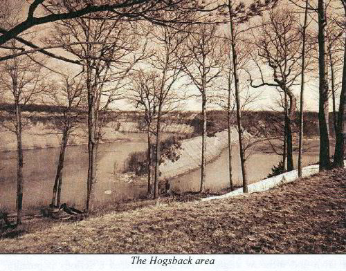
"When speaking of landforms, a "hogsback" is a narrow ridge,
usually
slightly humped, like the high, sharp, spinal ridge on a wild hog.
Our
Hogsback dramatizes a tight bend the river made thousands of years
ago, when
it was flowing across a flat plain at the level of the Overlook or
above.
Once the river cut to the rock, it was entrenched in its bed and
couldn't
flow elsewhere. This type of formation is described in geological
terms as
an "entrenched meander".
Eventually, the Hogsback may become an island, as the river
scours on the
outside of the curve and wears through the neck of rock. Or, the
Hogsback
may simply disappear entirely from erosion at the top and the build
up of
silt at the bottom."
We then proceeded to the Mt. Morris Dam just down river from the
Hogsback.
"With its central spillway 150feet above the river, the Mt.
Morris Dam is
the largest of its type east of the Mississippi..."
We got out, stretched our legs, took a little walk around. It
was time to
call it a day!
We got up early the next morning, 9/30/08, to catch a few more
sites before
we had to leave to visit relatives in Watertown, NY. On our way out
we
stopped at Inspiration point (see pic).
Another quote from the pamphlet:
"Part of the original 1,000 acre estate given to the people of
New York by
Mr. Letchworth, Inspiration Point was one of his favorite spots. IN
fact,
he named it for the way the beauty of the view could restore his
spirit.
The view towards the south, including both the Upper and Middle
Falls of the
Genesee, the trestle of the Railroad Highbridge, and all the
splendor of the
rock walls and forested land between, is one of the most famous in
the Park.
A short loop trail at Inspiration Point, with interpretive
signage provided
by the Lions Club, points out and explains some o the most
interesting
natural and historic features of the point. This trail is
handicapped
accessible and a rewarding experience for all.
It is interesting to think that only 90 some years ago, the area
around the
parking lot and comfort station was devoid of trees. The trees
around the
comfort station, with the orange bard on the upper trunks, are
Scotch Pines,
and were planted as part of the Letchworth Arboretum. Other trees
here
include the black locust, in the island of the parking area, and
some forest
understory trees that edge the lot. Native shrubs, like high-bush
cranberry, with dangling clusters of bright red fruit, also grace
the area.
Perhaps the most interesting trees in the area are found by
following the
trail east. A grove of large red pines is entered, looking
superficially
like many depression era plantations. These trees are older,
though, dating
from the 1860's and are native Eastern red pine, not the
duller-barked
Western variety most often found in plantations. They grew here,
perhaps
after a fire, in the open, dry soil on the edge of the gorges.
There are
remains of tow other special trees along this trail, too. At the
southwest
corner, there are sections of a huge white oak that stood by the
Upper/Middle Falls Snack Bar. About 150 years old, it saw all the
transitions, from industrial area, to private estate, to public
park, before
it fell. There is also huge hollow trunk section of a sugar maple
that
stood in front of the Glen Iris for many years."
We didn't walk far enough west to see the old down white oak and
large sugar
maple section. But, we did go east until we came to the red pine
area.
Yes, these are native red pines, and are starting to show age
characteristics, albeit very subtle. It is interesting to note that
directly across the gorge from this spot near the cliff edge,
appears to be
another grove of naturally growing red pines. The red pines weren't
of
exceptional girth, but one in particular was the tallest naturally
grown red
pine I've come across at just over 105ft.
There were a handful of ancient E. red cedars on the cliff edge
here as
well. Where they're growing is really quite precarious. They're
clinging
into almost bare mineral soil, some perched curling out over the
edge
downward, then back up into the air again. Incredible old dwarf
trees. A
very neat place indeed.
Inspiration Point Trees follows:
Species
CBH Height Comments
cucumbertree 4.8
69.1+
E. hophornbeam 1.7
52.6
E. red cedar 3.1
57.9
red pine
5.5 83
red pine
4.2 87
red pine
5.7 91.5
45 35.273N x 78 2.011W
red pine
5 94.8
red pine
5.5 96.8
red pine
5.3 105.1+
tallest personal find for
species
Scotch pine 5.8
89.6
white oak
9.8 87.1+
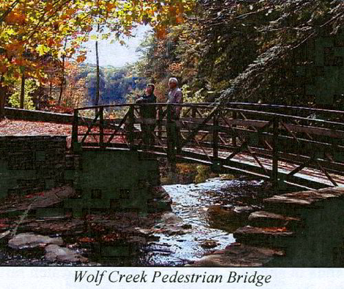
We continued north along the west rim road and next stopped at
Wolf Creek
(see pic). Pamphlet quote follows:
"*Wolf Creek* joins the Genesee River after a series of four
cascades that
drop a total of 225 feet into the Great Bend Gorge. Only the 1st
and 4th
can be seen, due to the narrow curves of the canyon. The first
cascade
drops about 70 feet; the last drops about 50 feet. The best view of
the
lower cascade is gained by taking the raft trip offered by
concessionaires.
The rafts stop at the mouth of Wolf Creek, and allow passengers to
disembark
and walk up the creekbed to the base of the falls.
Like most of the streams and waterfalls in the area, Wolf Creek
was the site
of early industrial development. Robert Whaley of Castile is
reputed to
have had a sawmill on the creek in 1808, and Mary Jemison's sons,
John and
Jesse, worked here at the time of their fatal quarrel, in 1812...
*Great Bend Overlook*
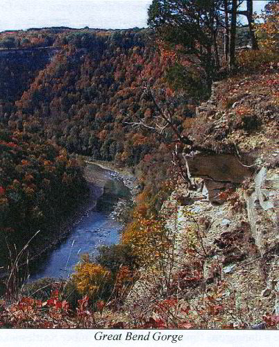
As the river makes a loop around the knobby hill opposite, in a
meander now
entrenched in stone, it flows in every compass direction, and uses
almost 5
miles to cover a straight line distance of little more than a mile.
This
Great Bend was created when the river cut this detour canyon,
bypassing the
valley that once carried the river. This former route of the
Genesee ran
straight from Lee's Landing to St. Helena and was filled by debris
left by
the retreating glacier. This blocked valley can be seen today, and
looks so
much lower than the path the river chose, that it can be difficult
to
picture how it must have looked before thousands of years of erosion
removed
the looser deposits that formed the dam.
On weekends in summer, you can sometimes watch rafts, canoes or
kayaks
bouncing through the rapids below cliffs that are the highest in the
park,
towering 550 feet above the river...
*Fiver Rocks or Humphrey's Overlook*
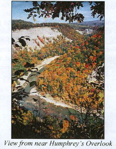
Called Five Rocks for the large boulders placed to prevent
visitors from
driving too close to the gorge edge, this overlook is officially
named for
Wolcott J. Humphrey, the first Chairman of the Genesee Region State
{Park
Commission.
This view of the river curling around the Great Bend cliffs is
one of the
most beautiful and most photographed scenes in the park. When the
reds,
oranges, and yellows of autumn's leaves cascade down the talus
slopes, and
the blue sky is mirrored in the river, the sight is unequalled.
Humphrey's Overlook is a popular spot for bird watching in
spring. Many
species can be seen and heard in the tall oaks that frame the
overlook or in
the bushes and shrubs below. In May, white trillium blossom on the
slope
and in autumn, bracken fern turns golden."
I got out and hiked the area a bit taking in the sites and
measuring a few
more trees while my wife took another car nap. The Wolf Creek area
is
really quite pretty. The main road curves about 3/4 of the way
around this
ravine site. Again, no really noteworthy trees, just trying to get
a
baseline for what can grow in these various conditions:
Species CBH
Height
E. hemlock 7
96.5
E. white pine 7.2
108.1
E. white pine 7.9
111.8
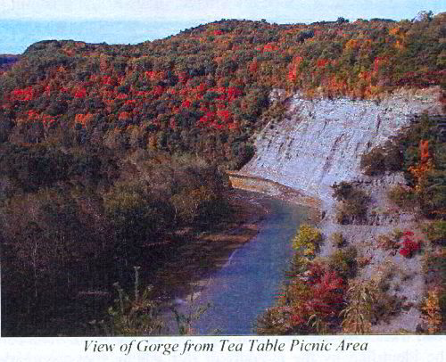
Our next and last stop was Tea Table Rock (see pic). Pamphlet
quote
follows:
"Tea Table was the name given to a large overhang of sandstone
that was a
popular picnic site at the turn of the century, granting a
spectacular, if
frightening, view of the river and Wolf Creek dropping below. The
ledge was
removed, lest it collapse under sightseers, after New York State
acquired
the property."
There are just so many incredible views here, one can get "visual
overload". Absolutely beautiful sites. Measured a couple trees
here as
well:
Species CBH
Height Comments
cottonwood N/A
87
"PI" growing on it, probably planted
E. red cedar 6.7
62.5
largest observed in the park
One last stop, my wife didn't even get out this time... was a
quick look out
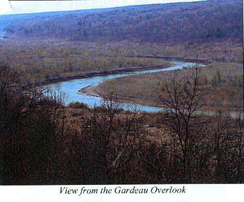
over Gardeau Overlook, see pic.
"The name "Gardeau" is a corruption of the Seneca word for the
area, "Gah Da
Hoh", which means "bank in front", referring to the cliff across the
river
that marked the center of the valley. This site was home to people
before
the Senecas, who referred to these people as "the old ones". It was
also
the site of a reservation awarded to Mary Jemison, and the place
that she
chose to make her home. The Gardeau reservation was 17,927 acres,
larger
than Letchworth State Park is today. Mary Jemison received the
property
when the Seneca lands were divided at the Treaty of Big Tree in
1797. This
gift was a mark of respect for Mary and the service she had provided
to
settlers moving into the area, and partly a consequence of clever
negotiations by her advisors...
Standing by the rail at the Gardeau Overlook and looking across
the river,
careful observation may show the largest known tree in the park
standing
next to a small cut where a side stream enters the river. Looking
between
where the 10 and the 11 on a clock face would be, a huge river
bottom forest
that was killed by the 1972 flooding of the canyon. It was spared
by clean
up crews who detected life still present and refused to cut such a
majestic
tree..."
I spent a good bit of time looking for this tree. I think I saw
it, even
with binoculars it was quite a ways out. If I have the right one, I
could
see the large crown of a tree breaking out over the others on the
opposite
and downstream bank of the river... That's a whole nother' day of
exploration just to walk to this one, cross the river & get back.
After
looking at the maps though, it appears there's a trail that comes in
from
the east that would be a much easier route that would exclude a
river
crossing.
So, after a two-day whirl-wind tour of Letchworth, we got enough
data for a
basic Rucker Index of 109.87:
Species
CBH Height Comments
E. white pine 9.7
120.4 Dehgayasoh Creek
white ash
9.1 119.4
Lower Falls
E. hemlock 8.9
119.1 Lower Falls
tuliptree
8.1 119.1
Middle Falls
sugar maple 8.5
105.6 Lower Falls
red pine
5.3 105.1+
Inspiration Point
bitternut hickory 6.8
105 Middle Falls
Absolutely incredible place. Definitely one of New York's
majestic
treasures. A must see for all Ents.
Dale
white oak
8.2 99.1+
Dehgayasoh Creek
Am. basswood 6
103.8 Lower Falls
shagbark hickory 5
102.1+ Lower Falls
Continued at:
http://groups.google.com/group/entstrees/browse_thread/thread/2dd3a5ef0a97ab8b?hl=en
|