Spent a very nice day with Ed Frank and Randy Brown at the Holden
Arboretum
in Kirtland Hills, Ohio. The weather was perfect, in the low 70's,
and we
had a guided tour by Holden Arboretum staff, visiting the Stebbin's
Gulch
area. Ed and Randy, I'm sure, will be posting detailed
measurements--here
are a couple of photos: Randy under the huge burl of a chestnut oak,
Ed next
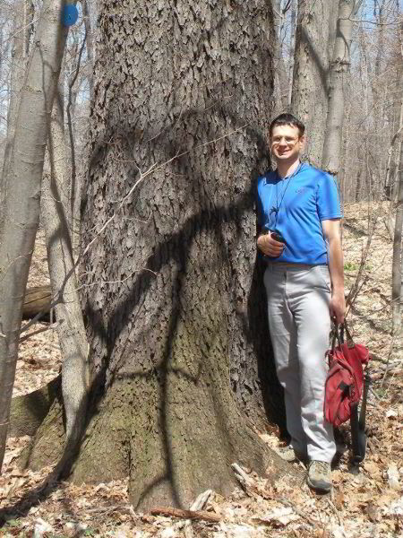
to a very nice sugar maple.
[Edward Frank, April 20, 2009]
Holden Arboretum, Ohio
On Saturday April 18, 2009 I met Randy
Brown, Steve Galehouse, and his son Mitch Galehouse at Holden
Arboretum in Lake and Geauga Counties in northeastern Ohio.
http://www.holdenarb.org/home/
I had corresponded with Steve and Randy before but had
not met either of them previously.
The trip to the arboretum was organized by Randy Brown.
I want to thank him for the opportunity to participate.
We met Michael Watson, Ethan Johnson, and Dawn Gerlica
from the arboretum the visitor’s center.
They were to be the guides on our trip.
Steve had been to the arboretum several times before as
he is from the Cleveland area.
I had visited Holden once previously on a trip with Carl
Harting in September 2007
http://www.nativetreesociety.org/fieldtrips/ohio/holden/holden_arboretum.htm
“The
Holden Arboretum owns over 3,600 acres, which includes the
recent Roudebush parcel purchase of 90 acres. Of that,
approximately 3,100 acres are natural areas. Approximately 85
percent of Holden’s natural areas are woodland; 12 percent
meadows; and the remaining three percent are wetlands, streams,
rivers, ponds and lakes.”
http://www.holdenarb.org/education/conservation.asp
“For the sake of
management purposes, The Holden Arboretum has been organized
into 14 natural areas. Some of these natural areas are well
known, such as Pierson Creek Valley, Bole Woods, Carver’s Pond,
Little Mountain, and Stebbins’ Gulch; and others are less well
known and visited. Some of Holden natural areas are open to the
public while others are closed to the public and accessible only
with a guide or permit.”
A map of these areas and the Arboretum properties can
be downloaded here:
http://www.holdenarb.org/education/documents/HoldensNaturalAreas.pdf
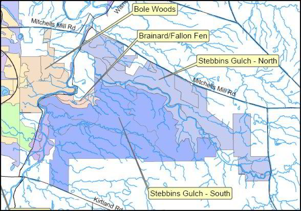
On this trip we were going to visit an area
known as Stebbin’s Gulch.
This area is described on the website:
·
Stebbins Gulch, North – A National
Natural Landmark that is an excellent example of a NE Ohio
bedrock ravine system. Guided hikes provide a rigorous and rare
natural and geologic history experience in a cold water stream
ravine. Along the bluffs of Stebbins Gulch is one of the best
remaining hemlock-northern hardwood forest remnants in Ohio.
·
Stebbins Gulch,
South – This 800-acre natural area is Holden’s largest unbroken
mature forest and protects the associated diversity of flora and
fauna of an old-growth forest. Access is limited to stewardship,
research or guided hikes.
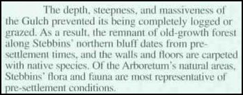
Geology and Topography
The northern edge of the Allegheny Plateau
in this portion of Ohio is marked by the Portage Escarpment.
The escarpment parallels the shoreline of Lake Erie and
climbs from around 780 feet at its base to almost 1000 feet at
its crest. North of
the escarpment is the narrow Lake Plain that extends to the
shore of Lake Erie.
The area to the south of the escarpment consists of a plateau of
Mississippian Age bedrock (359 – 318 million years ago).
This bedrock was repeatedly eroded by Pleistocene
glaciations during the last million years.
Outwash and moraines formed from the retreat of the last
glaciation episode has filled depressions in the landscape
leaving a gently rolling, poorly drained landscape.
Streams flowing across this plateau have eroded deeply
incised, steep sided channels into the bedrock and drain
northward to the Lake Erie.
Stebbins
Gulch is one of many incised stream valleys located in this area
of Ohio. It flows
from east to west and empties into the eastern Branch of the
Chagrin River, which in turn drains the entire area and feeds
into Lake Erie a few miles to the north.
Elevations range from 750 feet in the Chagrin River
Valley to just over 1200 feet in the surrounding hills.
In Stebbins Gulch itself the
walls of the ravine are composed of Mississippian Berea
sandstone underlain by Bedford shales and thin interbedded
sandstone.
The stream itself drops within the arboretum properties about 60
feet flowing over a series of small falls and rapids which have
developed where shales have eroded beneath more resistant
sandstone beds.
This bedding is clearly exhibited in the walls of the gulch.
Vertical faced ledges of sandstone are interspersed with
sloping segments of eroded shale.
Near the top of the cliffs a series of drip areas and
springs have formed immediately below the sandstone caprock
where the downward seeping water meets the relatively
impermeable shale below.
Stebbin’s Gulch North
After meeting in the lobby of the Visitors
Center, we gathered out gear and carpooled to the first stop of
the day –Stebbin’s Gulch North.
I was
looking forward to this area because it was the location of some
very old chestnut oaks. Dr.
Ed Cook collected a series of 24 cores in 1983 from somewhere in
the Stebbin’s Gulch area, very likely these same trees. The
oldest specimen dated from 1612 and likely is still alive today,
if so it would be 397 years old.
http://www.ncdc.noaa.gov/paleo/metadata/noaa-tree-3033.html
So this was something that promised to be worth seeing.
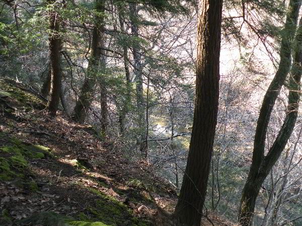
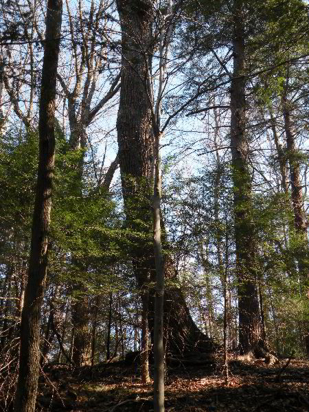
View on
edge of Stebbin's Gulch ravine on north side
On this trip Dawn brought her infant son
Aidan along. He is
about a year-and-a-half years old now.
On my last trip he was at minus 2.5 months old.
We had a short walk to the edge of the ravine.
The cliff plunged almost straight down.
This is one of the reasons why they don’t want visitors
to walk this area unguided.
From this point we turned left and walked upstream along
an old trail along the edge of the ravine.
Soon we were encountering large, gnarled, old looking,
chestnut oaks (Quercus
prinus; syn. Quercus montana).
In addition were many large towering, American beech.
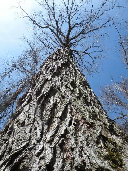
Chestnut Oak, 11.5 feet girth,
83 feet tall
The understory included a number of species
most prominently were numerous smaller eastern hemlock.
We walked from tree to tree.
The oaks were covered by thick ridged bark.
The stems were fat and bent.
In the canopy there were thick, heavy, stubby, branches
that had been bent and broken by years of weather and wind.
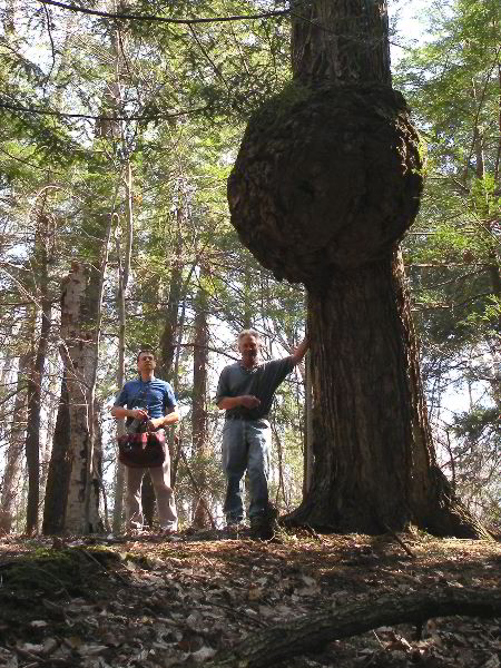
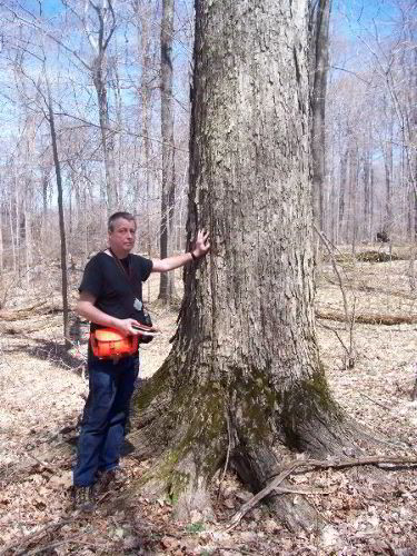
Randy
Brown and Steve Galehouse with large burl in Chestnut oak.
The tree was 9' 11" in girth and 93 feet tall.
Present on several chestnut oaks were giant
burls, some bigger around than the tree itself. These were the
biggest I have seen on any eastern tree.
I wondered how they formed.
This glossary
http://oak.arch.utas.edu.au/glossary/view_glossarylist.asp?term=B
defines a burl
as:
“A hard, woody outgrowth on a
tree, more or less rounded in form, usually resulting from the
entwined growth of a cluster of buds. Such burls are the source
of the highly figured burl veneers used for purely ornamental
purposes.”
Another site
http://www.newton.dep.anl.gov/askasci/bot00/bot00682.htm
includes this comment:
“They
are basically benign tree tumors.
They occur when a twig bud fails to
grow normally, differentiating into the tissues needed for
forming a limb,
and instead just multiplies and multiplies and multiplies its
bud cells. That's how you get the round growth with an irregular
grain structure.”
Along the rim of the valley the trees are
not only exposed to winds along their tops but are also subject
to winds along the side open to the valley.
Winds are funneled down valleys have an big impact on the
trees growing along their rims. Dr. Tom Diggins has shown in
Zoar Valley, NY that there is a preferred orientation of course
woody debris aligned with the valley walls as a result of these
types of winds. At
this site and at other similar sites you can see the branches on
the valley side are often more wind damaged than other branches
on the tree. The
same can be said of the other trees growing along the rim, a
bent and broken black gum comes to mind from this site.
However none of the trees here along the rim showed this
character quite as much as the chestnut oaks, perhaps because of
their age and the years of exposure to the wind, perhaps because
they have survived rather than died from wind events that might
have killed other trees.
They certainly were impressive.
The trees on the edge of ravine also face other
challenges. They
often are found leaning inward and struggling to stay upright.
The soil and rocks beneath them tends to slowly creep
downward or be washed into the valley below pulling the roots
and trees along.
There were smaller beech along the rim a
along the walls of the canyon, but the largest ones were set
back from the edge of the cliff by a hundred feet or more. Many
were eight to ten feet in girth, some larger.
They typically reached heights from between 100 feet tall
with some reaching into the mid- one-teens.
With additional time and dedicated searching a few
taller heights might be discovered among the tops.
It is hard to tell the age of American beech.
It has smooth bark and does not develop the heavy ridges
or platy textures of many tree species.
These have broad spreading crowns with large limbs.
They certainly are very mature trees.
I would not be surprised if they are 150 years old or
older, but still they could be much younger as well.
One of the curious characteristics of the
site was the hemlocks.
The website blurb has described it as a remnant
hemlock-northern hardwood forest.
There were a number of larger hemlock trees but most were
small and seemed to be young trees.
They did not have any of the gnarled characteristics or
heavy bark seen on older hemlock specimens.
Perhaps they are now, ironically spreading out because of
the loss of other species in the canopy.
I do not know what species they might have been replacing
or why they made up such a large percentage of the younger
trees.
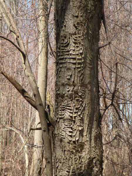
Patterns on red maple bark
The last trees we visited on the north side
of the gulch were some butternuts.
Dawn had told us that there were four butternuts.
One had died and decayed away.
A second was found leaning over on another tree and dead.
Two were hanging in there barely as they were succumbing
to blight. It was
sort of a down note at this point.
The trees had not leafed out yet, and they
were few herbaceous plants poking out of the ground yet.
At the cars a touch of green in the canopy of the trees
bordering the parking area caught our eye.
It turned out to be the
catkins of a stand of bigtooth aspen.
This was a quick tour of a small section of Stebbin’s
Gulch North, but I think of it more as preliminary scouting for
a future trip.
Stebbin’s Gulch South
Next we headed to the area designated
Stebbins Gulch South.
We pulled into a parking area near the west end of the
800 acres natural area.
In the parking area was massive red oak.
We measured it to be 13’ 4” in girth and 114.2 feet tall.
My initial shot upward reached about this number, but
further exploration could not push it to the over 120 as I had
hoped. The
character of this area of the site was entirely different from
the canyon edge area we visited on the north side of the gulch.
Here we were on top of the plateau itself.
The area was crossed by a series of horse trails. The
landscape was relatively flat with gently rolling hills and
depressions. This
area was underlain by clay rich glacial till and generally
poorly drained.
There was a good diversity of trees in the area with sugar
maples, red oak, and beech being the predominant species.
Tuliptree and white ash were also fairly common.
In the area immediately by the parking lot the trees
tended to be smaller, suggesting the possibility that the area
may have been logged at some time in the past, but there were no
overt signs of any logging.
Our guides wanted to show us an area of some big black
cherry, oak, and sugar maples.
After a short hike we were finding more large oaks and
other large tree.
Adjacent to the path was a black cherry, 11’ 2.5”
in girth, and 117.9 feet
tall. This was the
largest of several big black cherries in the immediate area.
Randy Brown and large black
cherry, 11' 2.5" girth, 117.9 feet tall
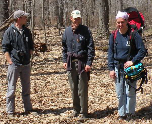
From left to right Michael Watson,
Ethan Johnson, and Dawn Gerlica (Aidan in backpack)
Shortly thereafter, with Aidan being tired
from being carried in a backpack through the woods, the people
from the arboretum left us on our own.
Steve, Randy, Mitch and I were off exploring.
Steve and I measured an impressive sugar maple 10’ 4” in
girth and 117 feet tall (see Steve Galehouse's photo in previous
post). It was large
in size and perfect in form.
We scattered across the area and measured.
Randy measured some large white ash trees.
I measured a tuliptree at 136.9 feet tall, only later to
be outdone by Steve and Randy with a 142.5 foot tall, 10 foot
girth specimen. Near the
tall Tuliptree was another large sugar maple with very rough
looking bark. We
were unsure of the identification until we walked over
to the tree and looked
at it in detail from
close up (the presence of sugar maple leaves under the tree
helped me). Another
tall species found was a 122.6 foot tall American beech.
It was located in the bottom of one of many shallow
depressions across the plateau.
Sugar Maple with rough bark
After measuring for awhile we got together
again and compared notes on what we had found and what species
we had measured. At
the time we had six species over 100 feet tall, but not many of
other trees present in the area.
We decided to try to finish out the ten species Rucker
Index and explore for other species.
This is an area where I am comparatively weak.
I am not good at identifying trees by their bark and form
alone. I can do
some well, but am not confident of my identification of others.
Randy and Steve are both excellent at this.
On the hilltops hemlock was absent, but smaller specimens
began to appear as one headed down slope to some of the small
streams in the area.
The ones higher on the slope were smaller, but eventually
we found some bigger trees
the tallest was just 108.9 feet tall – but hey it was
another species over 100 feet.
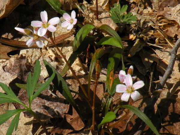
Flowers
White pine was all but absent from the
area. We sighted a
pair just off the trail to the north as we were walking in, and
Steve saw one across a small stream valley to the south.
These were the only ones we found in the entire area.
I have corresponded with Michael Watson, one of the
Holden people on the trip.
He writes:
“At Holden, I associate
white pine with our Little Mountain property. Soils up
there are shallow and pretty dry. Acidic, too I believe.
In South Stebbins the soils are richer and wetter (as you saw
from the condition of the horse trails). So my thought is
that the lack of white pines in South Stebbins is at least in
part due to the soils. As I understand it, Beech-Maple
communities are generally found on rich, moist soils - so
perhaps in those conditions they simply out-compete the pines. “
There are nice
stands of pines on Little Mountain.
Carl and I visited the site on the last trip.
The lack of white pines in the Stebbin’s Gulch South
section we visited really strikes me as they never were present,
rather than they were removed.
On the way out we measured the white pine Steve sighted
earlier. I got a
good shot from across the small stream valley and measured a
height of 131.4 feet.
Randy scrambled down and up to the tree to get a girth
measurement of 10.0 feet.
Another odd character of this side of the
gulch was the absence of chestnut oak and white oak.
We found no chestnut oak in the area we visited and only
one white oak tree.
I would have expected these oak species to have been present
here. We did not
get to the rim of the gulch itself on the south side.
I am curious how the character of the forest might change
along the rim, if it would more resemble the tree assemblage
found on our brief excursion on the north side.
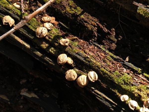
Last year's puffballs growing on an old log
Altogether I have measurements (actually
Steve and I) have measurements for 18 species of trees, twelve
of them were over 100 feet.
Randy measured white ash and sycamore each over 100 feet.
The species I have result in a Rucker Index of 117.17.
With the addition of Randy’s data that will likely
increase by a foot or two. During
this visit we only saw a small part of the 800 acre Stebbin’s
Gulch South section.
With more exploration I am sure many taller trees could
be found. It was
great to meet Randy, Steve, ad Mitch and I had a great time.
I came away with a sunburn and good memories.
What's Next?
There is still large areas of the arboretum
to visit. Many areas already scouted need to be have time
spent in them to properly document the trees present. Carl
and I measured a large black walnut on the first trip at 126.9
feet and Carl was not sure he found the actual top. It
needs to be remesured. Dawn told me of a fat red maple
that had been tapped with eight buckets at sugaring time.
She says it is a single stem and the biggest red maple she has
seen. It would be worthwhile to hike up the bottom of
Stebbin's Gulch itself, not to mention further explorations of
the plateaus on each side of the canyon. Corning Woods and
Bole Woods contain old growth that needs to be documented or
better documented. There is still much to do at the
arboretum.
Here is a spreadsheet of measurement data. I will post a
revised list later with randy's measurements included.
|
Holden
Arboretum |
April 18, 2009 |
Randy Brown, Steve
Galehouse, Edward Frank and Mitch Galehouse |
|
|
|
|
|
|
|
|
|
|
|
|
Tree (common name) |
species |
Height (ft) |
Girth
(ft) |
Latitude |
Longitude |
Elevation GPS (ft) |
Comments |
|
|
|
|
|
|
|
|
|
|
|
|
Stebbin's Gulch North |
|
|
|
|
|
|
|
|
|
Chestnut oak |
Quercus montana |
83 |
11.75 |
41' 36.459 |
-81'
16.280 |
1088 |
largest, leaning |
|
|
Chestnut oak |
Quercus montana |
93 |
9'
1" |
41' 36.425 |
-81' 16.186 |
1150 |
big burl |
|
|
|
|
|
|
|
|
|
|
|
|
Stebbin's Gulch South |
|
|
|
|
|
|
|
|
|
Tuliptree |
Liriodendron tulipifera |
136.93 |
10.5 |
41' 36.213 |
-81' 18.561 |
|
|
|
|
Black Cherry |
Prunus serotina |
117.9 |
11'
2.5" |
41' 36.192 |
-81' 18.511 |
1170 |
cherry along trail |
|
|
Sugar Maple |
Acer saccharum |
117 |
10'
4" |
41' 36.189 |
-81' 16.447 |
|
|
|
|
Black Cherry |
Prunus serotina |
111.86 |
9'
10" |
41' 36.174 |
-81' 16.405 |
|
behind fallen one |
|
|
Red Oak |
Quercus rubra |
109.79 |
14 |
41' 36.215 |
-81' 18.584 |
|
|
|
|
American Beech |
Fagus grqandifolia |
122.57 |
7'
7" |
|
|
|
near red oak above |
|
|
Hemlock |
Tsuga canadiensis |
44 |
3.0' |
|
|
|
|
|
|
Black Cherry |
Prunus serotina |
110.83 |
8'
8" |
|
|
|
one with grape vine |
|
|
Red Maple |
Acer rubrum |
99.3 |
6.0' |
|
|
|
|
|
|
Hemlock |
Tsuga canadiensis |
108.91 |
4'
4" |
|
|
|
tall top |
|
|
Cucumber Magnolia |
Magnolia acuminata |
107 |
11'
3.5" |
41' 36.116 |
-81' 16.521 |
|
near hemlock above |
|
|
Hemlock |
Tsuga canadiensis |
104.23 |
6'
3" |
41' 36.118 |
-81' 16.532 |
1127 |
|
|
|
Black Gum |
Nyssa sylvatica |
84 |
7'
6" |
41' 36.118 |
-81' 16.544 |
1088 |
|
|
|
Basswood |
Tilia americana |
103.89 |
7'
5" |
41' 36.176 |
-81' 16.448 |
1209 |
along blue trail |
|
|
Basswood |
Tilia americana |
89 |
|
|
|
|
|
|
|
Sugar Maple |
Acer saccharum |
111.74 |
9'
1" |
41' 36.240 |
-81' 16.655 |
|
very rough bark |
|
|
Tuliptree |
Liriodendron tulipifera |
142.5 |
9'
5" |
|
|
|
below sugar maple |
|
|
Slippery Elm |
Ulmus fulva |
? |
6'
3.5" |
41' 36.224 |
-81' 16.625 |
|
along trail |
|
|
Black Walnut |
Juglans nigra |
106.43 |
7'
5" |
41' 36.265 |
-81' 16.745 |
1052 |
along trail |
|
|
Shagbark Hickory |
Carya ovata |
102 |
7'
8.5" |
41' 36.255 |
-81' 16.759 |
|
along trail |
|
|
White Pine |
Pinus strobus |
131.3 |
10.0' |
|
|
|
across stream up bank |
|
|
White oak |
Quercus alba |
100.5 |
6'
6" |
41' 36.189 |
-81' 16.946 |
|
|
|
|
Red Oak |
Quercus rubra |
104 |
7'
7" |
41' 36.198 |
-81'
16.943 |
1013 |
|
|
|
Sassafras |
Sassifras albidum |
74 |
3'
4.4" |
41' 36.378 |
-81' 17.250 |
|
three single stems |
|
|
Norway Spruce |
Picea abies |
84.7 |
5'
8" |
|
|
|
beside sassafras |
|
|
Red Oak |
Quercus rubra |
114.24 |
13'
4" |
41' 36.370 |
-81' 17.367 |
|
red oak in parking area |
|
|
Yellow Birch |
Betula alleganiensis |
70 |
4'
7" |
41' 36.373 |
-81' 17.351 |
|
near parking area |
|
|
|
|
|
|
|
|
|
|
|
|
|
|
|
|
|
|
|
|
|
|
Tuliptree |
Liriodendron tulipifera |
142.5 |
|
|
|
|
|
|
|
White Pine |
Pinus strobus |
131.3 |
|
|
|
|
|
|
|
American Beech |
Fagus grqandifolia |
122.57 |
|
|
|
|
|
|
|
Black Cherry |
Prunus serotina |
117.9 |
|
|
|
|
|
|
|
Sugar Maple |
Acer saccharum |
117 |
|
|
|
|
|
|
|
Red Oak |
Quercus rubra |
114.24 |
|
|
|
|
|
|
|
Hemlock |
Tsuga canadiensis |
108.91 |
|
|
|
|
|
|
|
Cucumber Magnolia |
Magnolia acuminata |
107 |
|
|
|
|
|
|
|
Black Walnut |
Juglans nigra |
106.43 |
|
|
|
|
|
|
|
Basswood |
Tilia americana |
103.89 |
|
|
|
|
|
|
|
|
Rucker Index |
117.174 |