|
ENTS
On Monday August 24, 2009 I
visited Presque Isle State Park, just north of Erie, PA. The park
occupies a peninsula that juts 2 miles out into Lake Erie forming a
curved spit about 6 miles total in length. Presque Isle
is the most visited state park in the state because of a series of
popular beaches facing Lake Erie.
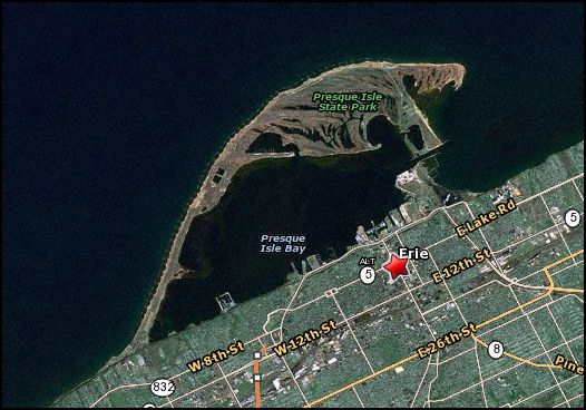 Presque Isle State park - photo from MapQuest Presque Isle State park - photo from MapQuest
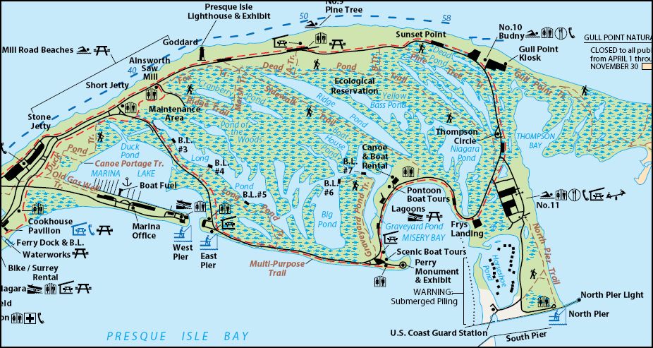
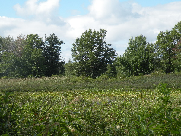
The park consists of a series of dune ridges separated by low
lying marshes and lagoons.
The beach ridges evolve as the offshore bars migrate onshore and
weld onto the shore as a subaerial bar. They probably build in
height as they migrate onshore in response to the steeper waves of
the surf zone. Sand is deposited in front of the bar; a lagoon is
trapped behind it. Cottonwoods and other vegetation take root on the
beach ridge, and dunes build on top of the ridge, increasing its
height to about 20 ft above LWD. Low areas behind and between the
beach ridges are submerged and appear as a series of elongated ponds
oriented WNW-ESE. Examples of these ridge ponds are Long Pond,
Cranberry Pond, and Ridge Pond (Figure 2). The recurving offshore
bars at the distal east end form a finger-shaped array of ponds,
which are oriented north-south. These distal ponds include Big Pond,
Yellow Bass Pond, and Niagara Pond .The Presque Isle system is an
eastward-migrating system which feeds upon itself as it migrates.
Within the system, material is eroded from the neck to the shifting
nodal point, which has recently been in the vicinity of Beach 10,
and is deposited along the depositional feature (Gull Point) or
offshore to create a new platform to the east, or landward, where it
shoals in the harbor entrance channel.
The Erie County natural History Inventory (1993) prepared by the
Western Pennsylvania Conservancy for the Erie County Department of
Planning outlines the vegetation present on the peninsula:
East of Long Pond, within the road that encircles the sandspit's
interior, a considerable portion of the sandspit's interior natural
communities remain in essentially pristine condition. Generally
speaking, the natural communities on the sandspit are progressively
older toward the Presque Isle Bay side and on the western end of
Presque Isle Peninsula. The result is a mosaic of natural
communities (i.e., habitats) supporting a diverse assemblage of
flora that represents a continuum of successional seral stages,
tending from palustrine ponds and bays (i.e., hydric) to a
terrestrial (i.e., xeric) climatic climax community (Kormandy, 1984;
1969).
The dry-mesic Eastern Great Lakes sandplain community (NC007) is
an open, dry grassland usually dominated by wood-grass (Sorghastrum
nutans), a panic grass (Panicum virgatum), and a beardgrass
(Andropogon scorparius). NC007 consists of seven distinct natural
vegetation assemblages and a mixed pine plantation that was planted
in one of the NC007 communities. The natural vegetation assemblages
include: a mixed graminoid sandplain vegetation assemblage; mixed
forest sandplain savannah dominated by a black oak-sassafras-black
cherry (Quercus velutina-Sassafras-Prunus serotina) savannah; a
shrub thicket sandplain vegetation assemblage dominated by common
cottonwood-wax-myrtle-morrow honeysuckle (Populus
deltoides-Myrica-Lonicera Morrowi) shrub thicket; a shrub savannah
sandplain dominated by wood-grass (Sorgastrum nutans); a Great Lakes
broadleaf sandplain forest consisting of a common cottonwood loam
forest; a crack willow-white willow (Salix fragilis-S. alba) forest;
and oak-black cherry-red maple (Quercus-Prunus serotina-Acer rubrum)
forest.
I have been visiting the park since I was a child, but this was
my first trip back since I became so heavily involved with ENTS.
The park has been described as containing a generally young forest
and shrub assemblage in generally younger stages of succession. The
comment about the interior being in essentially pristine condition
caught my attention. I wanted to see these areas even if they were
not great in age because they could be considered primary forests.
I planned a good hike along several of the trails. I started out
across from the lighthouse exhibit and hiked the Dead Pond Trail to
the opposite side of the spit, down the multiuse path to the start
of the Sidewalk Trail back across the spit to the Marsh Trail, to
the Ridge Trail, and along the Fox Trail back to my starting point -
a total distance of about 5.5 miles.
Dead Pond Trail: This trail leads over several former dunes and
through several distinct ecological zones. You will walk through
oak-maple forest, pines and sandplains. (2 miles)
Sidewalk Trail: This historic trail was originally constructed by
the U.S. Lighthouse Service as a path from the Presque Isle
Lighthouse to the U.S. Lighthouse Service boathouse in Misery Bay.
The trail was once a wooden boardwalk and was resurfaced with
concrete in 1925. (1.25 miles)
Marsh Trail: This trail bisects Cranberry Pond, one of the many
ponds on Presque Isle. The pond formed as water was trapped between
two ridges. (.25 miles)
Ridge Trail: This trail follows the edge of Cranberry Pond along
a portion of ridge that was a beach dune 300 years ago. (.5 miles)
Fox Trail: This trail winds through wooded swamps and oak-maple
forests. It is maintained and groomed as a cross-country ski trail
in the winter. (.5 miles)
It was a little past noon when I headed out to the park itself
after visiting the Tom Ridge Environmental Center near the park
entrance. The first section of the park consists of a narrow neck,
in places less than 800 feet wide before opening out into the
broader body of the peninsula. I drove down various side roads
checking out the landscape. The trees in this section all appeared
to be young and the area heavily used for marinas, docks and the
like.
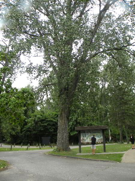
The first place I stopped was at the Ranger Station. Here was a
very big cottonwood growing in the parking lot. I measured it to be
102 feet high and 13' 11" in girth. There were several others
overgrown by vines in the woods nearby that are probably similar in
size. So there are some large trees in the park - just
not many. From here I drove around the rest of the perimeter of the
island to Presque Isle Lighthouse and Exhibit.
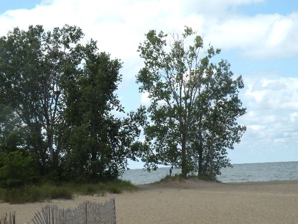 Lake Erie beach and shore line Lake Erie beach and shore line
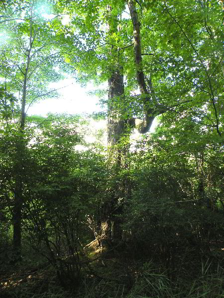
This marks the beginning of the beginning of the Dead Pond Trail.
I immediately was plunged into a forest setting. The trees were
not that large and consisted primarily of black oak, sassafras, red
maple, and some black cherry. The trail continues out along the
ridge on the north side of Ridge Pond, Yellow Bass Pond, and
Niagara Pond within the ecological reserve area. The trees in this
area were not very tall - the tallest were perhaps 50 feet tall and
relatively small in girth.
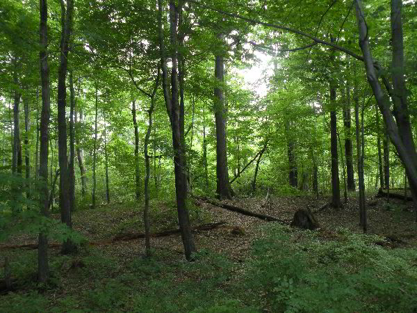 Near start of Dead Pond Trail Near start of Dead Pond Trail
The branches in the crowns of these trees were broken and bent.
In another setting this might be considered a sign of age, but here
on the peninsula the weather is harsh. These features could develop
in a comparatively short period of time. The trees are growing in
sand, with very high drainage rates and few nutrients. Soil is thin
or absent. The trees are clearly stunted. But I don't know how old
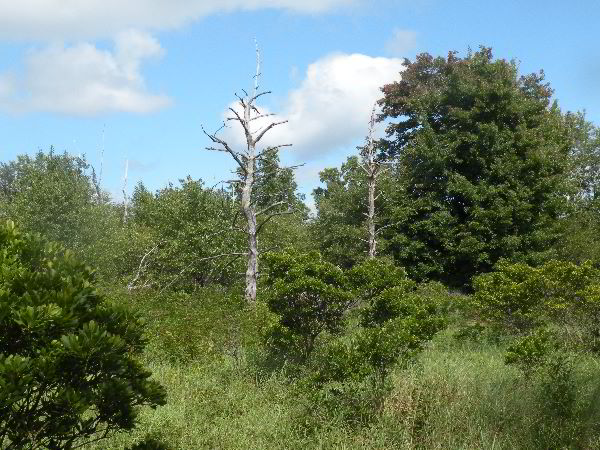
they might be. The weather Along the side of the trail more open
areas could be seen in the direction of the ponds. Soon the trail
dropped down off the ridge crest and out into a sand savannah. Here
the surface was dominated by grasses and sedges. There were patches
of buttonbush, and individual maple, oak, and sassafras trees.
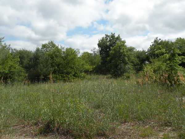 Sand Savannah along Dead Pond Trail Sand Savannah along Dead Pond Trail
 Sand Savannah - Forest Interface Sand Savannah - Forest Interface
The trail continued this under canopy and open area back and
forth along its length. Here and there among the open areas were
scattered cottonwood trees sticking out high above the other trees
maybe reaching 60 feet. What was curious is the fact that the trees
were bare except for balls of leaves near the top. Other trees in
the open areas had leafed branches extending all the way to the
ground. Eventually I reached the far end of the trail and emerged
at the highway on the far side of the peninsula. From here I walked
down the multi-use trail paralleling the highway to the start of the
sidewalk trail. This portion of the island is on the lee side of
the peninsula. The trees along the shore consisted mostly of
cottonwood and willows. These are invasive species of crack willow
and white willow rather than the native black willow. One
cottonwood in a small parking area measured 72 feet tall and 12' 9"
in girth. The willows were too bushy to easily measure, but ranged
up to 60 feet in height and perhaps 7 feet in girth.
Soon I reached the start of the Sidewalk trail that cuts back
across the spit. Here were some larger trees. The largest I
measured in this section was a red oak 101 feet tall and 8' 10" in
girth.
This section runs along the southwestern side of Ridge Pond.
Here after an area of low brush an expanse of lily pads and some
open water could be seen. This was really the first place where a
good view of the ponds themselves could be seen.
 Ridge Pond Ridge Pond
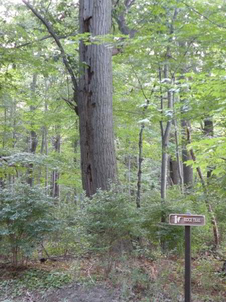
Near the end of the sidewalk trail I made an abrupt turn onto the
Marsh Trail. This trail cuts across Cranberry Pond. At the far
side of the pond this trail meets the Ridge Trail. It was in this
area that the largest trees were found aside from scattered
cottonwoods.
Name
Species
Height
Girth
Red Maple
Acer rubrum
81
9' 1"
Red Oak
Quercus rubra
60
10' 10"
Red Oak
Quercus rubra
79
7' 4"
Black Gum
Nyssa sylvatica
60
3' 8"
Sassafras
Sassafras
54
2' 1"
Red Oak
Quercus rubra
78
11' 3"
White Pine
Pinus strobus
57
3' 4"
Black Cherry
Prunus serotina
60
3' 4.5"
 Red Maple, 82 feet tall, 9' 1" girth Red Maple, 82 feet tall, 9' 1" girth
 Mostly dead Red Oak, broken top to 60 feet, 10' 10" girth Mostly dead Red Oak, broken top to 60 feet, 10' 10" girth
None of these heights are great, but there were a few respectable
girths. These certainly were the largest forest section I
encountered on the hikes. I am trying to track down more detailed
information about tree ages in the park. So if you have any pdf's
or access to online journals that might have articles you could send
me I would appreciate it. I plan to visit again later this fall,
especially if I get any goo leads or information to better help me
interpret what I am seeing.
Ed Frank
I mentioned that the short trees along the trails at Presque Isle
had bent and broken limbs from the weather. Here are a couple of
shots:
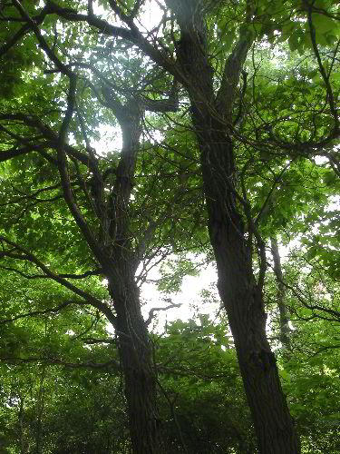 Sassafras Sassafras
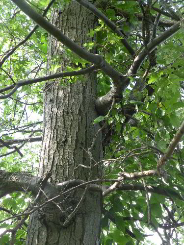 Red
Oak Red
Oak
Continued
at:
http://groups.google.com/group/entstrees/browse_thread/thread/97d4b36bf0cd6d8f?hl=en
|