|
==============================================================================
TOPIC: Hemlock Island, Allegheny River, PA
http://groups.google.com/group/entstrees/browse_thread/thread/743dc12b07d436e2?hl=en
==============================================================================
== 1 of 5 ==
Date: Thurs, Jul 17 2008 6:04 pm
From: "Edward Frank"
ENTS,
On Wednesday July 16, 2008 I met Dale Luthringer at 4:00 after work
for a quick trip to Hemlock Island in the Allegheny River just north
of West Hickory, PA. We had made several trips to the Allegheny
River Islands in the past. In September 2007 Dale Luthringer,
myself, and Anthony Kelley had visited a number of islands in the
River between Buckaloons and Tionesta. http://www.nativetreesociety.org/fieldtrips/penna/ariw2007/ariw2007a.htm
The goal of the trip was to explore and recon the remaining six of
the seven islands that made up the Allegheny River Islands
Wilderness area. The seventh island, Crull Island had been visited
by Dale Luthringer previously. http://www.nativetreesociety.org/fieldtrips/penna/allegheny_islands.htm
. In addition to those islands, we also stopped at several islands
that belong to the US Forest Service but are not a part of the
wilderness itself.
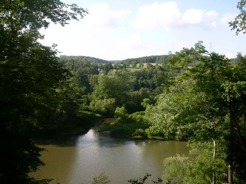
Courson Island from Tidioute Overlook
There also are a number of islands that are privately owned. One
stretch of the river between Tidioute and West Hickory, a distance
of 8 miles, was not canoed during the trip as it did not contain any
of the islands that were part of the wilderness. It does, however,
contain a number of islands owned by the US Forest Service and some
private islands. The most prominent of these islands is Hemlock
Island. The Western Pennsylvania Conservancy played a role in the
preservation of a number of these islands. Over 25 separate land
parcels on property abutting the river, totaling over 9500 acres,
and 21 islands were purchased by the Western Pennsylvania
Conservancy in the 1970s, 1980s, and 1990s with the objective of
protecting the river's scenic beauty and wildlife habitat
(Anonymous, 1988, 1992). The land was later turned over to the US
Forest Service. Seven islands, totaling 368 acres, were designated a
state wilderness in 1984 and a national wilderness area in the 1990s
(US Forest Service, 1997). I am not sure if Hemlock Island is among
their parcels, but their efforts should be commended in any case.
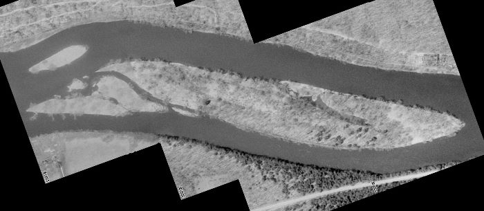
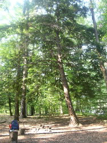
Hemlock Island
Dale had been past the island on canoe trips down the river years
ago, but had not actually been on the island before. Last week we
stopped up to check out the access to the island. It was hoped that
the channel between the eastern river bank and the island would be
shallow enough to wade, but the water was up and too murky to
attempt. We scouted out some other islands, but did not adventure on
to any of them on that trip. Using his mapping software, Dale
reported the island was about 0.8 miles in length and 0.1 miles
across, with an acreage of 42 acres. I would have guessed by
comparison that the island would have been in the low 50's for
acreage. From the riverbank we could see some emergent pines growing
from the island.
Hemlock Pines
We had not encountered any white pines on any of the wilderness
islands. The only white pine seen on the trip in Sept. 2007 was a
single specimen growing on privately owned Fuelhart Island. From the
boat we measured it to be approximately 115 feet. Looking at the air
photos from www.terraserverusa.com A number of dark blotches could
be seen on the upstream eastern side of the island that we believe
represented evergreens on the island. Elsewhere on the perimeter of
the island could be seen some larger deciduous trees- likely silver
maples and sycamore tree.
Terraserver Segment
Looking at the structure of the island it consists of a series of
s-shaped ridges originating as a sequential series of sand and
gravel bars deposited by flood and ebb stages in the Allegheny
River. As noted in previous reports Kinzua reservoir dammed the
Allegheny upstream of this island in 1965 and has affected the
overall dynamics of the river system. I am not sure of the specific
age structure or geologic series of these bar deposits. In general
the deposits at then upper end and tail end of the island are the
youngest. The oldest deposits are likely the higher elevation
deposits in the central and eastern side of the island.
We opted to take my small inflatable raft rather than one of the
park canoes to the island because of the steep bank leading from the
parking area down to the river. We arrived at the pull-off along the
highway and gathered our gear, only to discover we were short some
of our measuring equipment. Dale, being the measuring machine of the
two of us was outfitted with a full set of gear, while I grabbed my
camera, tape, ad rangefinder for a supporting role. We launched from
a rock at the base of the steep bank, and realized we should have
topped off the raft with more air before launching. It was not a
matter of the raft sinking, but a little bit of water washing into
the bottom as we set off. We soon landed on the far side and pulled
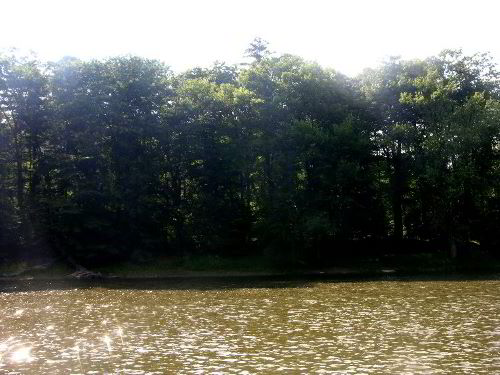
the raft onshore. The bank rose for about 15 feet to a nice camping
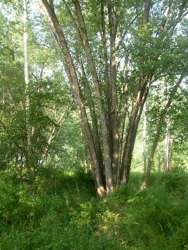
area ringed by pines and hemlock. We had not found hemlock on any of
the islands we had previously visited. With that we were off and
running measuring trees. Dale immediately started measuring the
white pines and hemlocks. It was exciting to find species we had not
documented previously.
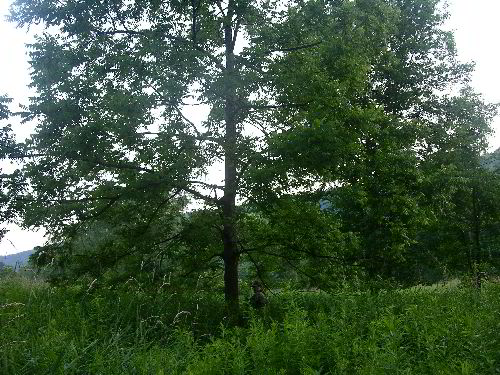
Hemlock at Landing Area
After measuring a number of trees in the immediate area of the
informal campsite we headed upstream/northward. The next area was a
lower level terrace a few feet above the current river level. The
are was heavily vegetated with masses of sensitive fern forming the
floor of the forest and scattered sycamore, black locust, white ash,
and hawthorn. We measured a few trees here and then we split up.
Fern Floor with Sycamore
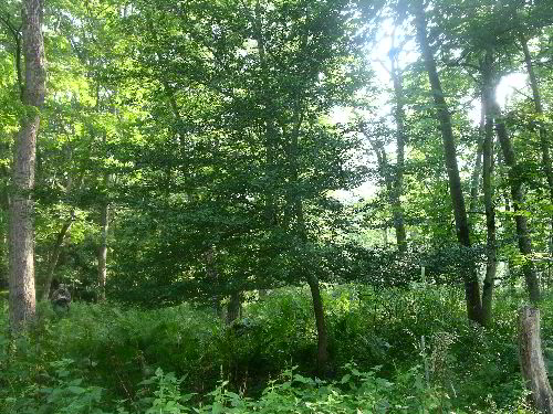
Hawthorn
Dale continued to measure the pines, hemlocks, oaks, and hickories
on the upper terrace, while I headed toward the northern end of the
island. The northern end of the island was at the lower terrace
level and became brushier with frequent patches of multiflora rose.
The trees here were not that large, The biggest were a few sycamores
in the seven to eight foot girth range and 70 to 80 feet tall.
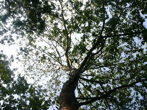
Sycamore Crown
There were also some silver maples in the same size range. One of
the silver maples was a multitrunk specimen with perhaps ten
separate stems each about a foot in diameter. These multitrunk
specimens form as a result of damage to the original stem from flood
debris and is a common occurrence with the species. In this setting
I would say for trees of any size a multitrunk silver maple is more
common than a single trunk specimen.
Multitrunk Silver Maple
The very top of the island was grassy and open covered with reed
Canary Grass, an invasive grass to wetland areas. I rounded the top
of the island and head back down the western side of the island. One
tree worth noting was a large Black Willow that I did not measure.
It was easily the fattest willow and likely the tallest found in the
river islands complex. I would guess it was over ten feet in girth
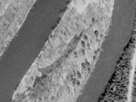
and 70 feet high at a minimum. Looking at the air photo of the
island above a large channel with water can be seen cutting into the
right (upstream) end of the island. Going down the west side (top of
photo) along the finger formed by the channel I found several good
sized silver maples.
Silver Maple 116 feet tall - rightmost trunk
The largest was 9 ft. 11 inches in girth, and measured 116 feet
tall. It was located in a small patch of knotweed - one of the few
significant patches found on the island. I crossed the channel on a
fallen log and rejoined Dale. By this time Dale had measured several
species of oak, maple, hickory, and many assorted species. I called
him over to measure the large silver maple across the channel. We
also measured basswood, and documented sassafras, flowering dogwood,
Am. hornbeam, and cucumber tree in this immediate area.
Basswood along central swash
The northern, southern and western sides of the island represent bar
deposits that are raised above the river level, but not to any great
height, likely less than 10 feet on average. It is evidenced that
these area flood periodically. The lowest tiers flood every spring,
while the higher levels flood every few years. These areas are the
same in character as was found on any of the other islands we
visited. The eastern side was something completely different. This
are was raised from 15 to 20 feet above the current river level. It
looked as if it had not been flooded for an extremely long time.
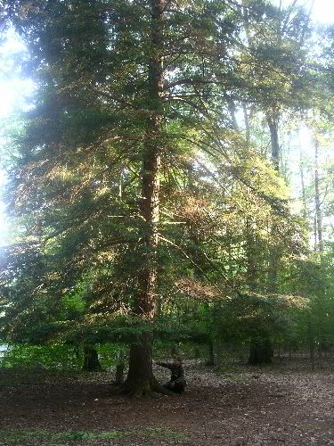
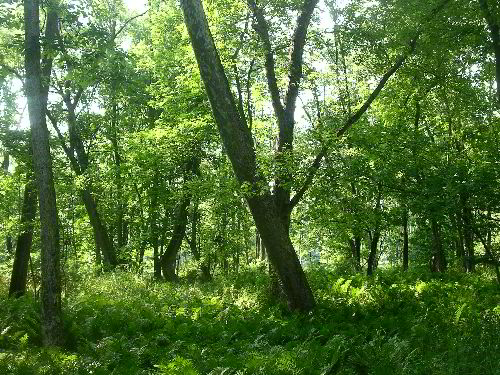
Hemlock
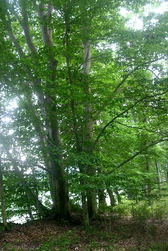
Beech trees along the top of the bank
The trees were spaced and open as if they were a section of a forest
typically found in a dry upland setting. The species diversity for
the island was very high because species were found in this upland
area that are not typically found in areas that are frequently
flooded. We found 32 woody species on our less than four hour stay
on the island, by far the highest of any island we have explored
along the river. The only area at all similar was a short section of
ridge along Thompson Island inhabited by some big red oaks.
The final prong of exploration of the day was a walk down a path
toward the southern (downstream) end of the island. The upland
forest setting gave way to a large open field of canary reed grass
with a few scattered trees. We waded through the tall grass and
measured a black walnut and a butternut poking their heads above the
field.
Black Walnut amidst field of Reed Canary Grass
We had encountered this same character on other islands. In 1985 a
series of tornados blew through the area, killing a number of people
in the village of East Hickory and vicinity, and essentially
denuding portions of several of these islands. I had noted on King
Island an Baker Island that butternut was one of the few tree
species growing among the fields of Reed Canary Grass. It appeared
to me that these trees were present prior to the tornados and
accompanying winds, and were broken off during the storms. They
since have re-sprouted from stumps or roots that previously existed.
The grass has prevented other species from re-establishing in these
areas. The islands themselves as a whole can be best described as an
open savannah setting dominated by sycamore and silver maple. There
were patches of natural grasslands on the islands prior to any human
alteration. These have for the most part been replaced by the Reed
Canary Grass. Whitney (2001) described the general nature of the
forest found on King Island, and that seems applicable to most areas
Hemlock Island outside of the eastern upland:
http://naturetourism.allegheny.edu/essay_alleghenyriverislandswilderness.pdf
"The groundlayer is dominated by sensitive fern (Onoclea
sensibilis). Ninebark (Physocarpus opulifolius), silky dogwood (Cornus
ammomum), and buttonbush (Cephalanthus occidentalis) are common
shrubs. Note the abundance of lianas (riverbank grape (Vitis riparia)
and wild cucumber (Echinocystis lobata))...King's Island is fringed
with canary reed grass (Phalaris arundinacea) and black willow
(Salix nigra)" .
Reed Canary Grass in a nasty invasive species: http://en.wikipedia.org/wiki/Reed_canary_grass
Reed canary grass (Phalaris arundinacea) is a tall, perennial
grass that commonly forms extensive single-species stands along the
margins of lakes and streams and in wet open areas, with a wide
distribution in Europe, Asia, northern Africa and North America...In
many places, reed canary grass is an invasive species in wetlands,
particularly in disturbed areas. When reed canary grass invades a
wetland, it suppresses native vegetation and reduces diversity. The
grass propagates by seed and rhizome, and once established, is
difficult to eradicate.
http://www.inhs.uiuc.edu/chf/outreach/VMG/rcanarygr.html
Across the field of Canary Grass were some other large looking
trees. We waded through the grass to find some more sycamores, and
silver maples of good, but not great size. Off toward the western
side of the island I could see a large single stem silver maple. I
pushed forward and Dale followed. Between us and the trees was a
massive moat of multiflora rose bushes. Eventually we found, worked,
pushed our way through being wounded in the process. Dale saw and
measured the height if a slippery elm - the only one of the trip,
but it was buried by brush ad briars to the point we could not get a
girth. I would guess a diameter of around 2 feet. From here we
pushed on to the large silver maple. This one was 14.7 feet in
circumference and 102.1 feet high from underneath. We pushed through
the multiflora roses to a more open area along the western side of
the island. Working our way back toward our raft as it was getting
dark we came across several large sycamores with girths greater than
10 feet and a couple other larger silver maples. Once we got back to
our raft, we paddled across the river as it was getting dark, for a
nice end of a good trip.
Statistics and Measurements for Hemlock Island:
Species
CBH Height
Comments
Am.
Basswood
5.6
75
Am.
Basswood
8.3
98.2
Am.
Beech
7.6
96
Am.
Beech
6.3
96.8
Am.
Hornbeam
1.5
33.6
Am.
Hornbeam
1.5
34.3
Apple
4.7
N/A
Bitternut
hickory
7.6
105.1+
Bitternut
hickory
4.9
105.9
Bitternut
hickory
5.4
108.1+
Bitternut
hickory
5.5
108.1+
Bitternut
hickory
7.3
111.6
Black
birch
5.5
78.1+
Black
birch
5.5
78.1+
Black
birch
6.4
96.1+
Black
cherry
6.8
87.1+
Black
cherry
5.2
95
Black
cherry
6.7
101
Black
locust
4.3
86.4
Black
oak
6.8
93.1+
Black
oak
7.1
115.5+
Black
walnut
3.3
50
Butternut
N/A
29.4 Forgot
to write the CBH down…
Cucumbertree
4
N/A
Cucumbertree
4.9
110.1
Cucumbertree
3.9
116.3
Dotted
Hawthorn
1.3
E.
hemlock
5.3
53
E.
hemlock
4.5
58
E.
hemlock
7.8
104.4
E.
white pine
7.6
108.8
E.
white pine
9.2
110.2
E.
white pine
8.5
113
E.
white pine
10.3
113
E.
white pine
7.4
118.2 41
35.811N x 79 24.228W
E.
white pine
10(2x) 121.7
E.
white pine
8
123.1
E.
white pine
8.6
124.7
N.
red oak
10.6
81.1+
N.
red oak
10.8
96.1+
N.
red oak
N/A
106
N.
red oak
8.7
106.8+
N.
red oak
10.9
108
N.
red oak
7.9
109.2
N.
red oak
7.3
111.1+
N.
red oak
8.4
111.1+
N.
red oak
6.2
112.2+
N.
red oak
6.1
114
N.
red oak
7.4
114.1+
N.
red oak
9.2
116.4+
Pignut
hickory
3.3
80.7
Red
maple
3
74.8
Sassafras
3.1
48.4
Sassafras
4.8
66.1+
Scarlet
oak
7.4
93.2+
Shagbark
hickory
2.4
53.8
Shagbark
hickory
5.7
107.1
Silver
maple
(3x)
95.4
Silver
maple
13.4
102.1+ 41 35.620N
x 79 24.475W
Silver
maple
14.7
102.1+ 41 35.525N
x 79 24.507W
Silver
maple
12.7(2x) 103.6
Silver
maple
9.9
116.4
Slippery
elm
N/A
95.9
multiflora rose barbwire 8 ft. up base
Sycamore
10.5
115
Sycamore
N/A
118.1
Sycamore
7.8
121.1 41
35.836N x 79 24.212W
Vitus
sp.
1.8
White
ash
5.7
94.1
41 35.851N x 79 24.210W
White
ash
4.4
99.1+
White
ash
8.5
102.2
White
ash
8.7
114
White
oak
4.2
84.1+
Yellow
birch
2.7
76
Species observed, but
not measured =
Black willow
Flowering dogwood
Mountain holly
Sugar maple
Total Woody Species = 32 (most
out of any Allegheny River Island surveyed to date)
Invasive species =
Japanese barberry
Reed Canary Grass
Japanese Knotweed
Multiflora rose
Hemlock
Island Rucker Index = 114.75
Species
CBH Height
E.
white pine
8.6
124.7
Sycamore
7.8
121.1
N.
red oak
9.2
116.4+
Silver
maple
9.9
116.4
Cucumbertree
3.9
116.3
Black
Oak
7.1
115.5+
White
ash
8.7
114
Bitternut
hickory
7.3
111.6
Shagbark
hickory
5.7
107.1
E.
hemlock
7.8
104.4
This can be compared quite well to the Rucker Index for the
Allegheny River Islands Wilderness as a whole from 2007 (including
parts of Anders Run)
Allegheny River Islands Rucker Index = 114.27 (Oct. 2007)
Species
CBH Height
Site Comments
Sycamore
12.1 145.5
Baker Island
PA height record
Silver maple
9.7 120.1
King Island
NE height record, (Formerly 123.3')
White ash
11.5 118.4
Anders Run N.A.
Swamp white oak 10.9
111 Anders Run N.A. E.
U.S. height record
Bitternut hickory
7.7 110.3
Baker Island
Black walnut
7.7 110.3
Thompson Island
Shagbark hickory
5.5 109.6
Anders Run N.A.
Sugar maple
8.7 108.1
Crull Island
Am. Basswood
9.8 105.1+
Thompson Island
Am. Basswood
7.8 105.1+
Thompson Island
N. red oak
17.9(2x) 104.3 Buckaloons R.A.
There are several variants of Rucker Index that can be calculated.
Merging the above list with the numbers from Hemlock Island and a
new measurement of the Sycamore on Baker Island we have a Rucker
Index of 119.2 for the Allegheny River Islands. It only drops to
118.6 if you eliminate Ander's Run entirely, replacing the White Ash
from there with one from hemlock Island, and replacing the Swamp
White Oak with the Sugar Maple from Crull Island. I have not seen
these trees, so I don't know if that would be appropriate or not.
The silver maple record on King is on a temporarily shore-attached
peninsula, but clearly part of the island system overall.
Allegheny
River Islands Rucker Height Index =119.2
| Sycamore |
147.7 |
Baker
Island |
PA
height record |
| E.
white pine |
124.7 |
Hemlock
Island |
|
| Silver
maple |
120.1 |
King
Island |
NE
height record |
| White
ash |
118.4 |
Anders
Run N.A. |
|
| N.
red oak |
116.4 |
Hemlock
Island |
|
| Cucumbertree |
116.3 |
Hemlock
Island |
|
| Black
oak |
115.5 |
Hemlock
Island |
|
| Bitternut
hickory |
111.6 |
Hemlock
Island |
|
| Swamp
White Oak |
111 |
Anders
Run N.A. |
|
| Black
walnut |
110.3 |
Thompson
Island |
|
|
119.2 |
|
Rucker
Height Index
|
As noted above we
identified a number of prominent invasive species on the trip:
Japanese barberry, Japanese Knotweed, Multiflora Rose, and Reed
Canary Grass. I am sure there are others, but they were not noted.
Many of the islands have evidence of Native American utilization.
More recently the southern half of Crull Island was used for cattle
grazing, there were a couple of gas wells on King Island. Thompson
Island was the site of the only Revolutionary War battle in the
region. http://naturetourism.allegheny.edu/essay_alleghenyriverislandswilderness.pdf
I am not sure how much the forests of Hemlock Island have been
altered by human activities. Some of the trees I would estimate to
being over 150 years old. A nice black cherry with balding found by
Dale is one example. Many of the trees had evidence of wind damage
in the past. The fattest basswoods and sassafras all had their tops
blown off at some time in the past. I would guess winds related to
the tornados of 1985.
The island certainly needs to be revisited and more time spent there
that we were able to do in a single evening. There are several big
sections of the island we did not see at all, let alone measure. I
know there is a nice Black Willow to measure, and I believe we can
get out species count higher, As a final note there were some fat
grapevines on the island. The largest was a respectable 1.8 feet in
girth.
Edward Frank (with Dale Luthringer)
== 4 of 5 ==
Date: Thurs, Jul 17 2008 7:20 pm
From: "Dale Luthringer"
Ed,
Thanks again for putting another one of our trip reports together.
I'm
pretty close to putting out my latest trip to Ohiopyle State Park
back
in April.
The Anders Run trees are located in the Allegheny River floodplain,
not
on any islands. We could easily do a variation of RI's, one for the
Wilderness Islands, one for all the islands on the Allegheny River,
then
another for the Allegheny River.
I bet we could get a select few black oak, black cherry, and white
ash
to 150 years on this island, with a number of white pine, hemlock
and
red oak in the 100-125 year range.
This island definitely needs another amphibious assault. I'll
remember
to bring my clinometer this time.
Dale
== 2 of 5 ==
Date: Thurs, Jul 17 2008 6:38 pm
From: JamesRobertSmith
Sounds like a heck of a long day! Too bad about the invasive
species.
Since there's a wilderness area there, wouldn't there be a project
to
get rid of the invasive species?
== 3 of 5 ==
Date: Thurs, Jul 17 2008 6:50 pm
From: "Edward Frank"
James,
It was an evening trip, so a short day. There isn't any effort to
remove the invasives, nor do I believe there is any funds to do so.
The best thing to do would be to mimic the natural flood cycle by
releasing large volumes of water from Kinzua Dam in the spring, but
the flood zone has so many camps and properties that would now be
flooded, by what would have been a normal flood prior to the dam,
this is unlikely to happen. This would significantly cut back on the
number of Multiflora Rose and the Japanese Barberry are not flood
tolerant and would die back after a few floods. The Japanese
Knotweed would be cut back dramatically with more frequent floods as
well. It likely would not do much against the Reed Canary Grass. We
can hope that they will re-initiate the flood cycles, but I would
not hold my breath. (I have a problem with people building houses,
businesses and the like in the flood plains - they are called flood
plains because that is where the rivers flood - and then we use tax
dollars to finance rebuilding in these same areas).
Edward Frank
== 5 of 5 ==
Date: Thurs, Jul 17 2008 9:28 pm
From: James Parton
Ed & Dale,
Outstanding report. You guys really got some measuring done.
Those inflatable boats are really useful. I have used them many
times
to float rivers fishing. Using them to access areas of interest
concerning trees is an idea that has already occurred to me, like
visiting the Black River cypresses down near the Carolina coast.
First
I gotta complete my move to a new home.
I have already found a forest of nice white pines near Lake Julian
that I intend to investigate. It is not far from my new home.
James P.
|