 |
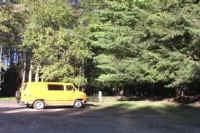
Parking area at the trailhead for the Paved Trail. At the beginning of the trail a straight segment leads into the forest for a distance of 65 feet until the loop is reached. All distances are given from the starting point of the trail and going counter-clockwise around the loop. |
|
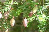
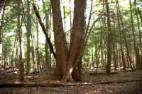
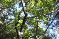
1) 85 feet. Almost at the beginning of the loop along the left side of the trail is multi-trunked hemlock. It is a one of the largest along this trail but is dwarfed in size by many of the giant hemlocks found elsewhere in the park. The small size of the hemlocks in this area is evidence they had been removed by timbering earlier in the twentieth century. Photos shows the trunk of this specimen and a close-up of hemlock needles and cones. |
|
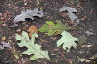
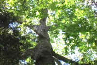
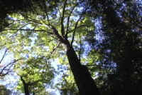
2) 110 feet. A white oak located along the right side of the trail. It is 98 feet tall. Photos show a view of the canopy of the white oak and a collection on white oak leaves on the ground. It is often difficult to see the leaves of these trees because the first leaved branches are so far up. One option is to look for leaves on the ground underneath the trees. A second key is to learn to recognize the different bark patterns of the different trees in the area. |
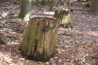 |
3) 225 feet. Remains of a pair of chestnut stumps. These trees were removed in the early part of the twentieth century and the stumps are so resistant to rot that they are still recognizable today. Around 1910 a fungal infection destroyed virtually all of the natural chestnut stands in the eastern United States. Today the once widespread and important tree is present only as a few sprouts and stunted trees that die before reaching maturity. |
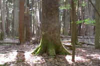 |
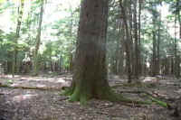
4) 235 feet. White oak about 25 feet off the trail to the right. Note how the tree flair out at the base and the moss covering the tree roots. |
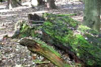 |
5) 305 feet. Decaying log along the left side of trail. Note the moss and fungus growing on the log. This decay cycle is one of the most important aspects of the life cycle of the forest that is too often not noticed by the casual visitor. |
|
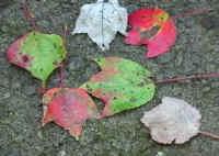
6) 315 feet. Red maple along the right side of the
trail. Note the twisting pattern exhibited in the basal portions
of the tree. Photos show base of the tree, view of the red maple
canopy showing some autumn colors, and red maple leaves.
7) 315 feet. The paved trail widens at this point to allow two chairs to easily pass. |
|
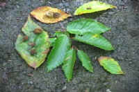
8) 345 feet. A clump of American beech trees along
the left side of the trail. Photos show a view of the canopy
of one of the trees and the leaves and beechnuts produced by the
tree. Notice the smooth surface of the bark.
9) 410 feet. An American beech tree immediately adjacent to the trail along the right side. This tree is 100 feet tall. The graffiti carved into trees like this lead to infection and the trees eventually death in some cases. |
|
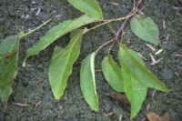
10) 430 feet. A large black cherry tree along
the right side of the trail. This tree has a circumference at
breast height (cbh) of 9.3 feet, and is between 105 and 110 feet
tall. Photos show the base of the tree, the distinctive bark, and
black cherry leaves.
11) 495 feet. A wide area along the paved trail. 12) 525 feet. Black cherry on the right side of the trail. 100 feet high, cbh 8 feet. 13) 590 feet. Black cherry on the right side of the trail. 108 feet high, cbh 7.8 feet. |
|
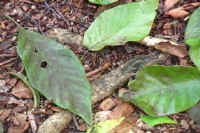
14) 615 feet. Cucumber magnolia located about
60 feet off the right side of the trail. It is actually along the
path of the adjacent Black Bear trail. The tree is large for its
kind at 110+ feet tall, and with a cbh of 8.8 feet. Photos show a
view of the tree from the Paved Trail, the tree canopy shot from
underneath the tree, and view of the cucumber tree leaves. These
leaves can be quite large and range in size from 4 to 10 inches in
length. They form a seed pod that resembles a small cucumber in
the late spring.
15) 623 feet. Wide area along the Paved Trail. |