|
WNTS/ENTS,
The time had come
for the 3-D mapping and volume modeling of the World’s tallest known
giant sequoia. Growing just over the ridge from Whitaker Forest, this tree had been rigged and
tape-dropped but the entire mapping process- including foliar, twig
and cone sub-sampling- had not yet been performed. Two mapping teams
were assembled for this project which was expected to span a full
three days. Steve Sillett and Marie
Antoine were one team and Bob Van Pelt and I the
other. At 94.8 meters (311’) this tree stands just centimeters
taller than another tree in
Redwood
Canyon.
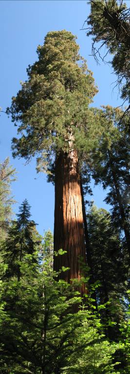
Composite stitch of
the tallest tree
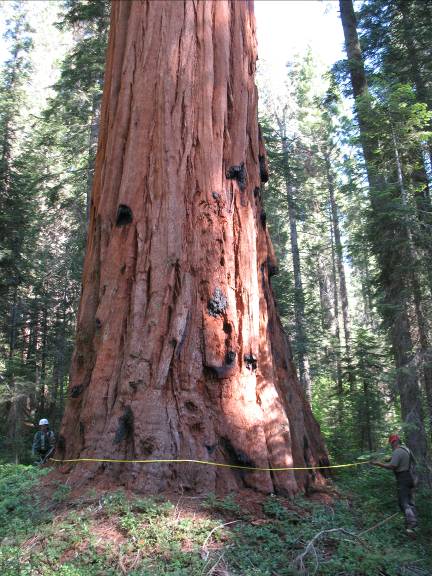
Marie and Bob
working on a basal tape wrap
Redwood
Canyon
in Kings Canyon
National Park, where the
tree grows, contains the lion’s share of superlative tall sequoias
(and areas of high potential to this day remain unexplored…). Thus
it is analogous to
Great Smoky Mountains National Park’s Big Fork Ridge, Cataloochee, NC which contains the vast majority of the
tallest known eastern hemlocks. It also contains one of the true
giants mentioned in Bob Van Pelt’s superb book, Forest Giants of the
Pacific Coast. The “Hart Tree” grows on a slope of Redwood Canyon and is among the 20 largest
sequoias known. I noted that I was now climbing the tallest known of
the largest western evergreen conifer in a superlative forest
reserve just I had done in the Usis Hemlock in the Tsuga Search
Project in the east. Like Bob, I was among the few climbing the
giants east to west.
The superlative
tree stands in a vegetation plot Bob and his colleagues had already
set up. Captured in this plot as well were several super-tall
sequoias including five others over 91.5 meters (300’) tall. Within
sight was another tree 93.0 meters (305’) tall. The plot and
surrounding forest was dominated by dense sequoias with white fir
and a scattering of sugar pine. The standing volume was incredible
with large trees nearly touching each other. One section of the plot
had nine sequoias forming a tight grove. You could stand in the
center of this grove on a thick bed of needles and be surrounded by
walls of wood. It certainly would be a nice bedroom for a giant. I
shot a video of the grove which I would like to post.
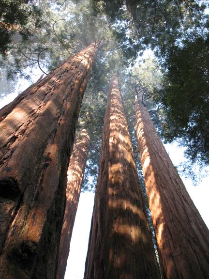
Dense grove in the
plot
The hike to the
tree was rather steep and the dusty trail made for lots of sneezes.
As before, the mosquitoes were hungry and kept us moving briskly.
Wildflowers were in full blast, many of which I recognized to genus.
The assemblage of herbs on the forest floor was oddly familiar to
the eastern forests. The presence of the wildflowers was due to the
lack of the grazing cows seen in Whitaker Forest. I loved the contrast of the
lupines, charcoal and the red bark of the old sequoias.
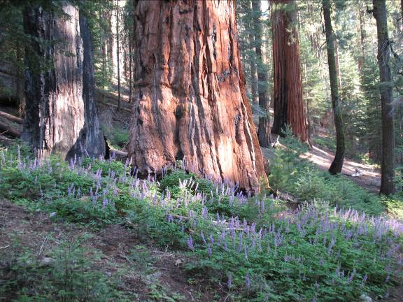
Lupines and sequoia
The massive debris
from fallen giants was also a new sight in contrast to the logged forest of Whitaker. The trail was routed through the
debris- as the debris was too large to cross.
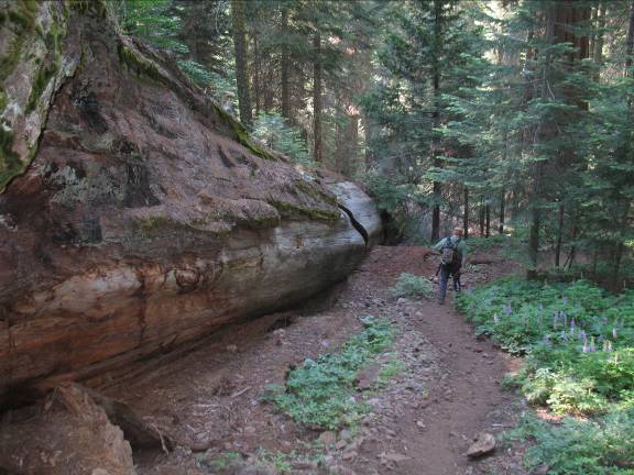
Bob passing by a
fallen giant on the trail
Bob mentioned that
the tallest known white fir at 69.2 meters (227’) was adjacent to
the tall sequoia. A tree 70 meters (230’) tall was thought to be
possible and thus was the “Holy Grail” number to shoot for. Indeed,
the white firs of Redwood Canyon were incredibly tall. During the
hike down I had a laser on hand to scope the forest for more tall
ones. 61 meter (200’) firs were absolutely everywhere and I located
several close to 67 meters (220’). I took note of a shafty tree not
far from the plot just up the canyon. Clumsy shots with the heavy
pack indicated a height around 70 meters. While the ropes and
reference tapes were being set for the mapping I went back to take
some detailed measurements. A clear top shot and basal reference set
above the clutter of the 1.28 meter (4.23’) diameter trunk yielded a
height of 70.4 meters (231’). SCORE!
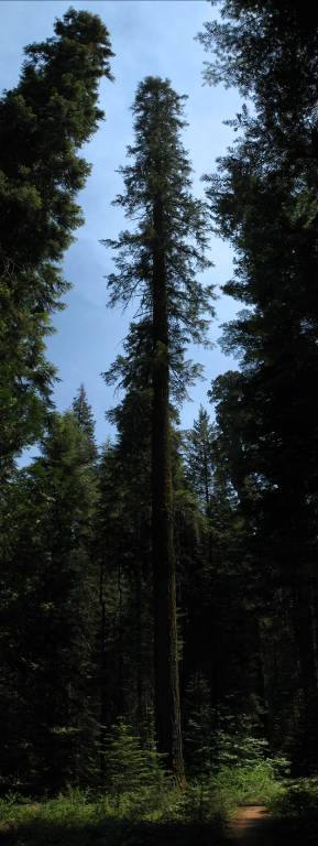
New height record
white fir 70.4 meters tall
We all took turns
pulling the 183 meter (600‘) climbing rope up the tree and through
the pulley. It was stubborn (stuck on a stub) and we thought we may
have to re-rig the tree. It finally came through and Steve ascended
first to anchor and reset the ropes for a dual ascent [one climber
on each side- the pulley and anchor point was 89.2 meters (292’)
up]. Once anchored, two climbers could ascend at the same time then
transfer to a separate rope once at the top. Typically the data
recorders stayed anchored to the ascent/descent rope while the
measurers traversed the canopy on separate lines.
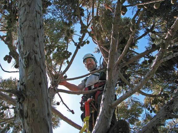
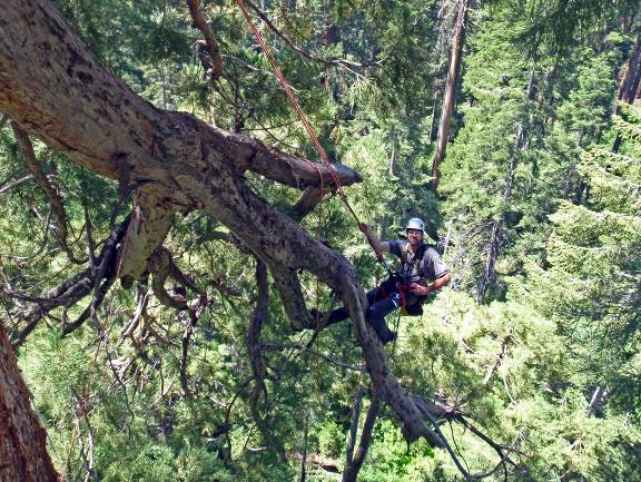
I ascended the
opposite side that Steve went up while Marie went up after Steve.
Steve and Marie were to start mapping at the top while Bob and I
taped-wrapped the main stem all the way up to them [at 5 meter
(16.4’) intervals]. We would then join them in the canopy mapping
and divide the tree into mapping sections. Free of branches for over
46 m (150’) the trunk was awesomely open and a deep red in the
brilliant morning sun. Bob hopped on the rope Marie had just left
and we began to gather diameters from the ground up (Bob will do a
footprint map as well). My rope was set so high and the trunk so
free of branches that I was literally able to swing the entire
circumference of the trunk after anchoring one end of the tape in
the soft bark. Little did I know that this task was so incredibly
easy compared with what was to come… However, on one swing my feet
slipped out of the soft bark and I made the mistake of holding the
end of the diameter tape with its claw hook. As I swung back around
the tree the claw hooked deep in my thumb, ripped out and then
sliced through my forefinger. Let’s just say the bark was a bit
redder than usual after that.
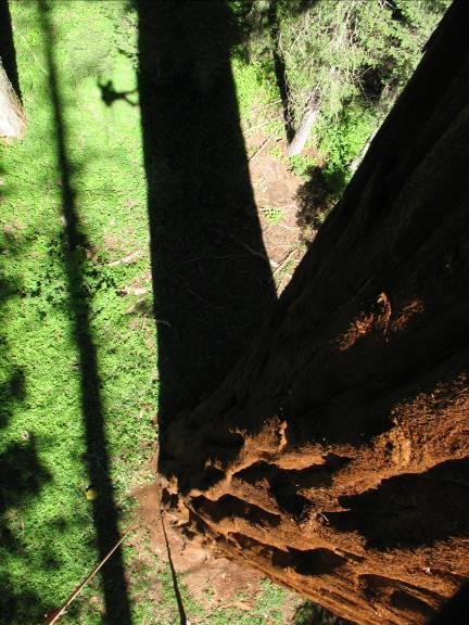
My shadow beside
the trunk shadow of the tallest tree
My thumb and finger
were wrapped in duct tape which did not help my grip as we ascended
the tree higher and higher. The central trunk was amazingly slow-
tapered and dropped from 3.64 meters (11.9’) diameter at 10 meters
(33’- where the trunk became circular) to still over 2.0 meters
(6.6’) in diameter at 66.2 meters (217’). As we ascended and entered
the lower crown I discovered that “my” rope had passed through an
impassable tangle of branches originating from an epicormic fan.
When Steve reset the rope after being stuck none of us could see
that it had passed through where it did. I recall this being about
50 meters (165’) up. I had to disconnect from the main rope and use
my lanyard to secure to the tree while I wrestled my way up, around,
and over this mess of slippery branches. I was secured to the tree
but was nervous nonetheless since the whole epicormic system could
fail and I would go with it. An unlikely event- but no backup plan
since I could not reconnect to the main rope until after I had
passed the tangled mess. I disconnected reluctantly and grabbed the
branches to pull myself around. I successfully made it over but
while I was reattaching to the main line the branch I was sitting on
failed. This was a live 5 inch diameter branch! Man, these trees are
weak! Fortunately (and deliberately) I was straddled over several
such braches and they held. I definitely strained some clenching
muscles I did not know I had! I noted the cracked branch (it had not
been mapped yet) and continued upward. The trunk wraps became more
challenging as I could no longer swing around the trunk and the
branches and limbs were huge. The trunk was still over 2.45 meters
(8’) thick even though we were 56.6 meters (186’) off the ground.
Bob and I tossed the tape to each other as best we could.
The main trunk
ended at 87.9m (288’). From here and farther below the top
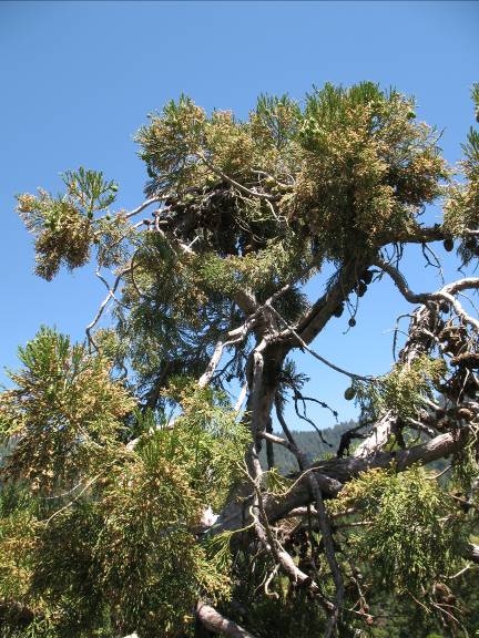
bifurcated again and again into a literal forest of thick stems.
Some were dead, partly dead and two ascended into the highest points
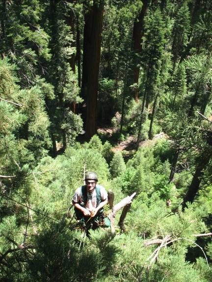
of the tree. Steve was on the highest leader. I ascended the other
leader which topped out at 94.5 meters (310’). I was tied in to the
tree at 305’- my personal highest climb.
Top bifurcations
and reiterations at ~79 meters (260’)
Me in the top.
(Actually, this is in a different tree…) Photo courtesy and © of Steve Sillett.
Steve and I were
the canopy scramblers and carried with us various instruments. We
had lasers for distances, carpenter’s tapes for shorter distances,
diameter tapes, compasses, as well as climbing gear; straps,
pulleys, carabineers etc.. Some were duplicated in the event of
dropping a piece of gear. Of course, all were tethered but
descending out of the top of the tree to retrieve a diameter tape
was not a reasonable option. Besides, after falling several hundred
feet the tape would have buried itself deep in the duff layer and
would never be found.
With this gear
Steve and I measured the crown of the tree in its entirety. Every
branch and every limb and every trunk was measured and referenced in
three-dimensional space. The point where a branch originated was
known; its height, azimuth and distance from ground zero (the center
of the base of the tree). For each branch we also measured how long
it was, the slope and direction it was growing, the diameter, and
the amount of foliage it had. We also counted cones (live and dead)
on a subset of branches. Each live branch was assessed as to how
many foliar units it supported. A foliar unit was a concise amount
of live foliage that can be quantified on a small scale. Thus, the
cumulative assessment of the foliar units on each and every branch
would indicate the amount of foliage on the entire tree. Prior to
data collection we all calibrated since foliar units were not
physically measured but subjectively estimated. Later, a sample of a
branch would be excised from the tree and carried back to camp for
detailed sub-sampling.
The highest point
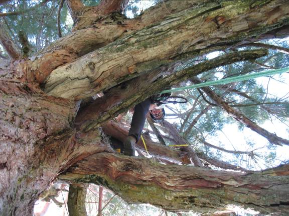
of the tree. Note that it is cracked and leaning to the right.
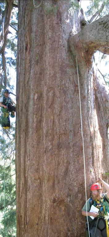
Bob at about 43m
(141’) with Steve above. Note one of two original branches above
Bob.
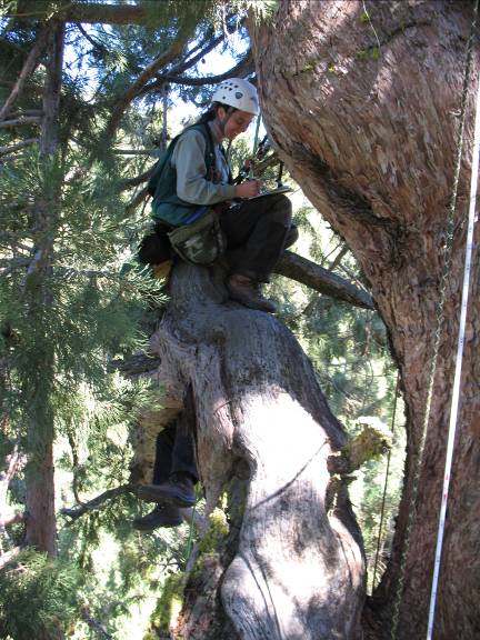
Bob and I started
the mapping process methodically from the top down. He would select
a limb or branch system and we would map it in its entirety before
moving to the next. This way the tree was divided into a logical
progression and confusion was minimized. Each system had a distinct
name based on the hierarchy of the mapping system and its placement
(height) in the tree. Some systems took hours to map and some were
quick. It all depended on the complexity of the system. This was a
very old tree and thus very little of it was not complex.
Live reiteration
off a branch of a dead reiteration off an epicormic sprout off a
dead original branch…
…with Steve by it
for scale… pondering what the %#$^ this thing is- and how to map it!
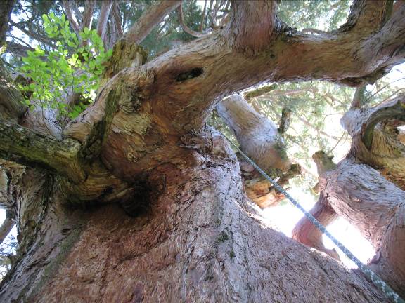
Epicormic fan with
epiphytic Corylus plants at 61 meters (200’)
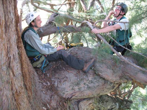
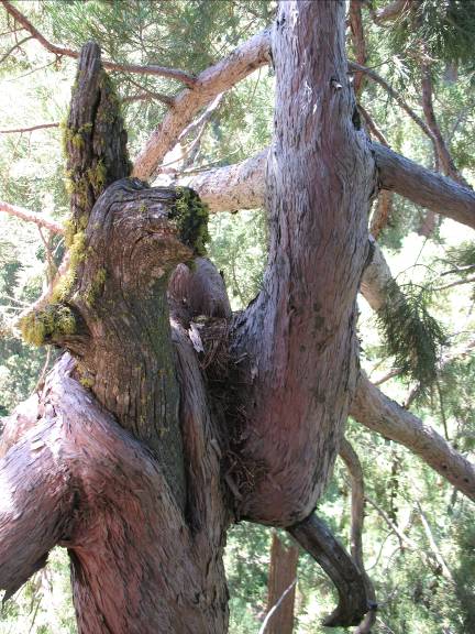
Marie and Steve
eating a delicious boiled egg breakfast at the beginning of the
second day of mapping. The dead stub below the twisted mass of
epicormic gnarlage is the remains of the original branch. These
brittle chunks of wood were the skeletal remains of the original
tree’s branches. All but two were long dead.
Better view of the
dead original stubs and live epicormic sprouts surrounding them.
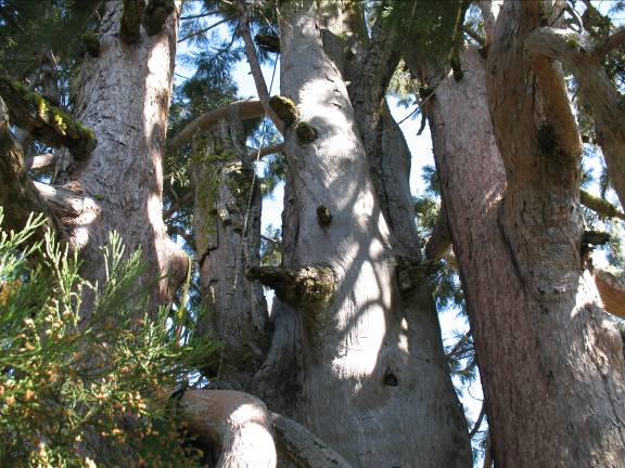
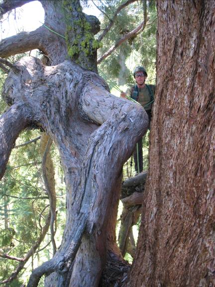
In fact, the entire
crown of this tree contained only two original branches. The rest of
the crown including the entire top was composed of epicormic sprouts
and reiterated trunks. The remaining two original branches were
absolutely huge and differed immensely from the epicormic sprouts.
The original branches were close to each other and heading in the
same direction. They were in fact, entwined. What was so wild about
these two relics of the original crown was that both were
plagiotropic- that is they grew in a cascade down the trunk. The
lower and larger branch system, ~.6 m diameter and originating at
plunged about 18m (~60‘) down the trunk. It also extended about 10m
(33’) from the trunk and had small, vertical reiterations erupting
to try growing upward. Climbing out (down) on these draperies of
gnarliness was actually rather easy. I would literally slide my way
down while lowering myself in elevation. I was connected to the
structure via my lanyard which kept me on the branch. As I got
farther out I set a redirect to anchor my tie-in point so a big,
nasty swing to the trunk wouldn’t be the result of an errant slip
while repositioning my lanyard.
Here I am after
redirecting my rope to descend even further out a plagiotropic
branch. Note reiterated trunk below, right of me. ©S. Sillett
Steve among the
numerous foliar units and a sea of young fir below.
Marie laughing as
Steve is swallowed by an epicormic octopus- see his feet?
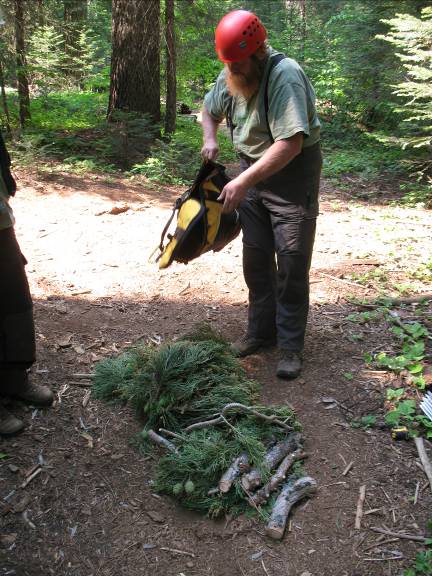
The mapping of this
tree did indeed take three days. The last day we were assisted by
Brian Kotwicka- the fantastic artist for the Sherrill Tree catalogs.
He climbed to extract a branch out of the tree to carry back for
further dissection and analysis. Although only 7.0 cm in basal
diameter the branch took three of us to carry it out. It is a good
thing we finished when we did as a forest fire entered the opposite
side of the canyon and the trail was closed the next day by the Park
Service. On the way out Bob and I measured another white fir I
spotted off the trail. Growing at the base of a steep slope and
wedged in with towering sequoias, this tree soared to another record
height of 71.5 meters (234.5’)!
Bob dividing up the
sample to share the load. The cones were HEAVY!
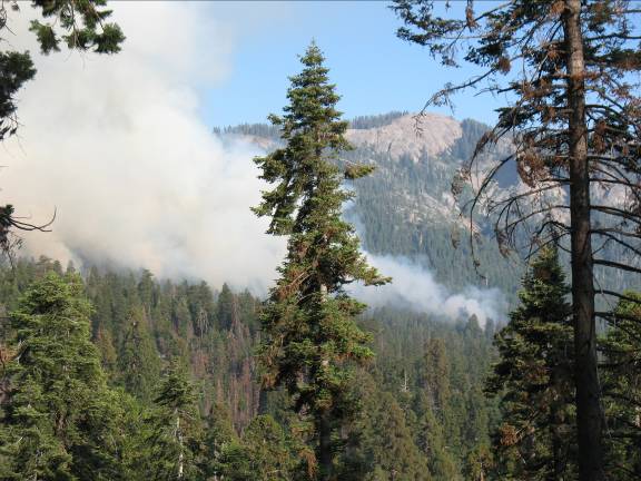
Forest fire burning
into Redwood
Canyon. The last day of the
mapping was quite smoky.
Smoky view on the
last day of mapping
And the fourth day
we rested. Well, sort of. We spent a long day exploring a granitic
dome and Sequoia National Park- including the Grant grove and Giant Forest with the four largest trees on
earth. This stunning trip will be the next installment…
Will F. Blozan
President,
Eastern Native Tree Society
President,
Appalachian Arborists, Inc.
Continued
at:
|