WNTS Trip Report – Great Basin Bristlecone Pines – 2008, 2009
2009
Last October I had an opportunity to briefly detour off of Eastern California’s Highway 395. It would take two hours to get to my destination, the Bristlecone Pine Forest, with about two hours to spend there, and two hours to get back down. For motorcyclists and sports cars, it’s a wonderful road that climbs up into the White Mountains (the second highest mountain range in California). With fairly continuous turns swinging left and right, an added ingredient of roller coaster ‘vertical curves’, thrown in seemingly at random, my rented ‘soccer mom’ minivan struggled to maintain its ‘aplomb’, its driver at the ready, particularly so, when in a tight canyon section, the road narrowed to one lane.
The road climbed up from the Owens River valley, through pinon pine woodlands, with intermittent vistas of one of the more magnificent sections of the Sierra Nevada range, just twenty some miles to the west.
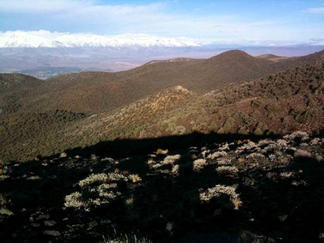
The image below relates the Sierra Nevada range (12,000 to 14,000 feet ASL) in the background with its recent snowline, and the ‘urban’ trees of the town of Bishop down in the Owens River Valley (5000’), with the foothills of the White Mountains rising in the middle ground, and this photo point at 9000’.
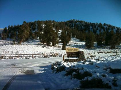
It was with some relief that I pulled in to the Schulman Grove of bristlecone pines (Pinus longaeva), named after Dr. Edmund Schulman. Schulman began his career as an assistant to Dr. A. E. Douglas, who is acknowledged by many as the founder of modern dendrochronology, because of his pioneering work in tree ring analysis while at the Lowell Observatory in the early 1900s. Schulman continued Douglas’s work, adding his own interest in climate research. His research took him eventually to the White Mountains, where in 1957 he discovered the oldest known bristlecone pine, at more than 4600 years, and named it Methuselah, after the oldest man in the Bible – thus starting a naming tradition that continues today in the ENTS organization. In 1959, the US Forest Service established the Ancient Bristlecone Pine Botanical Area.
“The significance of Dr. Schulman’s discovery can scarcely be overstated. The continuous bristlecone tree ring chronology, including living and dead wood, now extends back nearly 10,000 years. Data from these tree rings supports important scientific research on radiocarbon dating, past climates, air quality, frequency of fires, and water supply trends.” [Quoted from USFS brass plaque along trail]
Most of the Schulman Grove is to the right (East) of the photo above. The series of images that follow are within this photo’s field of view, starting from the lower right side and gradually climbing within the forest edge to the left, and turning back to the right in the forest shadows and onto the ridgeline. While the trail (called the Discovery Trail) heads back into the ‘woods’, my photos stop along the ridgeline, due to time constraints.
One of the first trees that the trail allows close proximity to follows, with some details of bud cones, seed cones, needle arrangement, bark characteristics, and the associated vegetation community (though sparse). An interesting story could be told of the concentric relationship of the two trees in the following image. Clearly patience is a virtue that bristlecones might be characterized with.
When George Sudworth (Chief Dendrologist for the fledgling US Forest Service at the turn of the last century) was assembling the guide to the “Forest Trees of the Pacific Slope” (1908), he described only two members of the Foxtail family, the Foxtail (Pinus balfouriana) and the Bristlecone Pine (Pinus aristata). It was years later (1963) that botanical differences split the Bristlecone Pine into two separate species, the Great Basin bristlecone pine (Pinus longaeva) and the Rocky Mountain bristlecone pine (Pinus aristata).
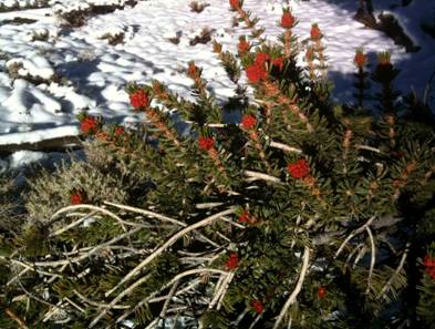
Ripening pollen cones of the Great Basin bristlecone pines (hereafter referred to as bristlecones), are shown below, can be seen as early as late May. Once they release their pollen, they shrivel and fall to the forest floor, and become forest floor litter. Needles in groups of five are grouped in fascicles. Like all five needle pines, when held close together, their cross-section is that of a cylinder, equally divided into five. During the heat of the day, the needles ‘close’, and reduce water loss. These and other features all contribute to the bristlecones ability to weather climatic extremes, the first step in developing the longevity they’re known for.
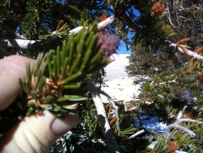
Seed cones develop in July from small spheres that can be found at the end of the shoot tips, where they are later pollinated by airborne pollen from the pollen cones pictured above. By the following July, a seed cone is formed, purple and resinous, as seen below. Note also the needles in their “closed cylinder” mode, on this bright 75 degree day.
Overtime, such reproductive efforts yield an opportunity for seedlings to get established and mature.
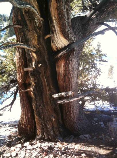
The next tree further up the trail demonstrates the tenacity of the bristlecones, engaging the dolomitic bedrock, and emerging victorious.
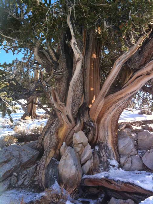
While it can’t actually be said that bristlecones ‘prefer’ dolomitic soils, so few other plants can persevere there, that the bristlecones ability to grow there simply outcompetes others.
The trail continues, turning back toward the ridge, and goes between four bristlecones nearly at the edge of the forest. The top two are both Great Basin bristlecone pines but have different genealogical traits, the larger one displaying a straighter grain and greater height, the shorter one twisted and contorted. A nearby brass plaque pointed out that the two trees down hill have first year cones of different colors, one purple (the most common) and the other with green cones (a genetic variation, yet to express its advantage).
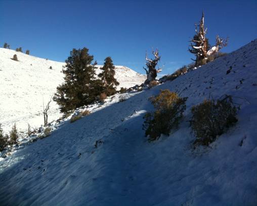
In the image above, a few scattered bristlecones can be seen in the background, with several. Another protected area, the Patriarch Grove (visited earlier in 2008) lies out these ridges about 12 miles north by dirt road. The Patriarch Grove report will follow this one in a later installment.
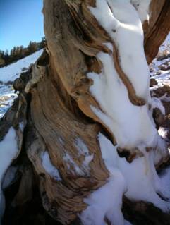
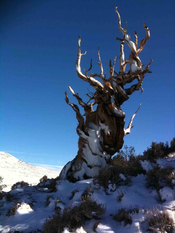
The twisted base above continues it sinewy ways in the image below, in the early morning sun.