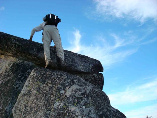
attached, but to what we weren’t sure. The stretchiness of the rope did little to assure our nervousness. Incredibly exposed for our skill levels, we returned to the saddle to further view the marvelous panorama that surrounded us.
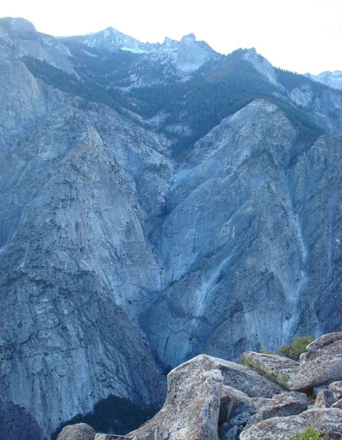
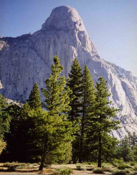
In a panoramic series that starts looking to the southwest, the south, and the south east, the sheer enormity of this topography takes awhile to set in. To the southwest from Burd’s view, the Middle fork of the Kings River winds it way out of Tehipite Valley, soon into Little Tehipite Valley and into the Sequoia-Kings Canyon National Park.
The image following that
swings to a southern view of a
forbidding expanse of granite that rises from the valley floor thousands of
feet, and is known as the Gorge of Despair.
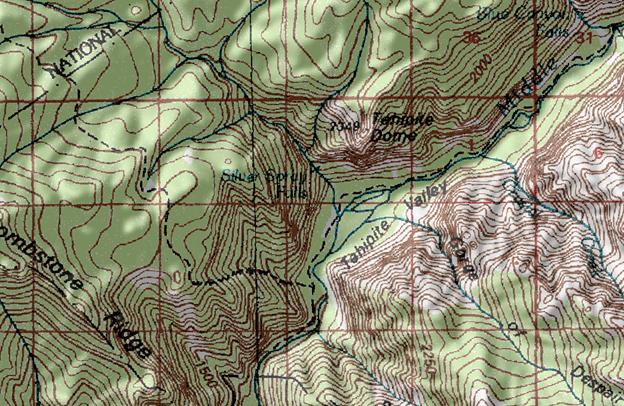
Such names are seldom frivolously selected by federal agency mapping
committees, and when appearing on
topographic maps, hikers and climbers
pour over them imagining what the
contours entailed in winter day dreams. From our perspective the real was more
formidable than we had imagined.
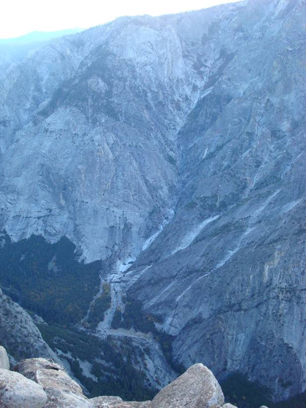
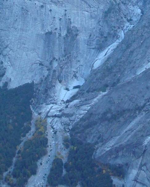
The last of the panoramic series looks to the southeast, to include a
part of the Gorge of Despair, the scoured granite watershed named Crystal
Creek. In its lower sections, a series of pools, waterfalls, and carved granite
channels were to capture our attention.

 As
we silently followed the nooks and crannies, we found what we’d identified on
an early version (1930’s, I think) of a Tehipite Valley Quadrangle, as Crystal
Pool about 1000 foot up from the base of
the Gorge of Despair. Like a tiny jewel,
the sapphire blue pool glowed in the abundant mid-day sun against the bright
white-gray granite. We vowed to sample
its depth as soon as we were able.
As
we silently followed the nooks and crannies, we found what we’d identified on
an early version (1930’s, I think) of a Tehipite Valley Quadrangle, as Crystal
Pool about 1000 foot up from the base of
the Gorge of Despair. Like a tiny jewel,
the sapphire blue pool glowed in the abundant mid-day sun against the bright
white-gray granite. We vowed to sample
its depth as soon as we were able.
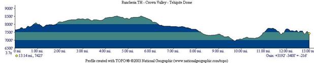
The following year , Dave and I returned to Cow Camp Meadow for an evening campsite. Taking a trail that led down to Tehipite Valley, we took some time peering over the edge where the Middle Fork Trail dived within sight down from 8500’ more than a half of a mile vertically to the valley bottom, passing through several vegetation zones, with Yucca appearing in the last 1000 feet (in the northern- and western-most point of its range, at least in my experience). The entire drop in elevation occurred within one square section (one mile square on a ‘topo’ map), averaging nearly 30 degrees (or a slope percent of 60). Not having experienced a drop in elevation that significant, we knew not what lie ahead for us, but were properly respectful of the seriousness of the ascent when we would return. We stripped our packs of all but the very essentials needed for an overnight hike; a hiker’s stove with the fuel it carried, one ground cloth, one rain fly between us, a summer sleeping bag each, food for two light meals, and precious little more. The rest of our gear we suspended in Sierra fashion between two trees on a rope and carabiner, hoping it would be there on our return.
In no particular hurry, we began our descent in a deliberate plodding gait, knowing that we would be using different muscles, than we had getting to this point. Even so, by half way, we discovered that our knees were so wobbly when we went to stop for a break, that we weren’t able to, in any graceful fashion. By 3/4ths of the way, we knew we must keep walking, but do our very best to keep our pace slow, as they were just as rubbery going too fast as they were going too slow. The view we beheld in the downhill segment was awesome to behold!
Arriving finally at the bottom, we faced absolutely flat terrain, which was quite welcome, but sandy and difficult to walk in, in our condition. We found suitable logs and rocks for easy seating, and could be gotten up from easily, and took a well-earned respite. Much different than the lush spongy meadows we’d come from, the valley floor was well aerated, dry sand and on that late May day air temperatures in the 90’s. Ponderosa pine, large cedars, sage brush, and yucca plants dominated the vegetation. Chipmunks and golden mantled ground squirrels were prevalent, with few other four-legged denizens noted.
Our brief respite over, we slipped into our packs and headed along the trail, generally traversing Tehipite Valley in a northerly direction (the topography to the south prevented all but the most adventuresome, as it was either whitewater crashing over a boulder field, or steep canyon walls). By the time we’d arrived at the north end of Tehipite Valley, we’d seen a wonderful open park-like forest dominated by 6-8 foot in diameter cedars, and 6-8 rattlesnakes! Fortunately our timing found them lounging about having gotten warm and comfortable in the abundant sun, with only one rattling its warning as the trail approached its vicinity, even then, the rattles nearly not heard with the closeness of the river, and its noisy passage.
Alert, ready for danger and adventure, we decided to proceed north along the trail, in the hopes that we could find some way of crossing the swollen, spring thaw-fed river. It was clear that we’d not be employing the rope and staff method we’d used the year before. We’d gone perhaps a mile or so, where we could tell that a major drainage was coming down along the northern most portion of the Gorge of Despair, and knew that we’d have to find a crossing on the Kings River, lest we add another with this side drainage.
Miracles of miracles, we came upon what was for us, a beautiful site…a 120 foot ponderosa pine at one time growing at the river’s edge, had been undercut by the river and it had toppled directly across the Kings River, the shore a mere 100 feet away. About 6-8 feet in diameter, the root wad splayed up fully twenty feet in the air. With the trunk at least a yard off the ground at water’s edge, we had to climb up the latticework of roots, and on to the top of the tree’s trunk…we cautiously began crossing the river, having to seriously concentrate on maintaining our focus on the trunk’s surface and not the whitewater roiling under us. Mid-stream, branches presented themselves as obstacles but were surmountable. The last twenty feet were still fairly high off the ground, and we felt monkey-like as we descended through the now vertical branches, where we fairly hugged the branches, then the ground, glad to have solid footing with little distraction.
Our next effort involved dead-reckoning up some brush covered talus (broken rock that had accumulated along the base of the Gorge of Despair) that was difficult but at least not treacherous (even though we were terribly alert for rattlesnakes!). By now it was late morning and the early June sun was seemingly focused on us, the granite talus bright from below, and the granite walls even brighter. As we peered at the base, we sought a route up to where we had reckoned the Crystal Pool to be. After some scrutiny, we saw our ‘yellow brick road’…the walls of granite, prone to what geologist call exfoliation, had ‘popped’ a two foot thick layer of granite off the monolith, which had slid down until a sufficient base had formed. The vantage point we had, showed a lower-left to upper-right two-foot wide diagonal route that climbed up the wall at perhaps 30 degrees diagonally to the right, just about the maximum steepness that our boot’s vibram soles could handle, without going to all fours. As we carefully ascended this route, I was conscious that the muscles and tendons that had been so abused in yesterday’s descent, weren’t in play today, and the stretching that the Achilles tendons were getting today. The diagonal route took us to a point above the Crystal Pool where we were able to gain access to it.
What a marvelous thing this pool was. Water from the rock jumble above had channeled down the granite, dropped in a 10-15 foot waterfall, and then into this pool that was perhaps 12-15 foot across and at various places, more than 6 foot deep. It then carved out through more or less level granite a channel some 30 inches wide and maybe 18 inches deep, for twenty or thirty feet before pooling again, this time in a large bathtup/Jacuzzi , with nature aerating bubbles into it. Again it channeled out at the far end, before crossing a shallow granite basin, prior to cascading over the edge, eventually to the Kings River below.
With temperatures approaching or exceeding a hundred degrees, and the water somewhat warmed with its traverse down across so much sun-warmed granite, it was playtime for awhile…wading in the pool led to swimming under the waterfall. Soon we began running up the granite wall that was behind the waterfall, until gravity took us back down to the pool…after perhaps an hour or two of such water play and basking in the sun, it was time to return to camp, in order to prepare the last of our food before we slept at the base of the climb that waited for us the following morning.
Waking early, we broke camp quickly, planning on getting up the mile high ascent before the sun came up over the Gorge of Despair and caught us midway. With even lighter packs going up, than the lightened ones we went down with, the ascent wasn’t as really as bad as the descent. Settling into a deliberate pace, we plodded up the grade, without stopping for more than needed pulls on our canteens. At least one of us didn’t stop, Dave made to the top sans stop, but about fifteen minutes from the top, I had to stop, with a pinching of neck and shoulder muscles that couldn’t be borne…the appearance of a large log that had fallen across the trail, then cut to reopen the trail. Fully five foot in diameter or more, I saw the perfect cylinder to lay back across, which allowed my entire body to stretch backwards…fifteen minutes later, I was recovered, and within a half hour had rejoined my friend at the top.
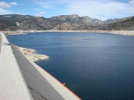
The return hike was to be certain beautiful, but so paled in comparison to our excursion into the Valley, that I recall little of the trailside. We reached our trailhead a dozen or so miles from Wishon Reservoir which crossed wistfully, with the feeling that we’d satisfied our vow to return, made a year earlier.
It has been many years since I made that trek, and many pounds later, I am fairly sure that I may not have the strength and stamina (and the good luck we’d had) to return to “The Pool”, though perhaps I may be able to gaze down upon it from “The Dome”. While I am reluctant to urge a wide segment of population to go there, I hope that there are worthy WNTS hikers out there who will leave no more trace of their presence there than I did, so many years ago. I’m assuming that the 120 foot ponderosa pine bridging the two shores of the Kings River has washed downstream in subsequent floods, but that magic prevails and a way there may be still possible. I should note that recent topos do not show the Crystal Pool, either because of a protective USGS mapmaker who’d been there and has removed labels, or perhaps a rockfall for which the Gorge of Despair would be a natural source.
I have gone to Google Earth and tried to locate features…the following coordinates are probably as inaccurate as my spatial recall, but the approximate coordinates for “The Pool” are 36-54-51.7N and 118-46-02.81E (in Degrees-Minutes-Decimal Second format). Happy hiking!