Manitoba
 Manitoba
| On March 14,
2010 the Eastern Native Tree Society and Western Native Tree
Society switched from discussion lists on Google Groups to a new
discussion list in a Bulletin Board format at:
http://www.ents-bbs.org/index.php
Posts made since the inception of the BBS on March 14, 2010 will
be sorted and archived on the BBS. Click on the link to go to
the equivalent section on the new BBS. This website will
continue to serve as a front end for the ENTS and WNTS groups.
It will continue to serve as a repository of older posts, and
will serve as the host site for special projects and features
that are not well suited for a BBS format. Please visit the BBS
for the latest information and trip reports. |
Field Trips and Discussions
 Manitoba Forestry
Index Page http://www.gov.mb.ca/conservation/forestry/index.html
Manitoba has over 26 million ha of forestlands, of which approximately 94% are provincial Crown land.
Our Crown forests are managed for diverse economic, environmental, social and cultural uses. To effectively meet these varied needs, Crown forestlands are designated for different uses such as Provincial Parks, Wildlife Management Areas, Ecological Reserves or Provincial Forests. Manitoba Forestry
Index Page http://www.gov.mb.ca/conservation/forestry/index.html
Manitoba has over 26 million ha of forestlands, of which approximately 94% are provincial Crown land.
Our Crown forests are managed for diverse economic, environmental, social and cultural uses. To effectively meet these varied needs, Crown forestlands are designated for different uses such as Provincial Parks, Wildlife Management Areas, Ecological Reserves or Provincial Forests.
Introducing Manitoba's
Forests http://www.gov.mb.ca/conservation/forestry/forest-education/general.html
The Province of Manitoba, Canada's central province, consists of 65.0
million hectares of prairie, lake and forest. The southern boundary of
the province borders the United States at 49° latitude and the northern
boundary flanks the new territory of Nunuvat at 60° latitude.
Forests make up about 26.3 million hectares of the province's 54.8
million hectare land base.
 |
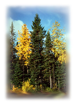
The Northern Coniferous
or boreal forest is our largest forest
zone. It covers a broad swath across the northcentral and central
part of the province, dipping down to extend across our eastern
border into Ontario. You'll find black spruce in the lowland bogs
and fens, and jack pine, poplar and white spruce on the uplands. |
|
|
The Broadleaf/Mixedwood
Forest dominates the south-central portion of the
province. This forest type is often referred to as the Aspen
Parkland, which consists predominantly of aspen, with
smaller amounts of white spruce, oak, maple and elm. |
|
|
The grasslands of southern Manitoba
parallel the edge of Manitoba's central forest zone. While often
thought as an endless expanse of grass, there are actually
thousands of small broadleaf forest stands
dotting the prairie landscape. These mini oases of deciduous trees
and shrubs not only provide critical habitat for wildlife, but a
valuable source of income to farmers and landowners through proper
woodlot management. |
World Wildlife Fund Mid
Continental Canadian Forests http://www.worldwildlife.org/wildworld/profiles/terrestrial/na/na0608_full.html
The mid-continental Canadian forest ecoregion extends from southern Great Slave Lake in NWT to encompass most of northeastern Alberta, central Saskatchewan and parts of west-central Manitoba. This ecoregion is classified as having a subhumid mid-boreal
ecoclimate. It is marked by short, cool-to-warm summers and long, cold winters.
|