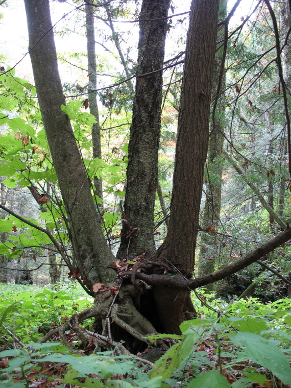
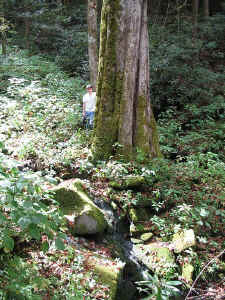
Ents,
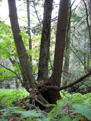
A striped maple, a yellow birch, and an eastern hemlock
germinated out of the same rotting stump and all have survived.
-Jess Riddle
On the Tennessee side of the Smokies, US 441 follows the narrow
valley
of the West Prong Little Pigeon River up to the range's main
divide at
Newfound Gap, elevation 5040'. The lower reaches of the valley
contain The Sugarlands, a broad area of gentle slopes at the
foot of
Mount Le Conte that once supported many farms. Forest has since
reclaimed those fields, and dense stands of vigorous tuliptrees
now
cover The Sugarlands and adjacent sections of the valley.
Probably in
part because of the farming emphasis of the lower valley,
commercial
logging operations never entered the upper watershed.
Consequently,
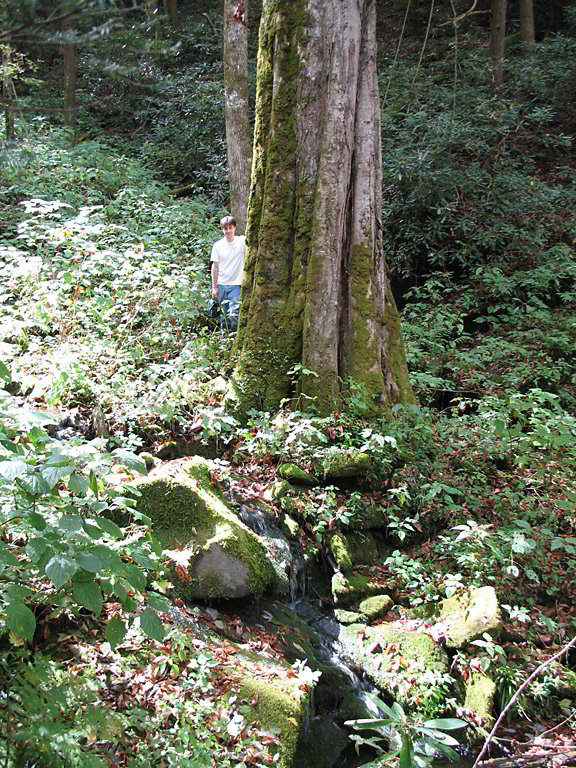
highway 441 now offers a multitude the opportunity to see an
ancient
forest of hemlock, yellow birch, red spruce and rhododendron.
Two of
the most popular trails in the park originate on 441 and allow
visitors a closer look at the uncut forest. The Alum Cave trail
passes through spruce forest, heath balds, and a large rock
overhang
on its way to Mount Le Conte. At 6593' elevation, Le Conte is
the
third highest peak in the Smokies and provides a great deal of
sheltering to the West Prong valley. On the other side of the
valley,
the Chimney Tops Trail ascends Sugarland Mountain through
northern
hardwood, buckeye, and spruce forest to the namesake pair of
exposed,
rocky promontories. The other upper, north facing slopes on
Sugarland
Mountain, which might be more appropriately called 'Sugarland
Ridge',
are similarly steep, so the West Prong valley is also well
protected
from the south.
The Cove Hardwood Trail, a lesser known interpretive path, also
originates on highway 441, and loops across the lower slopes of
Sugarland Mountain. The Park Service has produced a good
brochure to
go with the trail that, at numbered locations, points out
interesting
forest features, such as an old chestnut stump or the gradual
transition going up the slope from previously cleared forest to
little
logged forest. The trail winds through a forest with an unusual
abundance of bitternut hickory but otherwise typical cove
hardwood mix
of tuliptree, black locust, black birch, sugar maple, and yellow
buckeye. The fall herbaceous layer had an exceptional covering
of
acute-leaved hepatica and more typical populations of
plantain-leaved
sedge, a goldenrod, and other rich site herbs.
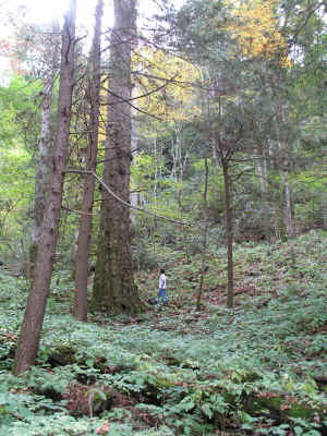
While the trail is well situated to introduce people to mixed
mesophytic forests, the most impressive mesophytic forests in
the area
grow farther upslope in a series of narrow, parallel,
north-facing
coves. Buckeye becomes dominant in coves with basswood,
silverbell,
and sugar maple also prominent in the overstory and smaller
numbers of
hemlock and beech. Striped maple, mountain maple and a few
yellowwood
make up occasional clumps in the understory, but saplings of the
shade
tolerant hardwoods, buckeye, silverbell and sugar maple,
comprise much
more of that layer. More herbaceous species thrive in the coves
than
in the more disturbed forest down-slope with black cohosh, a
goldenrod, bishop's cap, rock stone crop, foam flower, recently
sprouted chickweed, and intermediate wood fern all common. Given
the
steepness of the mountain's upper slopes, the cliffs facing into
the
coves along some of the ridges separating the coves, and the
cascade
in one cove, soil depth is surprisingly deep; boulders are only
common
in linear formations along the sides of some sections of cove.
The low, steep ridges separating the coves appear nearly as
moist as,
but less rich, than the coves. Hemlock covers the ridges for
over
1000' of elevation range and mixes with silverbell, tuliptree,
and red
maple at the lower ends. More than the overstory, the continuous
rhododendron cover marks the different conditions on the ridges.
Species Cbh Height
Basswood, White 11'10" ~124'
Buckeye, Yellow 13'11" 139.2'
Buckeye, Yellow 16'10" 139.2'
Buckeye, Yellow 13'7" 140.7'
Buckeye, Yellow 17'3" 142.8'
Buckeye, Yellow 12'0.5" 144.5'
Buckeye, Yellow 13'10" 145.5'+
Buckeye, Yellow 14'6" 145.6'
Buckeye, Yellow 11'0" 146.5'
Cherry, Black 11'7.5" ~120'
Cherry, Pin 4'4.5" 86.0'
Hickory, Bitternut 10'5" 133.7'
Hickory, Bitternut NA 145.3'
Hickory, Bitternut NA 147.5'
Maple, Red 15'5" ~120'
Maple, Sugar 11'7.5"
141.4'
Maple, Sugar NA 141.5'
Tuliptree 20'0.5" 148.1'+

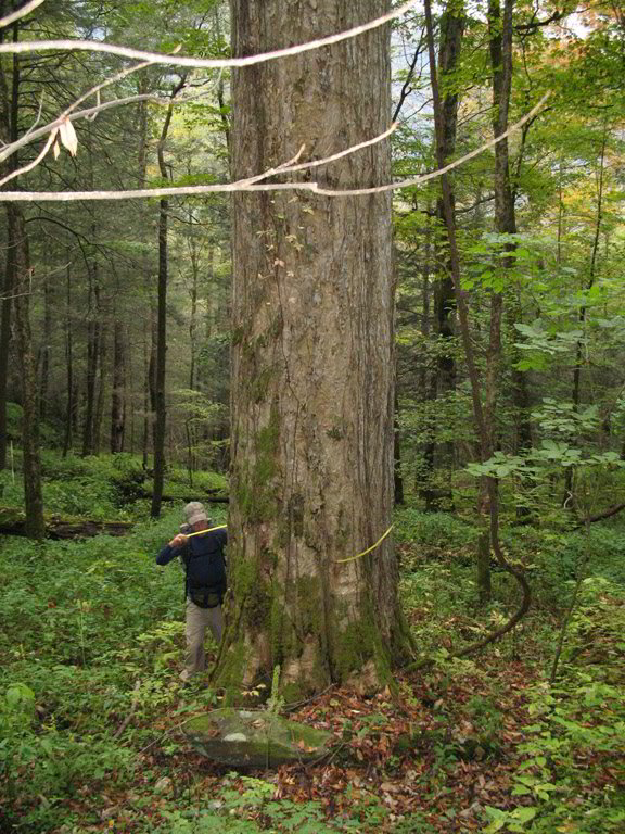
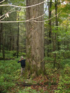
A columnar 13'10" cbh buckeye that is at least 145.5' tall even after a broken top.
- Jess Riddle |
Buckeye - photo by Michael Davie |
The buckeyes stole the show. Even having seen several excellent
buckeye forests, this one has no equal. Buckeye has unusual
dominance
in the coves and approaches records for both height and girth,
and
likely volume. At all other sites where ENTS has measured
buckeyes,
140' individuals are rare. Now, three of the five tallest known
grow
at this site. Since the current and preceding national champions
have
died, the 17'3" tree will likely qualify as a state
champion.
Buckeye - photo by Michael Davie |
Buckeye - photo by Michael Davie |
The
tree also promises to grow even larger since unlike most large
buckeyes, it appears relatively young with a domed crown of
straight
limbs. The two largest circumference buckeyes above have
somewhat
flared lower trunks, typical of very large buckeyes, but the
145.5'
tall individual has an exceptional lack of taper making the
trunk have
proportions similar to the largest hemlocks. Unfortunately, a
storm
broke out most of the crown, so only one large limb remains to
continue growth; the tree may have been even taller before the
crown
broke.
Several other bitternuts at the site approach or exceed the 10'
cbh.
Taken together, the bitternuts are one of finest groups in the
Southern Appalachians. The 147.5' height just tops the former
state
height record of 146'.
With even a modest crown spread, the pin cherry will have enough
points to qualify as a national co-champion under the American
Forests
system.
The sugar maples are a new state height records and the second
and
third tallest ENTS has found.
Having seen a couple tuliptrees around 15' cbh, Josh predicted
that
somewhere at the site one would reach 20' cbh. Within minutes we
saw
the 20' tree listed above, but it grows on a rhododendron
covered
slope rather than in one of the coves. The tree has a large
crown and
little taper, although it is not as columnar as some of the
large
tuliptrees. As far as I know, this is the first tuliptree over
20'
cbh found in the park in two years. The tree grows within site
of the
145.6' buckeye with the 141' sugar maple in between them.
We saw three coves during our day of exploring leaving three
similar
coves unexplored.
Jess Riddle, Michael Davie, and Josh Kelly
|