|
==============================================================================
TOPIC: Yellowstone National Park
http://groups.google.com/group/entstrees/browse_thread/thread/1dfe0d051ff8182d?hl=en
==============================================================================
== 1 of 9 ==
Date: Wed, Mar 26 2008 7:23 am
From: "Edward Frank"
ENTS,
I have for some time been wanting to write a description of my most
recent visit to Yellowstone National Park. The problem is while I am
writing for a tree interest group, the main focus of my visit to
Yellowstone was not the trees found there. Yellowstone also
represents much of the best and much of the worse aspects of the
national Park System as it exists today. It has some of the most
spectacular natural features found in the country or in the world,
but is plagued by the enormous number of visitors trying to view
these features. In 2007 alone there were 3,151,342 visitors, most of
these in the summer months. To support these visitors, during peak
summer levels, 3,500 employees work for Yellowstone National Park
concessioners and about 800 work for the park. My journey took place
in August 2005.
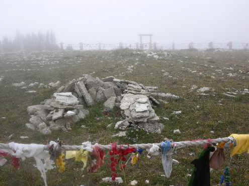
August 13, 2005: I spent the previous night in the western foothills
of the Bighorn Mountains in central Wyoming. I had just visited
Medicine Wheel Historical Site the previous day with fog rolling in
over the mountains.
http://www.nativetreesociety.org/native/medicine_whee.htm
It was a sunny morning as I headed westward toward Yellowstone.
Often on these trips people focus too much on the destination and
miss the trip itself. I came across a leaflet the day before on the
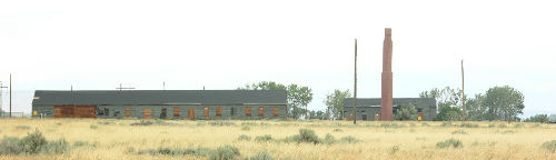
Heart Mountain Relocation Center Memorial, a Wyoming state
historical site along my way . This was a World War II relocation
camp for Japanese Americans. There is some information on the site
available on the internet: "On August 12, 1942, the Heart
Mountain, Relocation Center in Park County, Wyoming opened its gates
to Japanese Americans who had been forced from their West Coast
homes by the Federal Government after the bombing of Pearl Harbor.
Before long, Heart Mountain would swell to Wyoming's third largest
city, housing nearly 11,000 citizen and alien internees in its
tarpaper barracks and barbed-wire enclosures. Today, a few haunting
remnants of the camp remain - a couple of buildings and a towering
chimney. For many, the site constitutes a kind of American sacred
ground, a place where stories of government injustice and intense
human resilience intertwine." http://www.heartmountain.us/history.htm
There is a memorial at the site and a pathway pointing out
activities that took place at the internment camp, schools, Boy
Scouts, Sports, etc. It marks another of the less proud moments in
American history. The couple buildings remaining from the era are
not open to the public at this time.
Continuing westward from the Heart Mountain I headed toward the
eastern entrance to Yellowstone. The road to Yellowstone passes
through Cody Wyoming along Route 20/14/16 following along the
Shoshone River. Immediately past Cody the road passes through a
tunnel and emerges at a small visitors center at the breast of the
Buffalo Bill dam. This is an excellent spot to stop and stretch your
legs and tour the display. Importantly the facility also has a
restroom.
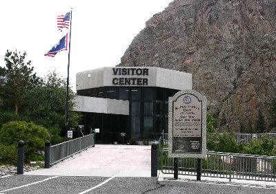
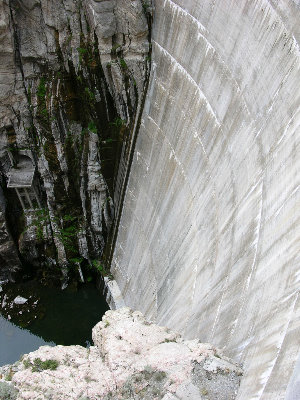
A walk to look across the breast of the dam is worth the time to
see. Inside were displays about the history of the dam, displays on
other local subjects, and even an Allosaur skull.
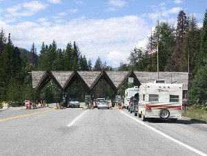
From here it is a straight shot to Yellowstone's east gate. The road
was full as I approached Yellowstone. Half of the vehicles were
tourists, the other half were construction vehicles working on this
section of the road.
As I creped along the highway there was time to
consider the history of the park and the unique geology of the
region. The park service website reads: "Welcome to Yellowstone
National Park! Established in 1872, Yellowstone National Park is
America's first national park. Located in Wyoming, Montana, and
Idaho, it is home to a large variety of wildlife including grizzly
bears, wolves, bison, and elk. Preserved within Yellowstone National
Park are Old Faithful and a collection of the world's most
extraordinary geysers and hot springs, and the Grand Canyon of the
Yellowstone. Yellowstone contains approximately one-half of the
world's hydrothermal features. There are over 10,000 hydrothermal
features, including over 300 geysers, in the park. The Yellowstone
Volcano is still active. Evidence for the activity of the
Yellowstone Volcano are the 1,000 to 3,000 earthquakes per year,
active ground deformation, and the over 10,000 thermal features
found in Yellowstone. There is no evidence that a catastrophic
eruption at Yellowstone National Park (YNP) is imminent."
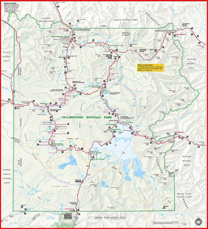
Yellowstone National Park Map
http://www.nps.gov/PWR/customcf/apps/maps/showmap.cfm?alphacode=yell&parkname=Yellowstone%20National%20Park
· World's First National Park
· A designated World Heritage Site
· A designated Biosphere Reserve Site
· 3,472 square miles or 8,987 square km
· 2,219,789 acres or 898,317 hectares
· 63 air miles north to south (102 km)
· 54 air miles east to west 87 km)
· 96 % in Wyoming, 3% in Montana, and 1% in Idaho
· 7 species of conifers - Approximately 80% of forest is comprised
of lodgepole pine
· One of the world's largest calderas, measuring 45 by 30 miles (72
by 48 km)
· One of the world's largest petrified forests
· Record year: 2007 - 3,151,342 visitors
· Yellowstone is home to over 1,700 species of native vascular
plants and over 170 species of exotic (non-native) plants.
The heart of the park is the geology. There rocks represent a series
of eruptions in the area. The oldest date to about 2 million years
ago. These are represented by massive deposits of welded tuffs.
Boyd, first published an accurate description of these tuffs in
1961, and recognized what was a previously unrecognized volcanic
event in Yellowstone. "These early volcanic episodes had
produced violent explosions and staggering volumes of volcanic ash,
later consolidated into welded tuffs. He demonstrated that these
tuffs covered thousands of square miles of Grand Teton and
Yellowstone and that they rimmed a large tectonic basin in
Yellowstone that contain even younger lava flows. The explosive
volcanic events that produced these tuffs were unbelievably large
and violent-many times greater than the 1981 eruption of Mount St.
Helens. They destroyed the southern half of the Washburn volcano and
whatever mountains existed between Mt. Washburn and the Red
Mountains. Geologists have identified streaks and thin layers of
Yellowstone volcanic ash from as far away as California,
Saskatchewan, Iowa, and the Gulf of Mexico. Volumes of ash blasted
into the stratosphere circulated around the globe and must have
altered the weather worldwide." http://www.yellowstone.net/geology.htm
Eruptions took place 2 million years ago, again 1.2 million years
ago, and finally 600,000 years ago. "The latest eruption spewed
out nearly 240 cubic miles of debris. What is now the park's central
portion then collapsed, forming a 28- by 47- mile caldera (or
basin). The magmatic heat powering those eruptions still powers the
park's famous geysers, hot springs, fumaroles, and mud pots. The
spectacular Grand Canyon of the Yellowstone River provides a glimpse
of Earth's interior: its waterfalls highlight the boundaries of lava
flows and thermal areas. Rugged mountains flank the park's volcanic
plateau, rewarding both eye and spirit."
The volcanic activity at Yellowstone is still occurring in what is
the worlds largest caldera. These activities are represented on the
surface in the form of hot springs, geysers, steam vents, and an
assortment of other geothermal activities. Most of the geyser
formations are of a siliceous (SiO2) nature, while those at Mammoth
Hot Springs to the north are characterized by deposits of travertine
( CaCO3). The heat driving these features is derived from a ht spot
representing a plume of hot material that may originate as deep as
the outer core/mantel boundary. This is the same hot spot that
created the features at Craters of the Moon Nationa Monument about
250 miles to southwest in Idaho. There are differences in the
eruptions at the two site. At COTM the eruptions were through a thin
section of the crust and consisted of a series of cider eruptions
and basaltic lava flows. These are the dark low viscosity lava found
in the Hawaiian Islands. At Yellowstone the crust is much thicker
and includes a massive overthrust that effectively doubled the crust
thickness. As the hot spot burned through the crust at Yellowstone
it became contaminated by quartz and other siliceous crustal
material. This resulted in a stickier, high viscosity lava and ash
more akin to the types of eruptions in the Cascade Range of
Washington. Think Mt. St. Helens. The tuffs here are pink in color
at Yellowstone because of the high quartz and feldspar content.
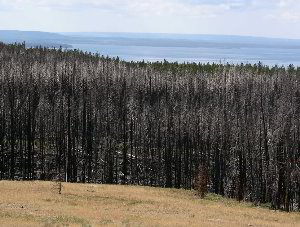
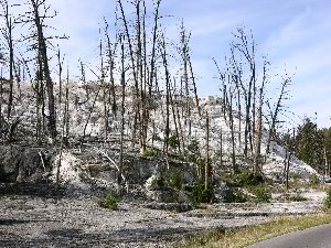
Coming in from the East Gate you climb a rise and then descend
downward toward Yellowstone Lake at Fishing Bridge. It was along
this path that I encountered the tell-tale signs of the major forest
fires that swept the park in 1988. The park website gives this
account of the fire: "On July 12, 1988, a small fire started
near the Falls River in the southeastern corner of the park. For
several weeks, the fire grew slowly as crews attempted to contain
it. On August 20, the winds picked up. This day would later become
known as "Black Saturday" because more acres burned on
this day alone than in the entire history of Yellowstone prior to
this day. During that week, high winds drove the fire for miles
until it approached the Lewis River. Defying all conventional
understanding of fire behavior and driven by 60 mph winds that
gusted to 80 mph, the fire blew all the way across the Lewis River
Canyon on August 23. Firefighters were astounded. Even the most
experienced Incident Commanders had never seen fire burn like it did
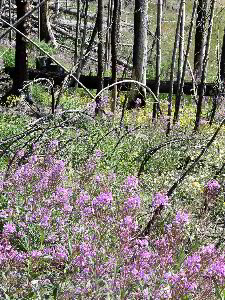
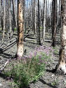
in 1988. While the fires shocked the nation and the world,
scientists had long known that a fire of this magnitude would burn
through a lodgepole pine forest like Yellowstone's on an average of
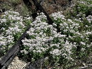
once every 300 years. In fact, lodgepole pine forests are adapted to
fire. Some of the pine cones need the intense heat of fire to open
the cones and drop the seeds for the next generation of forests.
While fire is often difficult for people to understand, for the
lodgepole pine forests it is as important and necessary as other
natural processes like rain and sunshine, death and rebirth.. The
1988 fires affected 793,880 acres or 36 percent of the park. Five
fires burned into the park that year from adjacent public lands. The
largest, the North Fork Fire, started from a discarded cigarette. It
burned more than 410,000 acres."
 |
 |
Beyond here the road descends to Yellowstone Lake, the Yellowstone
River, and its tributaries. These represent areas of extreme
lushness and green compared to the high desert I had been passing
through for the past several days. I stopped fro a few minutes at
Fishing Bridge and then was off, anxious to see some of the sites. I
headed northward to the Mud Volcanoes and Sulfur Cauldron areas of
the park. The road first passes the LeHardy Rapids on the upper
Yellowstone River. The rapids have an interesting history.
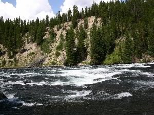
"The rapids were named for Paul LeHardy, a civilian topographer
with the Jones Expedition in 1873. Jones and a partner started off
on a raft with the intent of surveying the river, planning to meet
the rest of their party at the Lower Falls. Upon hitting the rapids,
the raft capsized, and many of the supplies were lost, including
guns, bedding, and food. LeHardy and his partner saved what they
could and continued their journey to the falls on foot. The rapids
became a popular visitor attraction when a boardwalk was built in
1984 providing access to the area. Due to increased visitation, a
group of harlequin ducks, which once frequented this area in spring,
have not been seen for several years. The boardwalk has consequently
been closed in early spring to protect this sensitive habitat, but
the harlequins have not returned."
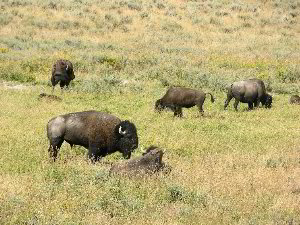
A short distance past the rapids I found a large gathering of
people. They were paused taking photos of a group of Bison grazing
near the highway. I stopped also, hey I want some photos also. From
here it was only a short skip and jump to the Mud Volcano ad Sulphur
Cauldron.
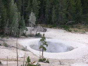
Sulphur Cauldron
The park service describes the area: "Mud Volcano/Sulphur Caldron- When the Washburn Expedition
explored the area in 1870, Nathaniel Langford described Mud Volcano
as "greatest marvel we have yet met with." Although the
Mud Volcano can no longer be heard from a mile away nor does it
throw mud from it's massive crater, the area is still eerily
intriguing. The short loop from the parking lot past the Dragon's
Mouth and the Mud Volcano is handicapped accessible. The half-mile
upper loop trail via Sour Lake and the Black Dragon's Caldron is
relatively steep. Two of the most popular features in the Mud
Volcano front country are the Dragon's Mouth and the Black Dragon's
Caldron. The rhythmic belching of steam and the flashing tongue of
water give the Dragon's Mouth Spring it's name, though its activity
has decreased notably since December 1994. The Black Dragon's
Caldron exploded onto the landscape in 1948, blowing trees out by
their roots and covering the surrounding forest with mud. The large
roil in one end of the Caldron gives one the sense that the Black
Dragon itself might rear it's head at any time. In January 1995, a
new feature on the south bank of Mud Geyser became extremely active.
It covers an area of 20 by 8 feet and is comprised of fumaroles,
small pools, and frying-pan type features. Much of the hillside to
the south and southwest of Mud Geyser is steaming and hissing with a
few mudpots intermixed. This increase in activity precipitated a
great deal of visitor interest and subsequent illegal entry into the
area. The most dramatic features of the Mud Volcano area however,
are not open to the public. The huge seething mud pot known as the
"Gumper" is located off-boardwalk behind Sour Lake. The
more recent features just south of the Gumper are some of the
hottest and most active in the area. Ranger-guided walks are offered
to provide visitors an opportunity to view this interesting place.
Farther in the backcountry behind Mud Volcano, several features are
being tested for the existence of thermophilic microbes, which may
offer insights into origin of life theories as well as having
medical/environmental applications. The Sulphur Caldron area can be
viewed from a staging area just north of Mud Volcano. The Sulphur
Caldron is among the most acidic springs in the park with a pH of
1.3. Its yellow, turbulent splashing waters bring to mind images of
Shakespeare's soothsayers. Other features which can be viewed from
this overlook are Turbulent Pool (which is no longer
"turbulent") and the crater of a large, active mudpot."
 |
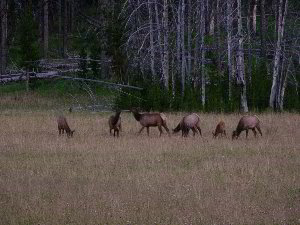 |
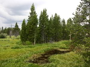
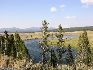
Hayden Valley
Immediately north of this series of geothermal features is the
Hayden Valley. It is a beautiful open valley and an excellent place
to view wildlife The park website says: "It is an excellent
place to look for grizzly bears, particularly in the spring and
early summer when they may be preying upon newborn bison and elk
calves. Large herds of bison may be viewed in the spring, early
summer, and during the fall rut, which usually begins late July to
early August. Coyotes can almost always be seen in the valley. Bird
life is abundant in and along the river. A variety of shore birds
may be seen in the mud flats at Alum Creek. A pair of sandhill
cranes usually nests at the south end of the valley. Ducks, geese,
and American white pelicans cruise the river. The valley is also an
excellent place to look for bald eagles and northern harriers."
I did not see any Grizzlies, but there were numerous birds, and on
the return trip later that evening there were a number of large
herds of Elk along the valley.
 |
 |
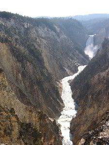
The Yellowstone River flows from the Hayden Valley into the Grand
Canyon of the Yellowstone. "The Grand Canyon of the Yellowstone
is the primary geologic feature in the Canyon District. It is
roughly 20 miles long, measured from the Upper Falls to the Tower
Fall area. Depth is 800 to 1,200 ft.; width is 1,500 to 4,000 ft.
The canyon as we know it today is a very recent geologic feature.
The present canyon is no more than 10,000 to 14,000 years old,
although there has probably been a canyon in this location for a
much longer period. The exact sequence of events in the formation of
the canyon is not well understood, as there has been little field
work done in the area. The few studies that are available are
thought to be inaccurate. We do know that the canyon was formed by
erosion rather than by glaciation. A more complete explanation can
be found in the Geological Overview section. The geologic story of
the canyon, its historical significance as a barrier to travel, its
significance as destination/attraction, and its appearance in Native
American lore and in the accounts of early explorers are all
important interpretive points. The "ooh-ahh" factor is
also important: its beauty and grandeur, its significance as a
feature to be preserved, and the development of the national park
idea.
The Upper and Lower Falls of the Yellowstone are erosional features
formed by the Yellowstone River as it flows over progressively
softer, less resistant rock. The Upper Falls is upstream of the
Lower Falls and is 109 ft. high. It can be seen from the Brink of
the Upper Falls Trail and from Uncle Tom's Trail. The Lower Falls is
308 ft. high and can be seen from Lookout Point, Red Rock Point,
Artist Point, Brink of the Lower Falls Trail, and from various
points on the South Rim Trail. The Lower Falls is often described as
being more than twice the size of Niagara, although this only refers
to its height and not the volume of water flowing over it. The
volume of water flowing over the falls can vary from 63,500 gal/sec
at peak runoff to 5,000 gal/sec in the fall. A third falls can be
found in the canyon between the Upper and Lower falls. Crystal Falls
is the outfall of Cascade Creek into the canyon. It can be seen from
the South Rim Trail just east of the Uncle Tom's area."
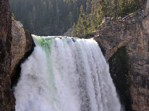
This is one of the most heavily visited areas of the park. Just
getting to the canyon was a long walk through a jam-packed parking
lots and crowds of people. It is still worth the stop however. The
canyon is beautiful to behold. You can manage to get good photos of
the canyon and the falls without the crowds showing in the images.
As always,if you hike more than a few feet along any of the trails,
the number of tourists precipitously drops. An excellent view of the
Lower Falls can be had by taking Uncle Tom's Trail and walking down
an almost endless series of stairs to near the bottom of the canyon.
When I was there the light was backlighting the lip of the waterfall
and a deep green wedge of light shining through the water could be
seen at the top of the falls as it plunged over the lip of the
falls.
"The Yellowstone River is the last major undammed river in the
lower 48 states, flowing 671 miles from its source southeast of
Yellowstone into the Missouri River and then, eventually, into the
Atlantic Ocean. It begins in the Absaroka Mountain Range on Yount
Peak. The river enters the park and meanders through the Thorofare
region into Yellowstone Lake. It leaves the lake at Fishing Bridge
and flows north over LeHardy Rapids and through Hayden Valley. After
this peaceful stretch, it crashes over the Upper and Lower falls of
the Grand Canyon. It then flows generally northwest, meeting it's
largest tributary, the Lamar River, at Tower Junction. It continues
through the Black Canyon and leaves the park near Gardiner, Montana.
The Yellowstone River continues north and east through the state of
Montana and joins the Missouri River near the eastern boundary line
of the state. The Missouri River eventually joins the Mississippi
River, which flows into the Atlantic Ocean at the Gulf of
Mexico."
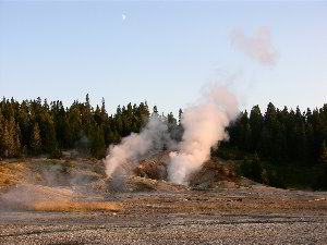
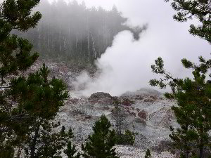
The final stop for the day was at the Norris Geyser Basin. This is a
fantastic area of pale pink and beige thermal deposits and geysers.
The website says: "Norris Geyser Basin is the hottest, oldest,
and most dynamic of Yellowstone's thermal areas. The highest
temperature yet recorded in any geothermal area in Yellowstone was
measured in a scientific drill hole at Norris: 459°F (237°C) just
1,087 feet (326 meters) below the surface! There are very few
thermal features at Norris under the boiling point (199°F at this
elevation). Norris shows evidence of having had thermal features for
at least 115,000 years. The features in the basin change daily, with
frequent disturbances from seismic activity and water fluctuations.
The vast majority of the waters at Norris are acidic, including acid
geysers which are very rare. Steamboat Geyser, the tallest geyser in
the world (300 to 400 feet) and Echinus Geyser (pH 3.5 or so) are
the most popular features. The basin consists of three areas:
Porcelain Basin, Back Basin, and One Hundred Springs Plain.
Porcelain Basin is barren of trees and provides a sensory experience
in sound, color, and smell; a 3/4 mile dirt and boardwalk trail
accesses this area. Back Basin is more heavily wooded with features
scattered throughout the area; a 1.5 mile trail of boardwalk and
dirt encircles this part of the basin."
This has to be my favorite geyser basin of any in the park. What was
amazing when I visited was the solitude. After the crowds of people
at the Grand Canyon of the Yellowstone, this area was empty. Perhaps
another couple people were present for part of the time I visited
the basin. The light was perfect. The setting sun was shinning
through the steam and mist from the geysers and enhancing the
natural colors of the rock. If I had to choose a single geyser basin
to visit in the park, this would be the one I would recommend. It
was getting dark, so I hurried and managed to hike down to the lower
falls themselves before dark. I fond a campsite at Canyon Village
and spent the night there. I ate at a "Village" restaurant
and did the tourist looking in the shops.
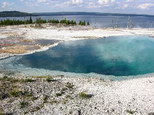
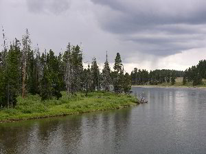
West Thumb area
August 14, 2005: After a good nights sleep in my tent, I awoke to
some frost on the tent. At about 7,000 feet it get cold even in
August. Later that morning found me exploring the West Thumb Geyser
basin. The West Thumb is a branch of the Yellowstone Lake that
formed as a result of the collapse of a secondary caldera.
Yellowstone Lake and west thumb are the subject of ongoing research.
"Yellowstone Lake with a surface area of 132 square miles,
Yellowstone Lake is the largest lake at high elevation (i.e., more
than 7,000 ft.) in North America. It is a natural lake, situated at
7,733 ft. above sea level. It is roughly 20 miles long and 14 miles
wide with 141 miles of shoreline. It is frozen nearly half the year.
It freezes in late December or early January and thaws in late May
or early June. Recent research by Dr. Val Klump of the Center for
Great Lakes Research and the University of Wisconsin has
revolutionized the way we look at Yellowstone Lake. Figuratively, if
one could pour all the water out of Yellowstone Lake, what would be
found on the bottom is similar to what is found on land in
Yellowstone; geysers, hot springs, and deep canyons. With a small
submersible robot submarine, the researchers found a canyon just
east of Stevenson Island which was 390 ft. deep. Prior to this
finding, the deepest spot in the lake was thought to be 320 ft. at
West Thumb. Underwater geysers, hot springs, and fumaroles were
found at West Thumb and Mary and Sedge bays. The hottest spot in the
lake was found at Mary Bay where the temperature was recorded at 252°
F (122° C). Hollow pipes, or chimneys of silica, several feet in
height, were found rising up from the lake bottom at Mary Bay. It is
thought that these are the old plumbing systems of now dormant
geysers. Rock spires up to 20-feet tall were found underwater near
Bridge Bay. Samples of this rock are being analyzed, though it is
believed that these features are probably related to underwater
thermal activity." In addition to the West Thumb Basin, I also
discovered a Moose, and visited a couple of nice waterfalls in the
southern portion of the park- Lewis Falls and Moose Falls.
 |
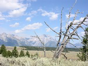 |
Tetons
I continued southward leaving Yellowstone and heading to Jackson
Hole, Wyoming and the Tetons. As you head southward the Tetons loom
in the distance to the west. They form massive jagged peaks rising
from a flat plain. Blue in the distance the blocky mountains have
snow capped peaks and remnant glaciers still dotting the glacier
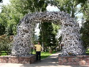
sculpted skyline. The southern end of this excursion ended in
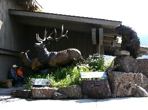
Jackson Hole. A notable feature you must visit while in town are the
large Elk Antler Arches that mark the four corners of the town
square. It is clearly a tourist town filled with shops, and live
action gunfights playing in the streets. A worthwhile free stop in
town is the Jackson Hole and Greater Yellowstone Visitors Center on
the north side of town. The Visitors center contains bronze
sculptures, artwork, and an entire herd of mounted elk. Jackson Hole
is also the location of the National Elk Refuge. This was not the
time of the year to see elk, but that is a goal for another trip.
 |
 |
Leaving Jackson Hole going back toward Yellowstone is a one way road
running northward, that takes you to Teton Lake and along the base
of the Tetons themselves. Here you can see closer views of the
mountains and see them rising above Teton lake. If you have more
time boat rides can take you to hiking trails on the western side of
the lake that lead into the Tetons themselves.
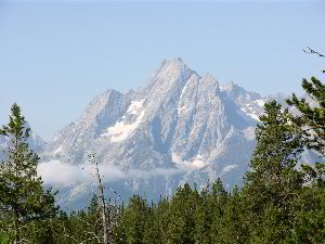
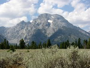 Mount Moran
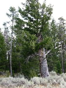 Old Tree
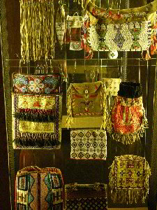
Another place worth stopping is at the main visitor center for
Tetons National Park. One building houses an amazing collection of
native American art. It is dimly lit, and they don't allow flash
photography to help protect the artifacts. I took a series of timed
exposures that worked out well, and didn't violate any of their
rules. The guide there got the idea that I was a professional
photographer with my Nikon and tripod, and I didn't dissuade her
from the idea as I photographed the items. From here I headed back
to Yellowstone. I made camp for the night at the campground at
Grants Village.
August 15, 2005: Morning found me stopping along the roadside and
photographing several undeveloped geysers and springs along the
shore of Yellowstone Lake. From here I headed to the Black Sand
Basin. This is a smaller basin just west of the Upper Geyser Basin
containing Old Faithful. I spent some time in the relative peace of
this basin before heading to see the circus at Old Faithful - the
Upper Geyser Basin. Old Faithful Geyser was erupting as I drove up.
A crowd of people filled the grandstand benches surrounding the
eastern half of the geyser. I was not really impressed. I bypassed
the Old Faithful crowd and visited many of the other geysers and hot
springs in the Upper Basin. Eventually I returned back in time to
catch the next eruption of the Old faithful Geyser. Only I stopped
and photographed from the backside of the loop around it. This I
could see it the eruption but did not need to deal with the crowds,
nor even see them. After the eruption I continued to explore the
rest of the Upper Geyser basin and vicinity
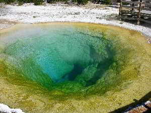 Morning Glory Pool
One of the interesting features was the Morning Glory Pool. It is a
bright blue in color. The color of the various pools are indicative
of the temperature of the water present. Different algae and
bacteria with different colors grow in different temperatures and
provide a rainbow of color in the pools. At one time people had
thrown rocks in the pool clogging it, and restricting flow. The pool
changed temperature and effective died. The NPS managed to clean out
the rocks plugging the pool, and now it has returned to full color.
Unfortunately my exploration of these basins resulted in getting the
top of my head sunburned through my hair. I searched to find a hat,
and eventually was forced to buy a Wyoming Cowboys baseball cap for
only $15.
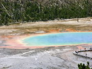 Grand Prismatic Spring
The next stop was the Midway Geyser basin. "This geyser basin,
though small in size compared to its companions along the Firehole
River, holds large wonders for the visitor. Excelsior Geyser reveals
a gaping crater 200 x 300 feet with a constant discharge of more
than 4,000 gallons of water per minute into the Firehole River. Also
in this surprising basin is Yellowstone's largest hot springs, Grand
Prismatic Spring. This feature is 370 feet in diameter and more than
121 feet in depth." The main problem with visiting this area
was that I was walking on a boardwalk just a few inches above ground
level. The Grand Prismatic Spring is a fantastic sight, I just
couldn't see it from that perspective. I ended up crossing the road
and climbing a hill to get a higher viewpoint of the pool. It did
not look like was the first to do so as there was a noticeable path,
but the climb was well worth the effort.
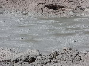 Fountain Paint Pots
I stopped by a couple of other smaller geyser basins and caught a
few more eruptions. The next major site I visited was the Fountain
Paint Pots. In the Lower Geyser Basin. "This large area of
hydrothermal activity can be viewed by foot along the boardwalk
trail at Fountain Paint Pots and by car along the three mile
Firehole Lake Drive. The latter is a one-way drive where you will
find the sixth geyser predicted by the Old Faithful staff: Great
Fountain. Its splashy eruptions send jets of diamond droplets
bursting 100-200 feet in the air, while waves of water cascade down
the raised terraces. Patience is a virtue with this twice-a-day
geyser, as the predictions allow a 2 hour +/- window of
opportunity." The Fountain Paint Pots is the highlight of this
area. It looks like a bubbling kettle of mud. "Fountain Paint
Pot is one of many mudpots found in the park. In early summer the
mudpots are thin and watery from abundant rain and snow. By late
summer they are quite thick. The mud is composed of clay minerals
and fine particles of silica. In this area the rock is rhyolite,
which is composed primarily of quartz and feldspar. Acids in the
steam and water break down the feldspar into a clay mineral called
kaolinite."
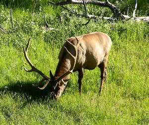 Bull Elk
From here I headed northward back to the Grand Canyon of the
Yellowstone. I caught a nice bull elk grazing along the way. The
evening again found me at the Grand Canyon of the Yellowstone. I
camped in the Canyon Village campground for the night.
 Steamboat Geyser
August 16, 2005: The morning fond me heading to the Norris Basin. It
was shortly after dawn. This is the most crowded national park in
the system in the middle of the summer. I was the only one in the
basin. A worker running a street sweeper was just leaving the empty
parking lot as I pulled into the area. One of the sights I found
that foggy morning was an eruption of the Steamboat Geyser. It is
one of the largest geysers in the park and one that only erupts
occasionally and unpredictably. In a major eruption the geyser
throws water up to 120 meter in height, two to three times the
height of Old faithful, with major eruptions occurring in intervals
from 4 days to 50 year apart. I saw an eruption of this geyser - not
a major one, but an eruption and I was alone in the entire geyser
basin.
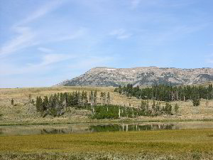 Gallatin Range
From here I left to visit the Mammoth Hot Springs area of the park
near the northern boundary. Along the way you pass below the peaks
of the Gallatin Range Mountain Wilderness. One lake, I don't now its
name, had fantastic reflections of the trees along its shore and the
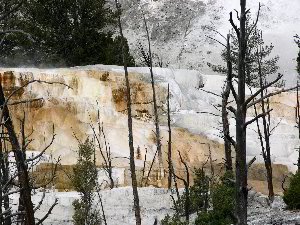
mountains beyond. "Mammoth Hot Springs are the main attraction
of the Mammoth District. These features are quite different from
thermal areas elsewhere in the park. Travertine formations grow much
more rapidly than sinter formations due to the softer nature of
limestone. As hot water rises through limestone, large quantities of
rock are dissolved by the hot water, and a white chalky mineral is
deposited on the surface."
 |
 |
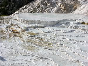
Mammoth Hot Springs
The Mammoth Hot Springs area is beautiful and of an entirely
different nature than the rest of the park. It looks like travertine
cave pools of a massive size, only sitting on the surface. At
different times different areas of the complex are active. Those
areas that are inactive are dry and chalky looking, while those
actively flowing are delicate and shinny in the light. One annoyance
was a busload of Japanese tourists who pushed their way ahead of
other people. Myself and others waited patiently while they seemed
to take every combination of themselves posing in front on one of
the massive travertine flows. But then they seemed to start to do it
all over again and would not let anyone else on that section of the
boardwalk. Finally I just pushed my way past. It was amazing to see
areas where the travertine masses were growing outward and
overwhelmed trees, now embedded in the flowstone mass.
 Mammoth Hot Springs
Along the way to the Mammoth Hot Springs and continuing to the
northern border of the park in Montana are the The Gardner River and
Gardner River Canyon. "The North Entrance Road from Gardiner,
Montana, to Mammoth Hot Springs, Wyoming, runs along the Gardner
River. The road winds into the park, up the canyon, past crumbling
walls of sandstone and ancient mudflows. The vegetation is much
thicker in the canyon than on the open prairie down below, the
common trees being Rocky Mountain juniper, cottonwood, and
Douglas-fir. Low-growing willows also crowd the river's edge in the
flatter, flood-prone sections of the canyon." I passed through
the historic northern gates to the park and headed northward. My
next stop: Glacier National Park, MT
Ed Frank
== 2 of 9 ==
Date: Wed, Mar 26 2008 8:53 am
From: dbhguru@comcast.net
Ed,
Wow!! What a post! Fabulous trip description. You've set the bar on
this one. I'm going to have to work extra hard on Episode III.
Bob
== 3 of 9 ==
Date: Wed, Mar 26 2008 9:06 am
From: Larry
Ed, All I can say is Awesome writing. Between you and Bob I feel
like I'm traveling all over the United States. Yellowstone, has
always been one of my favorite places to visit. I'll have to get out
that way someday. Great photos! Larry
== 4 of 9 ==
Date: Wed, Mar 26 2008 9:16 am
From: dbhguru@comcast.net
Larry,
Ed really out-did himself on this one. I was especially interested
in his mentioning of the Medicine Wheel in the northern Bighorns. I
visited the Wheel on 3 different occasions. It was a kind of
spiritual quest for Jani.
Bob
== 5 of 9 ==
Date: Wed, Mar 26 2008 9:52 am
From: Larry
Bob, You guys make me want to go back out west! Everyone should
experience the solitude of the Mountains. I to have a bond with them
and once you establish that, it seems to never leave you. Dad was
stationed at White Sands and Ft. Bliss. I lived in the surrounding
Mountains, every chance I got with friends or not I was there.
Although 14 years old I was allowed to explore them as much as I
wanted. I went to Colorado in 2000 and loved every minute of it! I
plan to return this October, luckily a friend owns property there.
He
has invited me to go again, I can't wait. Perhaps I will try to post
something about my youthful experiences in the Mountain Range at
White
Sands, N.M. and take a stab at writing. Also my trips to Colorado,
you
guys are inspirational! Larry
== 6 of 9 ==
Date: Wed, Mar 26 2008 10:53 am
From: dbhguru@comcast.net
Larry,
We look forward to your descriptions. By all means, give writing a
try. I'm sure you'll do well, and besides your among friends. While
in New Mexico, did you ever get up into the Wheeler Peak area of the
Sangre De Cristo? It is New Mexico's highest mountain, 13, 161 feet
or there abouts if I remember correctly. Great area. I also explored
the volcanic mountains in the extreme northeastern part of the Land
of Enchantment. Capulin NM comes immediately to mind. Another area
of wide expanses, memorable vistas, and soul cleansing solitude.
Your mentioning of Colorado reminds me of my many hours spent
exploring and climbing in the Colorado Rockies. I think I'll polish
up an essay I wrote back in the late 1980s about the Sawatch range
of the Rockies and post it to the list. I'll have to first type it
into Word. I only have a hard copy, but I'll bring it up to date as
I type it. It will be episode III. Then, I'll return to Wyoming for
a series of episodes on the Big Horn Mountains. I hope you and the
others on the list don't tire out. Once the writing genie is out of
the box, it's hard to get it back in.
BTW, on Sunday, I'll be going to the ENTS grove of Mohawk and
searching for your tree. I do have a digital camera, believe it or
not and will take pictures.
Bob
== 7 of 9 ==
Date: Wed, Mar 26 2008 11:35 am
From: Larry
Bob, Funny you metion that. We drove through Raton Pass and stayed
in the foothills of the Sangre De Cristo mountains. I looked at the
Spanish Peaks daily. We drove over to them one morning and enjoyed
the
Scenic surroundings, breathtaking area. When I go back I'll get lots
of
photos. We stayed near the town of Aguliar, Colorado. I mostly
stayed
in Southern N.M. when we where there in the late 1960's. Santa Fe
was
as far north as I got. I need to go back and visit, my memories are
strong there. Larry
== 2 of 5 ==
Date: Wed, Mar 26 2008 1:36 pm
From: dbhguru@comcast.net
Larry,
I climbed West Spanish Peak in the mid-1980s. It is a spectacular
mountain with an incredible view from the summit. The two peaks,
i.e. East and West Spanish Peak, were considered by the Aztecs to be
the Earth Mother's breasts. They later migrated to the area in and
around Mexico City. Lots of folks don't realize that the Aztecs
lived in that area of the Southwest. Cordova Pass separates the
Spanish Peaks. I think it used to be called Apishapa Pass (sp). The
little town of Le Veta, near the peaks, has a heck of a privately
run museum with an enormous cottonwood on the premises. The tree was
planted by John Francisco about 150 years ago. I haven't seen the
tree since the mid-1980s.
Bob
TOPIC: Yellowstone Report
http://groups.google.com/group/entstrees/browse_thread/thread/30eec654dbc36df0?hl=en
==============================================================================
== 1 of 1 ==
Date: Wed, Mar 26 2008 1:39 pm
From: DON BERTOLETTE
Ed-
You're definitely showing a flair for reporting! While I have not
yet 'done' Yellowstone, it is on my 'lifelist' and you've given me
an excellent preview.
Geologist (amateur or otherwise...;>) that you are, I'm guessing
that you've made it out to the Grand Canyon, another World Heritage
site, and an early national park. It's naked geology is there for
the whole world to see, and as much of the world sees it as
Yellowstone (GCNP visitation has been a little higher the last
couple of years I think). And as a plus, it has 150,000 acres of
reasonably undisturbed forest ecosystems (pinon-juniper, pure
ponderosa pine, mixed conifer (ponderosa pine, douglas fir, white
fir, aspen), and spruce-fir). Perhaps 10,000 of that is
bio-geographically isolated enough to provide researchers with
'old-growth' analogs, ie, very nearly undisturbed ecosystems,
especially the fire-adapted ponderosa pine ecosystem.
One of the (dis)advantages that Grand Canyon has is: first the good
news, almost all the visitation occurs in a very small focused
developed area at the South Rim...the bad news, almost all the
visitation occurs in a very small focused developed area at the
South Rim.
For those able to manage strenuous hiking (and reversed at that,
start out going down hill, and then return going up hill) under
arduous climate inputs (unbearable for 'most' from June through
September, when 'most' visit), eons of geologic change expose
themselves around every corner in the trails, or for those lucky
enough to do a river trip, eons of geologic change expose themselves
around every bend.
-Don
==============================================================================
TOPIC: Yellowstone
http://groups.google.com/group/entstrees/browse_thread/thread/26ea96aa1e51dcd2?hl=en
==============================================================================
== 1 of 3 ==
Date: Thurs, Mar 27 2008 7:16 am
From: michael matzko
ENTS,
I have had the opportunity to work and live in Yellowstone for over
six summers in my twenties. It is bar none the most magical place I
have been in my lifetime and that is why I go back year after year
for ten consecutive years. My experiences in Yellowstone have taken
me to many off-trail limited access locations. However, with over
1200 miles of hiking trails going off trail is not a necessity.
I now live and work in the Smokies at the Great Smoky Mountains
Institute at Tremont where tourism is whole different ballgame then Yellowstone.
Cades Cove a 6500 acre tract in the park annually gets around the
same amount of tourism as Yellowstone 2.3 million acres. My point to
all this is go to Yellowstone and take a hike on some of the less
popular trails and you will see more bison than people. Yellowstone
is the wildest place left in the lower 48 don't miss it. In fact it
takes about 5 trips to really get a sense of what that place has to
offer.
I will get off my soap box now
Thanks,
Michael Matzko
TOPIC: Yellowstone
http://groups.google.com/group/entstrees/browse_thread/thread/26ea96aa1e51dcd2?hl=en
==============================================================================
== 1 of 2 ==
Date: Fri, Mar 28 2008 8:24 am
From: michael matzko
ENTS, The back country of Yellowstone is such an amazing place and I
have been lucky enough to explore a great deal of it. For those who
are interested I have included a few photos to get your juices
flowing. If anyone is heading out there for the first or second time
drop me a line and I would be happy to clue you in on some great (no
tourist) locations.
Michael
== 2 of 2 ==
Date: Fri, Mar 28 2008 4:52 pm
From: JamesRobertSmith
My wife and I were planning our first trip to Yellowstone this year.
However, we needed three weeks to do it the way I wanted it done and
while I was able to get the time off, my wife couldn't. So we're
going
to shoot for 2009. My wife will stay in our fiberglass travel
trailer
while I dayhike and do a couple of overnight back country trips.
I dearly love the GSMNP, but the crowds have become absolutely
hideous. I really wish they would close Cades Cove to all motorized
traffic. Permanently. In addition, I wish that they'd close access
to
many of the trails to horses. I don't mind horses, but they
absolutely
destroy the trails on which they're allowed. I understand all of the
clauses in the original park plan, but enough is enough. The Great
Smoky Mountains National Park is being seriously damaged by some of
these practices.
Of course I think the transmountain highway and the road to
Clingman's
Dome should all be dismantled and put back as far as can be to a
natural gradient, making the central part of the park a true
wilderness.
|