ARIW:
King Island and
Kibbe's Island Campground |
October 1, 2007 |
| Edward Frank |
ENTS,
On
Wednesday September 26, 2007 Dale Luthringer and I made a return
trip to the Allegheny River Islands Wilderness to continue the
measuring project. The
goals for today were a return trip to King Island in Forest County
and to Kibbe's Island Campground farther downstream in Venango
County a few miles south of Tionesta.
King
Island is located in the Allegheny River between West Hickory and
Tionesta. It is next
to the last large island going downstream that make up part of the
Allegheny River Islands Wilderness - the countries smallest
wilderness area.
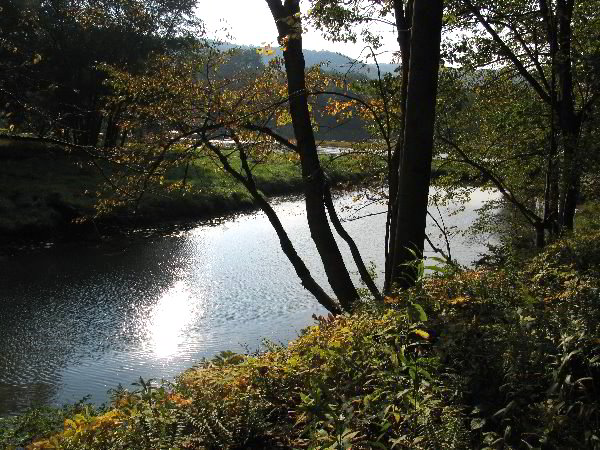
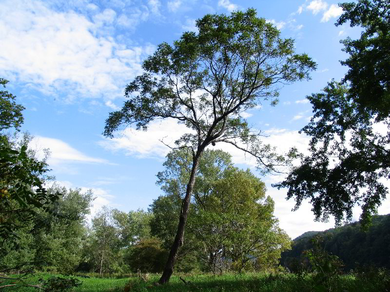
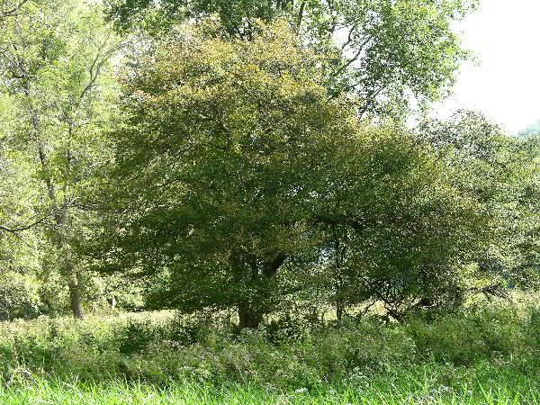
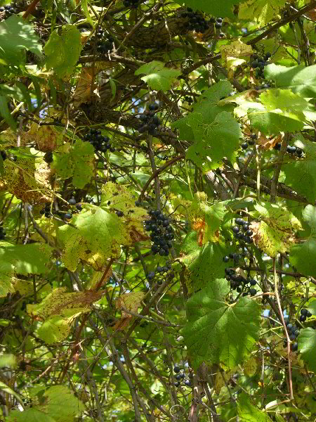
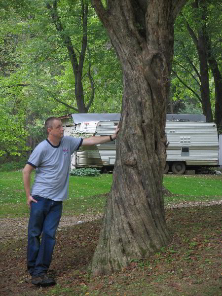
Tip of peninsula with
beaver dam - photo by Dale Luthringer |
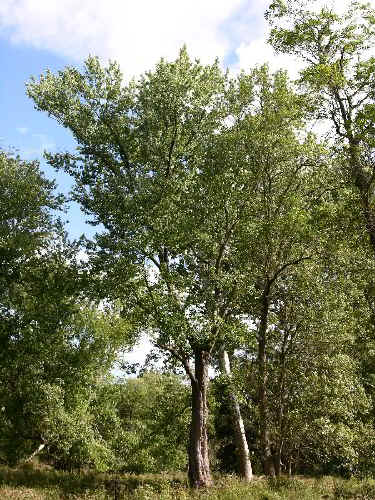
Silver maples growing on
tip of penninsula, including height champ - photo by Ed Frank |
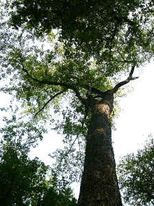
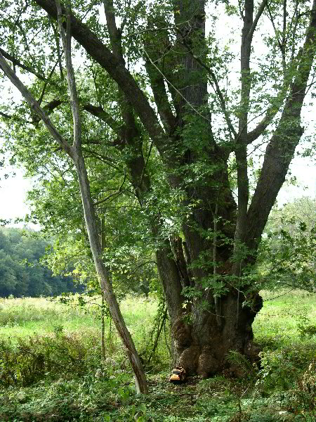
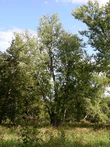
View from underneath height champ - photo by ed Frank |
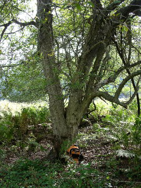
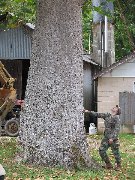
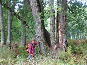
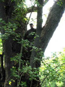
Silver Maple height champ
123.3 feet, note person for scale - photo by Dale
Luthringer |
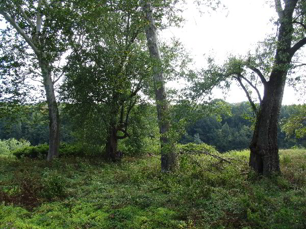
The first stop was a peninsula immediately south of King Island
along the western bank of the river.
At one time this had been a river island, but the upper end
of the channel separating the peninsula from the bank had silted
shut. During high
flow the peninsula likely returns to island status, but most of
the time it is not. At
the south end the channel is blocked by a beaver dam.
Crossing here allows access without wading.
Dale had walked through this area two years ago as part of
his initial reconnaissance of the area and measured some trees.
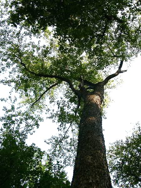
The vegetation, like most of the islands is dominated by
silver maple and sycamore. Near
the southern end of peninsula is the tallest silver maple in the
northeast measured in 1995 at 123.3 feet and 9.7 feet cbh.
http://www.nativetreesociety.org/fieldtrips/penna/king_island.htm
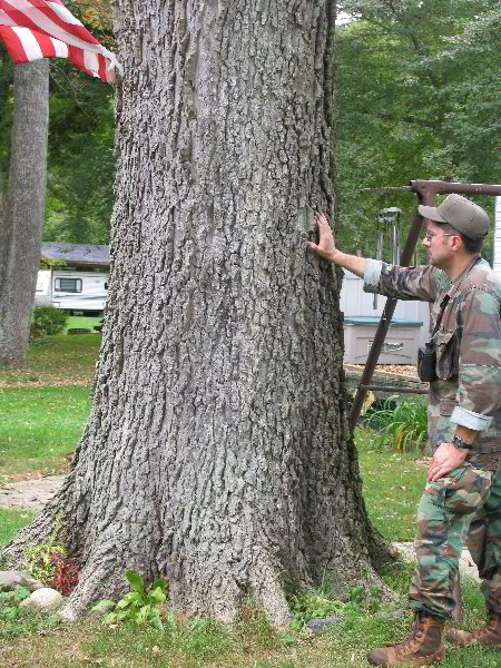
Re-measuring from the far shore the tree appeared to have lost a
couple feet in height, likely fro wind damage since the previous
measurement. We paused for a few photographs.
The lower end of the peninsula was forested by silver
maples of various sizes from saplings to the large specimens
measured.
A
short distance up the river is a gated side road that leads down
to the river and the central portion of Kings Island just
offshore. When we
arrived there were people down the road working by some fields. We
were concerned that if the land was being used by local residents,
that we might not be able to access the island from this point
anymore. We gathered
our gear and headed down the road.
The people we saw were US Forest Service people surveying
ad laying out vegetation plots on the floodplain of the river.
Several field sized patches had been cleared for planting,
and even a few bat boxes had been installed on poles. We spoke to
them briefly and headed on down to the river.
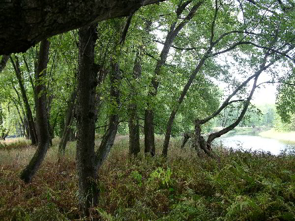
On this side of the island the river channel is less than
70 feet wide and no
more than knee deep. We
waded across and began our exploration.
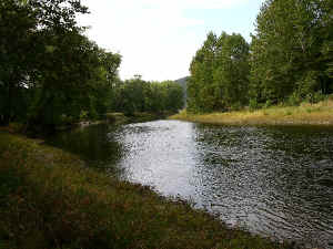
Allegheny River channel separating
King Island from the shore - photo by Ed Frank |

King Island scene at crossing point -
photo by Ed Frank |
I
had visited the island a couple of weeks previously with Dale and
Anthony Kelly. The
southern end of the island had been explored, but we had not yet
visited the upper end. In addition a major goal was to photograph
some of the trees we had previously measured. We started up the
island. The central
portion was essentially flat and open with a ground cover of an
unidentified vine (invasive).
We took some shots of the general forest and of floodwater
channels cutting across the island.
We soon came to the larger butternut we had measured on the
previous trip.
Largest butternut on King Island -
photo by Dale Luthringer |
Flooding scars on silver maples in the
center of kings Island - photo by dale Luthringer |
Here Dale and I split up. I
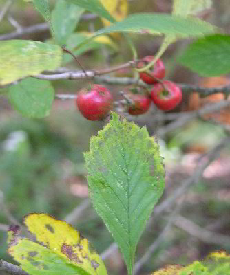
went to photograph the butternut and then on to the big hawthorn.
Unless there has been a bigger one submitted since last
year, this tree points out to be the new National Champion for the
dotted hawthorn at 122 points.
http://www.pabigtrees.com/trees/species/crataegus_hawthorn.htm
I wanted to get some better photos of the tree and some
close-ups of the leaves and fruit.
Dale continued to measure trees in the southern portion of the
island. I know he
found several more 12 x 100 class sycamores, I hope he will add a
post outlining his finds. From
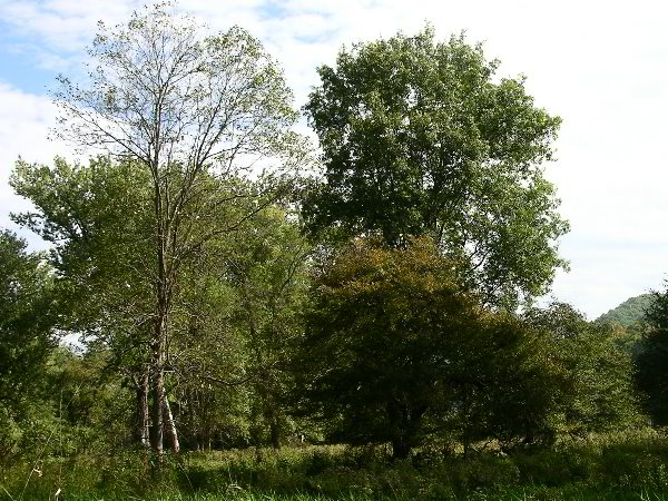
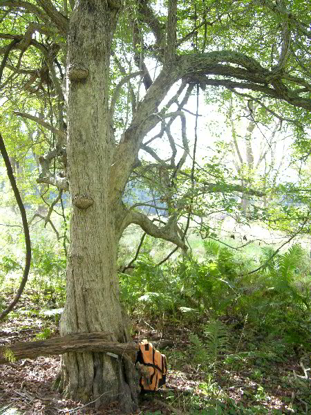
here I went northward to photograph a very large single stem
silver maple and an even bigger multi-stem specimen.
Silver maple sycamore complex - note person for
scale under second tree from left (click for a larger image)
photo by Dale Luthringer |
Large single trunk Silver Maple - photo by Ed Frank |
Dale was still busy measuring some I continued to the north
end of the island. Just
past this area was another large multi-stem silver maple, and a
very nice bitternut hickory. There also were a few more modest
sized butternuts and some black maple. A survey of the island had
described some of the willows present in the islands as
"peach-leaf willow," however as far as I could fine the
only species I could identify was black willow.
Certainly the few we measured were black willow.
Perhaps there are peach-leaf willows present, but we did
not find them or at least identify them as such. Continuing
northward are a few nice trees, but nothing of any great size.
I rounded the upper end of the island and headed back to
the central area with the biggest silver maples and the hawthorn.
Grapes were fruiting on the vines growing through the
trees. At this point
my camera stopped working, so I was done taking photos for the
day. I paused under
the shade of the silvers for a bite of lunch and Dale soon
rejoined me.
 |
 |

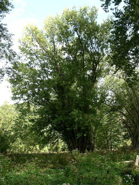
Four views of a large multitrunked Silver Maple - photos
by Ed Frank and Dale Luthringer |
 |
We shot
a series of photos of the mutitrunked silver maple, and then went
back to measure the couple of larger trees I had found just a
short distance north. The multitrunked silver here consisted of five distinct trunks,
We measured the cbh of the trunk containing the
tallest top, at 108 feet.
(Dale has the numbers).
The next tree was a black willow - 7.8 feet cbh, and height
of 60.1 feet. Not
spectacularly tall, but the largest I had seen on the island and
therefore worth noting. The
bitternut hickory was one Dale had measured previously at just
over 105 feet. I
measured one top to 108 feet on this trip.
Obviously
this island had at some time in the at suffered from wind damage,
with numerous trees blown down.
There are large sections of open grassland with few trees
growing. The
exception here and on Baker Island just downstream. Baker
had been struck by two tornados in 1985 according to the Forest
service description. These
openings on King look very similar and possibly date from the same
time. The exception
in both cases are Butternut trees.
They form low mounds that look like sumac from a distance.
One of these on Baker island had a core remnant tree was
around 7 feet circumference and snapped off.
The other appear to be growing from root sprouts.
The ;larger trees are bedraggled, and much older survivors
of the wind event.
On
the way out we stopped at what had once been an old camp or
farmstead. I saw an unusual tree with fruit growing aside
the road. As I walked over, it turned out to be a pear tree
covered with pears. we each grabbed a pear to eat and dale
measured the tree. We made it back to the cars just as the
rain started to pour.
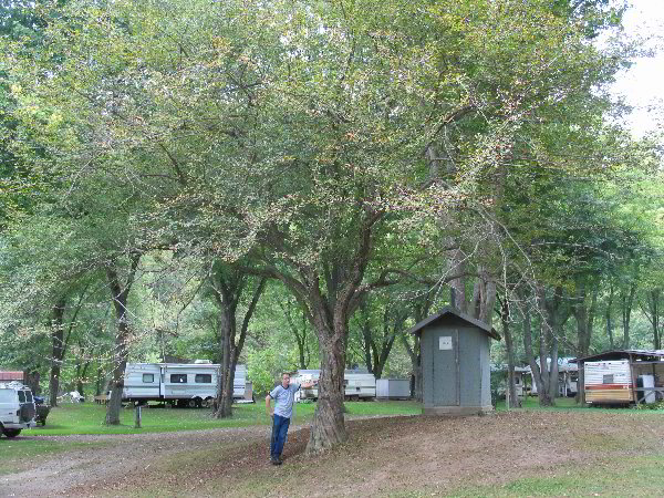
From
here we decided to visit Kibbe's Island Campground a few miles
south of Tionesta. This
is not part of the wilderness, but represents a comparable
ecosystem in the river. The
land is a private campground, and not really an island, but a
floodplain along the west bank of the river.
In times past higher floods would ct off portions of the
area forming islands. After getting permission to enter and
getting a gate card, we started our measurements.
There is a massive Sycamore in front of a equipment barn.
It had cbh of around 20 feet and measured 116 feet high.
The top of this and the other sycamores we measured had
been lost due to winds at some time in the past.
It had a truly massive trunk.
We went on to measure several ore sycamores, a large
hackberry, and some hawthorns.
One hawthorn measured 3.3 ft cbh, 31.4 feet tall, with a
crown spread of 36 feet. A
very nice tree, but not the largest.

Kibbe's Island hackberry
- largest of two measured |
Kibbe's Island hackberry
- largest of two measured
|

Largest hawthorn at Kibbe's Island Campground - photo by
Dale Luthringer |
Largest hawthorn at Kibbe's Island Campground - photo by Dale
Luthringer |
Dale had visited this site a week ago and found a very nice
hawthorn. In a previous private post Dale wrote: "I found a
beautiful (dotted) Hawthorn downstream below Tionesta a couple of
days later on Kibbe's Island Campground
that was a solid 5.5ft CBH x 33.9ft high x 45.8ft avg.
spread for 111.4AF Points. This hawthorne was all solid
single stem tree. No guesswork as to where to measure CBH on
this baby." Indeed it was a beautiful specimen. We took a
series of photos and headed back out.
From the looks of the campground, it appears that the
owners left all of the big sycamores and large hawthorns in place
as the cleared the property.
A few silver maples and other species were also present.
A few hawthorns at some campsite obviously had been planted
as they formed rows, and were of a different species, but there
were dozens of really nice large hawthorns scattered about the
place. We paused to give the owners the numbers we had found,
before leaving as I measured one last sycamore at 14.9 feet cbh,
and 101 feet tall. (Dale
how about some more numbers).
We had spotted what looked like a large cedar growing
across the river near a camp, but when we stopped by it turned out
to be a Norway spruce juxtaposed in front of another tree.
So no luck there. The
end. I will post photos on the website shortly from this
trip.
Edward
Frank
|
| |
==============================================================================
TOPIC: ARIW - King Island and Kibbe's Island campground, PA
http://groups.google.com/group/entstrees/browse_thread/thread/01ac3e916cf7035d?hl=en
==============================================================================
== 1 of 2 ==
Date: Wed, Oct 10 2007 5:01 pm
From: "Dale Luthringer"
Ed,
Great job on putting this post together. Sorry I couldn't get this
out
earlier. Here's my stats for our recent King Island and Kibbe's
Island
Campground trip:
Kings Island 9/26/07 (Frank & Luthringer)
Species CBH Height Comments
Bitternut hickory 11.1 108 was 10.8 x 105.9+ on
6/21/05
Black willow 7.8 60.1
Butternut 6.5 69.1+ pic in link
Pear 3.4 42.7 first species
measure, house foundation near access road
Silver maple 10.7 104.8
Silver maple 12.1 109.8 1 stem of 4x
Silver maple 9.7 120.1 NE height record
re-measure, down from ~123ft, Kings Island Peninsula
Slipper elm 6.4 94.7
Sycamore 12.6 110.1 was 12.6 x 105.5+ on
6/21/05
Sycamore 10.6 116.2
Sycamore 10.8 123
Sycamore 9.1 127.7+
Sycamore 10.8 129.2
Sycamore 12.2 131.8
Sycamore 7.9 136
Sycamore 11 136.1
White ash 4.3 81.1+
Kibbe's Island Campground 9/26/07 (Frank & Luthringer)
Species CBH Height Comments
Common hackberry 9.3 89.5
Dotted hawthorne 3.3 31.4
Sycamore 14.9 101
Sycamore 15.6 116.5
Sycamore 13.6 116.8
Also, here is a review of Rucker Indices for various islands on
the
Allegheny, and the Allegheny River floodplain as a whole from
Buckaloons
Recreation Area to Tionesta:
Thompson Island Rucker Index = 105.33
Species CBH Height Comments
Sycamore 10.6 140
White ash 7.3 111.1+
Silver maple 10.2 110.5
Black walnut 7.7 110.3
Am. Basswood 7.8 105.1+
Am. Basswood 9.8 105.1+
Bitternut hickory 6.8 104.4
N. red oak 13.5 102+
N. red oak 13 102+
Pignut hickory 4.3 90.9
Black locust 7.2 90.1+
Black cherry 4.3 88.9
Courson Island Rucker Index = 92.1
Species CBH Height Comments
Sycamore 15.2 129
White ash 9.1 111.1+
Bitternut hickory 5.1 108.1+
Silver maple 12.2 97
Black locust 9.8 96.1+
Pignut hickory 5.5 94.5
Am. Basswood 7.9 90.6
Slipper elm 9.3 69.1+
Butternut 8 63.8
N. catalpa 5.9 61.7
Allegheny River Islands Rucker Index = 114.27
Species CBH Height Site
Comments
Sycamore 12.1 145.5 Baker Island
PA height record
Silver maple 9.7 120.1 King Island
NE height record
White ash 11.5 118.4 Anders Run N.A.
Swamp white oak 10.9 111 Anders Run N.A.
E. U.S. height record
Bitternut hickory 7.7 110.3 Baker Island
Black walnut 7.7 110.3 Thompson Island
Shagbark hickory 5.5 109.6 Anders Run N.A.
Sugar maple 8.7 108.1 Crull Island
Am. Basswood 9.8 105.1+ Thompson Island
Am. Basswood 7.8 105.1+ Thompson Island
N. red oak 17.9(2x) 104.3 Buckaloons R.A.
We're short just one species to get a starter RI for both King and
Baker
Islands. All species on the Allegheny River RI include those on
islands
or associated floodplains. We did not include species outside of a
riverine or palustrine environment. Therefore, I did not include
tall
ravine species such as those located in Anders Run N.A.
(150ft class white pines, 120ft class hemlocks, black cherries,
and
basswood).
Dale
|
| |
== 2 of 2 ==
Date: Wed, Oct 10 2007 5:08 pm
From: "Gary A. Beluzo"
WOW! YOU GUYS ROCK!!
Gary
Gary A. Beluzo
Professor of Environmental Science
Division of Science, Engineering, and Mathematics
Holyoke Community College |
| |
|
| |
|
| |
|
| |
|
| |
|
| |
|
| |
|
| |
|
|