|
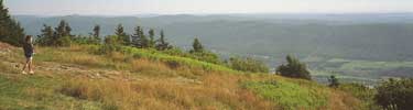
Appalachian Trail on Mount
Greylock, MA - NPS photo
 Massachusetts
| On March 14, 2010 the Eastern Native Tree
Society and Western Native Tree Society switched from
discussion lists on Google Groups to a new discussion
list in a Bulletin Board format at:
http://www.ents-bbs.org/index.php
Posts made since the inception of the BBS on March 14,
2010 will be sorted and archived on the BBS. Click on
the link to go to the equivalent section on the new BBS.
This website will continue to serve as a front end for
the ENTS and WNTS groups. It will continue to serve as a
repository of older posts, and will serve as the host
site for special projects and features that are not well
suited for a BBS format. Please visit the BBS for the
latest information and trip reports. |
Field Trips & Reports
-
My tallest eastern Massachusetts white pine
measured to-date Edmund Hill Woods is a tract
of conservation land in Northborough, Mass., a swampy section of
the woods with a slope on one side is dominated by white pine.
The site is fairly exposed to west and north wind, as a result
the pines are pretty ragged looking up top. One pine in
particular stands out for having the largest diameter in the
grove, I...
more » Mar 12, 2010.
-
Conway State Forest Hello Ents - I've been doing
some hiking in the Conway (Mass) State Forest (CSF), enjoying
the flora and fauna but also with an eye towards locating
veteran trees. I believe I may have found a stand of hemlocks
and oaks on a steep ravine slope which may have spared them from
the loggers craft for a few (human) generations. The CSF has
been logged...
more » Mar 7, 2010.
-
Southwick,MA sugar maple ENTS. On the way to the
transfer station today I spotted on the side of route 202/10 a
sugar maple. Went home and got the measuring equipment. 19' cbh
@ 90' high. Will stop later for some pictures. Sam March 4,
2010.
-
Historic landscape in MA #2 More on Prexy's Ridge - I
realized I was rushing when I sent that and forgot to include
the information that Tony D'Amato had taken cores of some of the
trees there 5 years ago when we were fighting a proposal by
UMass to build a dorm on the top of the hill into the trees; and
also that I'd forgotten to...
more » Feb 25, 2010.
-
Historic landscape in Massachusetts Bob will remember the old
trees on the UMass Amherst campus (he measured one of its old
black birches last winter and has looked at the trees in other
years). The area is called Prexy's Ridge because the university
president's house was on the same ridge (it's now the
chancellor's house). Some of the trees growing on the ridge are
more than 200 years...
more » Feb 24, 2010.
-
Loupinski Farm Conservation Area We explored the
conservation/ wildlife preserve area off Honey Pot Road in
Southwick/Westfield MA over the last 2 days. The area is
small overgrown fields most near the road, wetlands and
possible old wood lots, alot of doubles and triples in the
area and more recent signs of activity. The area is a
mixture of white pine, hemlock, black birch and maybe black
locust. There are some oak, white birch, shagbark hickory
and a few pitch pines. The white pines range up to 100' high
and 10' 8" cbh. Hemlocks 100' high 6'5" cbh. Black birch up
to 80' high 6'3" cbh. If they are black locust they were up
to 70' high 6' cbh. Most of the pitch pines were near the
road and up to 70' high 6' cbh. We covered about 80 +% of
the area. Sam...
more » Feb 22, 2010.
-
Honey Pot Road Bob, Gary, Bart, did you
see the shag bark hickory on the side of the road near the
horse farm when you were nearby? 71' high 9' cbh. Sam
Feb 22, 2010.
-
Great Brook watershed revisit We went back today and
concentrated on measuring pitch pines. On the east side we found
one of the pitch pines at 6'5" cbh and 75' high. I had no luck
finding any pitch pines over 85' high. On the east side I
measured a white pine at 114' high, 9'6" cbh. Sam Feb
20, 2010.
-
Great Brook watershed ENTS. Over the past 2 weeks my
wife and I made 5 trips into the watershed of Great Brook which
contains 4 wells for W.Springfield, MA Water Works.
W.Springfield owns 375 acres and most of the acres are in
Southwick,MA and border Westfield,MA. I don't know at this point
how many total acres in this area are under the control of the
Southwick Conservation Commission. We explored about 75% of the
area, alot of the areas not explored were covered with young
growth. What I will call the west side of the brook area is
mostly white pines, biggest 10' cbh about 70' high, oaks,
nothing over 80" high or 10' cbh and many, many pitch pines,
many in groves and one plantation. On the east side is more a
mixture of white pine, biggest 104' high 11'11" cbh, pitch
pines, oaks and black and white birch. Now the pitch pines! The
largest cbh we saw and there was alot in this range was 6'. I
know there are some pitch pines in MA over 100' high so I didn't
pay much...
more » Feb 20, 2010.
-
Westfield, Ma pitch pine ENTS. 70' high, 9'6" cbh.
Pictures on the dark side, late in the day, Sam Feb 18,
2010.
-
Southampton, MA trees First email was the sugar
maple. This should be the white pine. Sam Feb 18, 2010.
-
Southhampton,MA ENTS, Checked a old cemetery
on Fomer Road in Southampton and measured what might be a double
White pine, see picture, 95' high, 12'9" cbh. On the way back we
measured a sugar maple at 84' high, 16'7" cbh, second picture. I
saw a tall pine on the bank of the new intake reservoir area of
the Manhan River and stopped to measure it. Had to go down a
bank and just before I found a good spot to shoot it I slipped
on snow covered ice. I got the shot, 134 + feet!, and went back
to the road. The fall must have rattled my brain because I found
a better area to shoot it. Turns out I shot the base of one tree
and the top of another. It ended up 110' high. Sam...
more » Feb 18, 2010.
-
Westfield,MA trip ENTS, while on the way to a
geocaching/ hiking/ tree hunt today I passed by a pitch pine in
a yard. It looked like no one was home and it was just a few
feet off the treebelt so we parked on a side street and I
measured it at 65' high and 9'.6" cbh. It was a real nice
looking pine even with a big U cutout for powerlines. The
geocache was in a white pine,black birch, white birch and oak
forest. Most were short of 100' and up to 6' cbh. One white pine
was 104' high and 10'2" cbh. I totally missed seeing in my hunt
for a geocache and tall pines a grove of tulip trees! I got a
reading on one tulip at least 104' high and another tulip at
9'3.5" cbh. Sam...
more » Feb 17, 2010.
-
Fowl Meadow, Blue Hills Reservation, Milton
MA Continuing my measuring
activities in the DCR Blue Hills Reservation Milton, in
eastern Massachusetts. To re-cap, the reservation is
primarily rocky uplands but there are lower areas on the
edges of the reservation that produce the tallest trees for
the area. In a previous report I recorded a max height for
the reservation, a 121' white pine...
more » Feb 15, 2010.
-
Drake/Sodom mountains Gary, ENTS, I decided on a
change of pace today and checked out the mountain bike approach
to Drake Mountain but I think I will approach it from Honey Pot
Road area. I think I can do some of it from the back roads of
Granville. I then parked across from the Granville Gorge and we
hiked up the northeast slope of Sodom Mountain a short distance
to a trail following the lower slope east to S. Loomis Street.
The forest is made up of oak, white birch, black birch and alot
of hemlocks. I was hard pressed to find anything higher then 100
feet or more then 7 feet cbh. I saw no pitch pines or maples. I
did find and measures one tulip tree, about 100 feet high and
6.6 feet cbh. The tulip was at the head of a small ravine. There
was a deeper ravine but I will have to revisit it. We could see
signs of older and newer logging in the area. The picture shows
Charlie at the base of the tulip. Sam...
more » Feb 14, 2010.
-
Sodom Mountain Gary, while we were on the
Forest Park trip you asked about Sodom Mountain in
Southwick/Granville and possible old growth in some of the
ravines, do you have any rough idea where some of them may
be? I may head up there in the next few days. Thanks, Sam
-
Forest Futures Vision Process Hi all, I have
participated as an Advisory Stakeholder Group member in the
process and was just reading your conversation online. I
completely agree with protecting as much land as possible as
parklands and reserves. I hope that Commissioner Sullivan
will take your expertise and passion for our forests...
more »
Nan Finkenaur
Feb 10, 2010
-
My comments on the TSC meeting in Amherst
I found it less then satisfactory. I found
the start was handled well by the committee but when they
asked for questions to clarify some of the points brought up
so far it went down hill. Instead of clarifying questions
the audience tried putting their personal agendas on display
including subjects beyond the scope of the TSC. They broke
up the audience into groups with a moderator for each group
to discuss the 10 points before the final question and
comments period. There was so much background noise from not
only the group meetings but from people just waiting around
for the final period. Unless you were close to the speaker
you could not hear anything. We started to leave at this
point but not before I spoke to the DCR Commissioner Rick
Sullivan about the noise. He agreed about the noise here and
at the other meeting but they were following guidelines set
up by UMASS. Many of the people just waiting around he
recognized from the other meetings...
more » Feb 10, 2010.
-
buckland sf larch John: We had the same snow
storm in West Virginia as they did in the DC area and I lost
both electricity and internet access for four days. I had
written the following e-mail just before we lost power and I
was unable to send it. I hope it is not too late at getting
posted. In Shelburne Falls at the intersection of Route 2
and 2A there used to be...
more » Feb 8, 2010.
-
future forest plan for MA Bob: You have passed on some
very good information and documentation of the effort and detail
being done to plan the Massachusetts forests for a possible 100
year horizon. I wanted to pass on the link below about some
studies that have been taking place at Walden Woods using 150
year old records created by Henry Thoreau....
more »
Feb 5, 2010.
-
Mystery tree revisited ENTS, Aw shucks folks, I think
it is a pitch pine after all. Gary, Bart, and I went to
photograph the tree and check its physical characteristics
against the list that our fellow and lady Ents gave us. Our
conclusion is pitch after all. The tree is large at 8.8 feet in
girth and not tall at about 71 feet. However, the tree didn't
have resin blisters nor give off any special scent. Its cones
looked like pitch the more we looked. We examined more foliage
and at first thought we'd found a pattern of twos and threes on
the needle fascicles, but on closer examination, the twos
probably represented lost needles. Sorry for all the fuss....
more » Feb 5, 2010.
-
Deciduous European larch John: I headed out to Buckland
State Forest today after my third meeting ended. My second
meeting was a training by the USDA on the Asian Longhorned
Beetle. The tunneling by beetle larvae girdles tree stems and
branches and repeated attacks lead to dieback of the tree crown
and, eventually, death of...
more » Feb 4, 2010.
-
Gary, Bart, and Bob Show ENTS, Today Gary Beluzo, Bart
Bouricius, and yours truly headed out to look for tuliptrees in
the Russell, Southampton, Westhampton, etc. areas. We examined
the Westfield mystery tree first. I'll over that topic in
another email. We then went to a Division of Fish and Wildlife
site off Honeypot Road that was supposed to have tuliptrees. We
didn't find any. So we switched gears and decided to look for
pitch pines....
more » Feb 4, 2010.
-
Two recommendation for a response to the TSC
draft Bob: I thought it perhaps best
that I separate out these two recommendations from the general
discussion. This first statement would apply to lands in all
three classifications: Although our organization focuses on
native trees, we also appreciate the value and beauty of certain
non-invasive exotic species...
more » Feb 3, 2010.
-
Robinson State Park newsletter 2/2/10 Bob, Gary, ENTS, Did you get
this newsletter? They talk about Robinson SP Day on 6/19/10.
There is also an inline attachment from MA Forest & Park Friends
Network about Forest Futures vision Process. Sam Feb 3,
2010.
-
Forest Visioning Plan: Green Certification Bob, If you want to know what
other states with a well-established timber industry are doing
with regards to green certification: * *Wisconsin DNR is dual
FSC/SFI certified while DNR managed private lands are FSC:
[link] * Michigan DNR is dual FSC/SFI certified:
[link]...
more » Feb 3, 2010.
-
Forest Visioning Plan
Because of the short time I have to respond to the TSC
draft, I need to speed up the review process of Forest
Futures . Instead of dealing with the TSC draft report line
by line, time constraints dictate hitting the most important
themes first. So, I'm putting the big stuff on the table all
at once....
more » Feb 3, 2010.
-
Starting the review of Forest Futures ENTS, It appears that from a
conceptual standpoint, the partitioning of DCR forests into
woodlands, parklands, and reserves is acceptable to most of you,
i.e. you acknowledge that the idea has merit. One and maybe two
of you seem to be saying no partitioning - all to parklands and
reserves. Clarifications would be appreciated. Again, I'm only
referring to the concept. The details come next. We will address
TSC's recommended acreages for each partition, and after that,
what can and cannot be done in each partition. If I understand
the responses to the partitioning so far, I would categorize
them as follows. Please correct me if I'm wrong....
more » Feb 2, 2010.
-
Today in Stanley Park Westfield, MA Bob/Gary/ENTS, I know you have
measured alot of trees in the park but have you measured any on
the west side of the brook, the area off Granville Road? We
found a maple or oak today and measured it at 15' 5" and 90'
high. I will download 2 pictures of that tree and 2 of a pine
and grape vine. Sam...
more » Feb 1, 2010.
-
Forest Futures Process analyzed The
TSC recommends 3 types of forest properties on DCR lands:
woodlands, parklands, and reserves. Basically, woodlands would
be actively managed for timber. Parklands would be managed for
recreation, and the reserves would not be managed, but left to
natural processes. This sounds simple enough, but there are gray
areas. Presently, DCR manages 308,323 + 105,272 acres of
forests. The 105,272 are watershed lands. The rest is state
forests, reservations, and parks. The following statement
established the TSC vision of woodlands, parklands, and
reserves. The TSC vision presently does not address watershed
lands. Here is the actual vision statement formulated as a
recommendation....
more » Jan 30, 2010.
-
Tough life for a tree On a hike near the
Southwick, MA town sandpit the other day my wife spotted
this birch. Its growing over cinder blocks, a burnt beam
from the nearby burnt building and 3 or 4 of its exposed
roots crewed thru by a beaver. She wants to stop back later
to see if it is still living. So far I would say it is.
Sam...
more » Jan 30, 2010.
-
Starting the review of Forest Futures
At the beginning of the draft report, the TSC presents its
vision of the future forests of Massachusetts. Quoting: " Key
Elements of the Vision for Massachusetts Forests in 2110 147 148
The vision for the year 2110 contemplates more than half the
land area of the Commonwealth 149 will remain in forests, with
large blocks of reserves surrounded by parks and woodlands
actively...
more » Jan 29, 2010.
-
Forest Futures Project
Joint ENTS project ENTS, Last year a project was
launched by the Department of Conservation and Recreation (DCR)
here in Massachusetts called Forest Futures. It was to be a
visionary undertaking involving forest experts and stakeholders
who would come together and develop a common vision for the
future of our forests, recommend improvements to existing
systems, regulations, and practices, and present the results to
the Commissioner of DCR. The period from now until February 22nd
has been established for public input. I am getting ready to
review the draft report released by The Steering Committee
(TSC). Many important issues are on the table, some highly
contentious....
more » Bob Leverett, Jan 28, 2010.
-
Cottonwood in Pittsfield,MA
There is a MA State Champion eastern cottonwood listed for a
small park on Columbus Street in Pittsfield,MA. Does anyone know if it is called Pitt
Park. Thanks, Sam Jan 27, 2010.
-
Forest, Laurel, and Turner Parks
Today Bart Bouricius
and I headed to Longmeadow Mass to visit several urban
parks. It was an exploratory mission. The first park we
visited was quite small. I can't recall its name. Bart ?
However, the park has about half a dozen pitch pines between
86 and 92 feet. Girths are all modest. Those trees gave me
hope of finding taller pines in the Longmeadow area. So we
moved on....
more » Jan 26, 2010.
-
Buckland SF site list
Bob, Tim, I returned to the BSF site to check the boundary
markings. I was relieved to confirm the entire grove is within
the marked boundaries -- marked by boundary markers on each side
(Cowls Lumber owns the adjacent property) and with a stone wall
as a monument. The site is in the lower right corner of...
more » Jan 24, 2010
-
More Norway Spruce Buckland State
Forest I returned yesterday to the site at the
Buckland State Forest where I recently measured a Norway Spruce
to 130'. In my previous post I noted the site had rich
potential. I was curious about the extent of the Norway spruce
area, and whether I would find any red spruce alive among the
many skeletons....
more » Jan 23, 2010.
-
Chestnut Run, Blue Hills Reservation, Milton, MA
01/22/10 Chestnut Run is a brook that
runs east through an area on the northern edge of the Blue Hills
Reservation. Woods adjacent to the lower part of the brook near
Unquity Road have some of the tallest trees found in the
reservation. These are not exceptional trees for New England but
are good for the immediate Boston area. A white pine grove on
the edge of...
more »
Jan 22,2010.
-
Buckland MA big tree site John: There are a couple
of places in Buckland that could have some very tall Norway
spruce and some unusually tall red pine. If you have never
visited the Buckland Recreation area along Rt 112 I would
encourage checking it out. The area also sports some very
nice white pine and other trees along some...
more » Jan 21, 2010.
-
Norway Spruce find Hi Bob, ENTS: I have been
checking out a new site in the Buckland State Forest just
outside Shelburne Falls. I like having so many nice forests
nearby. This site is kind of high up a series of hills that
rises up from the Deerfield River downstream of the Falls.
It is known to me as the site of the "Charter Oak" as I have
heard it called, which is a 5 or 6...
more » Jan 21, 2010.
-
Today at Robinson State Park
Parked at the Westfield/Agawam line and followed a powerline down to the
river, its not as steep as the M+ M Trail that's here. This
part of Robinson State Park is only a few hundren feet wide
on both sides of Route 187. I expected to see some big trees
along the bank of the Westfield River but the biggest was a
white pine at 10'6" cbh, 100+. We followed a old road back
up to the road near the hamburger/hot dog stand, GOOD hot
dogs, on route 187 and measured a white pine on the ridge
above the other white pine, 9' cbh 108+ high.There are alot
of white pines here in this size range.We walked back on 187
past the car and back into the park. We followed the ridge
above the river to this end of the park. The Westfield River
is about 100 feet below the ridge and most of the trees on
the bank are hemlocks in the 4 or 5 feet cbh 85+ range. At
the end of the ridge we went back down to the river and walked
down stream back towards the car. Jan 20, 2010.
-
Will Blozan in Massachusett
My friend Will Blozan and family has been visiting Monica and me
over the past several days. I thought I'd put together a brief
photo chronology of his visit. On Monday Will and I headed for
MTSF. I wanted to make use of Will's eagle eye. He quickly sees
what takes me time to sort out. The first assignment was to
eyeball some of the Pocumtuck Pines for missed opportunities. The Pocumtucks are a
crowded grove. The first image, Image WillInPocumtuckPine.jpg,
shows brother Will next to a 149.1-foot tall, 8.9-foot girth
white pine. This handsome beauty will likely join the ranks of
the 150s at the end of this year's growing season. I took this
image while standing in a leech field. We decided to name the
tree the Poopy Pine....
more » Jan 19, 2010.
-
Tree Climbing Eastern MA -
This morning I watched a really nice video of a climb of a white
pine in eastern Massachusetts by Andrew Joslin. Gnarly white pine -
Climbing a tree with character, White Pine, eastern
Massachusetts, height 109.36ft. , circumference 9.55 ft.,
January 18, 2010 - "Balmy winter climb in a venerable old pine
full of twisty deadwood and some nice limbs to hang a rope on. "
7:55 by moss TreeClimber (Andrew Joslin)
[link]...
more »
-
2 New England sites to look at? I
think I've come up with 2 potential sites for the New England
ENTS to look at. The first site is Island Grove Park in
Abington, MA. This site was used as a meeting place for
Abolitionists from 1846-1865; in the 1919(?) book on Historic
Trees of Massachusetts large White Pines are shown at this site,
and recent photos also show large White Pines but it's hard to
tell how big they are from these recent pictures. I wonder if
the ENTS could see how big and old these White Pines are Jan 17,
2010
-
Robinson State Park I
was in Robinson State Park today checking my skills with the new
laser against your measurements of the champion tulip. There
were 4 of them near each other and I forgot which one was the
champion. I was only getting 122 to 129 feet high. My wife and I
tried the 3 sides of the cove but couldn't get any better. We
worked our way down into the cove and I measured the biggest cbh
at 10'.3". January 17, 2010
-
Forest Park with Bart and Sam
Larry, The distribution of the
12-ft girth oaks is very sparse in the park. So far we've found
only three. Those three will get larger, but not necessarily a
lot larger. I haven't tried to map out the size distribution for
the oaks in Forest Park yet. But the vast majority will be from
7 to 10 feet around. On my next visit, I plan to take lots of
photos of the trees to provide a better feel for what's there
and what the trees looks like, age wise. None of the hemlocks
I've seen in Forest Park appear very old, somewhere between 120
and 160 years. None have developed flatten crowns or bark
characteristics of truly old hemlocks. The pines appear to
represent a range of ages from about 120 up to maybe 200 years
for a few, but most are under 200. Basically, the Park harbors a
scattering of older trees embedded in a younger matrix. It is
going to take time to sort out the age distributions. There are
a few much older trees scattered around. A few are sugar maples,
trees that probably reach 250 years, but nowhere that I've seen
so far do they for a stand. Lots of work to do....
more »
By dbhg...@comcast.net -
Jan 13, 2010
-
Weather, adelgids and what is being lost in the
forest I recently visited
Massachusetts and spent many hours walking around my
families' farm in Franklin County. The last time I spent
much time walking around my native territory prior to this
trip, the HWA had not yet arrived. The first thing I noticed
was a nearly complete absence of healthy...
By forestr...@aol.com -
Jan 9, 2010
-
Buckland State Forest & Norway Spruce January 24, 2010
-
Forest Park in Springfield
January 5, 2010
-
Magical morning
Mt. Holyoke Range December 26, 2009
-
The Special Public Forests of Massachusetts - video
http://vimeo.com/8369352
December 24, 2009
-
Pine Hill Surprise Catamount State
Forest - Dec 21, 2009
-
Rocky Mountain Park, Greenfield MA
December 21, 2009
-
One more photo of the grandfather Pine
December 9, 2009

-
Photo of the Grandfather tree
December 8, 2009
-
West Springfield, MA trees December
7, 2009
-
Thoreau Pine Climb - music video
December 7, 2009
-
Settling the issue on Thoreau
December 6, 2009
-
Andrew Joslin and Henry David Thoreau
December 4, 2009
-
120' Eastern Hemlock survey December
3, 2009
-
Sunderland Sycamore is on Wikipedia
Nov 30, 2009
-
Tall Silver Maple Arnold Arboretum
Nov 28, 2009
-
more 140's Nov. 23, 2009
-
Japanese stiltgrass in MA Nov. 23,
2009
-
Continuing the mission Nov. 21, 2009
-
Meet the Neil Pederson Pine Nov.
19, 2009
-
Trout Brook Ramble Slideshow Nov. 17,
2009
-
Dunbar Brook
Promising pine Nov. 16,
2009
-
Photos of Forbes Woods Milton Mass. cherry
Nov. 16, 2009
-
Forbes Woods, Milton, Massachusetts 11/15/09]
correction Nov 14, 2009
-
Catamount update #3 Nov. 14, 2009
-
Forbes Woods, Milton, Massachusetts 11/15/09
Nov. 14, 2009
-
Dunbar Brook Monroe State
Forest Nov. 11, 2009
-
Catamount update #2 Nov. 10,
2009
-
Oak bark characteristics Nov.
10, 2009
-
A Great Tree - Mt. Tom Hemlock
Nov. 10, 2009
-
Fitzgerald Lake
Evening reflections Nov.
10, 2009
-
Dendrology - the study of trees, # 1
Nov. 8, 2009
-
Catamount -- a further look
Nov. 8, 2009
-
Arms/Audubon site in Shelburne Falls
Nov. 7, 2009
-
Great Trees protected in a Massachusetts
Forest Reserve Nov. 7, 2009
-
ENTS site visit in the Monroe State Forest with
Bob, John, and Julia Nov. 7, 2009
-
Look Park Nov 6, 2007
-
Catamount State Forest Nov. 6,
2007
-
From earth to earth Nov. 2, 2009
-
Hophornbeam the Ironwood of the Northeast
Nov. 2, 2009
-
Ironwood tree Oct. 31, 2009
-
ALB in Worcester MA Oct.
27, 2009
-
Back to Tim Oct. 27, 2009
-
Old growth red spruce located in a National
Natural Area Mt. Greylock - Oct. 18, 2009
-
Bear Hole Area hike. Oct. 17, 2009
-
big Shelburne white pine Oct. 17,
2009
-
Shelburne, MA foray Oct. 16, 2009
-
Photos of logging near tomb, Chester MA
Oct. 15, 2009
-
Recent hikes (Chester, MA etc.)
October 14, 2009
-
Purgatory Chasm's surrounding forest
Oct. 14, 2009
-
Dunbar Brook travelogue Oct. 14, 2009
-
Eastern Cottonwood, West Roxbury
Oct. 13, 2009
-
Nice chestnut Oak, Boston, Mass. Oct.
13, 2009
-
Seal in ocean Oct. 13, 2009
-
16' 4" CBH Sugar Maple in Franklin Park, Boston,
Massachusetts Oct. 13, 2009
-
Morning moods - Cape Cod National
Seashore Oct. 13, 2009
-
Tilted ocean Cape Cod - Oct.
12, 2009
-
Atlantic ocean Cape Cod -
Oct 11, 2009
-
Visiting the Thoreau Pine Oct. 9,
2009
-
Lee's New Pine- Monroe Stae
Forest Oct. 5, 2009
-
Ashburnham church Sept. 27, 2009
-
Watatick
(WNTS) Sept. 25, 2009
-
Ashburnham spruce Sept. 24, 2009
-
Skinner State Park September 20,
2009
-
Petticoat Hill September
18, 2009
-
Hillside Nurseries Oak Sept
18, 2009
-
Photo Documentation of Forest Sites - Back to Bob
September 17, 2009
-
Sugar Loaf Conn. River
Valley Sept. 17, 2009
- Taconic State Park
Doug fir September 15, 2009
-
Bashbish Mountain and Falls
September 14, 2009
-
Bryant Homestead September 11,
2009
-
Our front yard September 8, 2009
-
Ice Glen September 1, 2009
-
Arnold Arboretum Silver Maple height discrepancy
September 1, 2009
-
Gary and Bob in Dunbar Brook
September 01, 2009
- Bare Mountain
Hickories August 28, 2009
- Ashburnam Norway Spruce
Gonna grab you August 28, 2009
-
Ashburnham Norway Spruce
August 28, 2009
-
Mount Tom and Red Pines August 28, 2009
-
Ashburnham Norway Spruce MA August 28, 2009
- Dunbar
Brook 3 MA August 21, 2009
-
Gorgeous Sugar Maples August 20, 2009
-
Katydid and Grasshopper in White Pine Canopy, MA
-
Dunbar Brook White Pine Climb August 19 2009
- Dunbar
Brook MA August 18, 2009
-
Geology of Todd and Clark Mountains, MTSF, MA August 12,
2009
-
Negus the Big Little Mountain MA August 7, 2009
-
Mount Greylock Sortie MA August 4, 2009
-
Mount Greylock Hopper MA August 3, 3009
-
Requiem for a red spruce MA August 2, 2009
-
Old Growth
Awareness in MN and MA July 31, 2009
-
Mount Tom Adventures MA July 30, 2009
-
Dwarf Chinquapin Oak, Arnold Arboretum, MA July 26, 2009
- More
Look Park MA July 25, 2009
-
Look Park Northampton MA July 23, 2009
- Graves Farm MA July 19
2009
-
Legacy
Trees of Mount Tom, MA July 16, 2009
- Presentation
to MA Technical Steering Committee of the Forest Futures
Visioning Process July 14, 2009
- TreesPlease, Great Barrington, MA June 27, 2009
http://groups.google.com/group/entstrees/browse_thread/thread/c3735c7a3cbd44f2?hl=en
- The Working Forest - Harvard Forest April 21, 2009
http://groups.google.com/group/entstrees/browse_thread/thread/b85cf75106f22f8d?hl=en
- Great Blue Heron Rookery Davenport Pond in north
Petersham.
April 16, 2009
- Eastern Cottonwood, West Roxbury
March 15, 2009
- HWA confirmed in
Shelburne
http://groups.google.com/group/entstrees/browse_thread/thread/44ac7052e1e6aa2c?hl=en
March 10, 2009
- Amherst and Hadley MA
Some more local trees
Feb 22, 2009
- American Hollies in MA
Feb
11, 2009
- DAR Forest Goshen, MA - Day Hike Report
Feb 06, 2009
- Barton Cove, Gill, MA Tree Hunting Report
Feb
2009
- Howland Cemetary Pines, Conway, MA
Jan 2009
- Concord White Pines
Jan
2009
- Broad Brook - Backyard Bounty
Jan
2009
- Deerfield MA - Rewind and a few photos
Jan
2009
- Deerfiled MA -
First Day Out Hits Measuring Strikes Gold
Jan
2009
- ENTS and MA DCR Dec
2008
- Ice Glen Dec 2008
- Monica's tuliptree
Dec 2008
- Mt Tom Project MA
Dec 2008
- A Mini-Study, Child's Memorial Park, MA
June 2008
- Pin Oak Tells the Story,
Child's Memorial Park, MA June 2008
- Coastal
Retreat and an Elfin Forest: Cape Ann, Halibut Point
SP, Crane's Beech, MA April 2007
- Catalpa and Black
Willow March 2002
- Chester Center MA -
One Fine Home May 2008
- White Pine Growth Cold River MA
Nov 2008
- Connecticut River Valley Milestone Reached
Oct 2008
- Connecticut River Valley- Broad
Habitats Nov 2002
- Connecticut River
Valley July 2002, July 2003
- Connecticut River Black Oaks
Dec 2002
- Conway, MA - Yo Mama Pine
May 2006
- Deerfield- Cow
Pattie Cottonwood Sept 2003
- Deerfield
River near Shelburne Falls Nov 2003, Dec 2004
- Deerfield
River, Middle Section Feb 2005
- Deerfield and Deerfield
Elm Feb 2006
- Dighton MA
Tuliptree Jan 2007
- Dunbar Brook and Broad
Brook June 2007
- Dunbar Brook
hemlock July 2007
- Eastern
Massachusetts Gallery
2006 Steve Hewlett
- First Forest Summit
Field Work Oct 2003
- Franklin Park, Boston,
MA Aug 2006
- Franklin County - Liriodendron
in Franklin County, MA Jan 2007
Mount Tom
Robinson
State Park
http://www.friendsofrobinsonstatepark.org:80/
- Shelburne Area July 2003
- Shelburne Falls Dec 2004,
Nov 2005
- Smith Brook, MTF June
2004
- Southwick - MA Pignut
Champ Feb 2007
- Stockbridge 2004
- Templeton
- North Meets South in a Templeton MA Swamp Nov 2007
- UMASS Black Birch
Dec 2008
- Whatley Sycamore
- Pickking Up the Spares Jan 2007
- Weekend Follies (MTSF,
Monica's Woods, Look Park, MSF) May 2005
- Westfield
River Watershed Jan 2005
- Westfield
Gallery and Trip Report
Feb 2005
- Westfield, MA - Yo
Mama's Sister Pine May 2006
- Windsor State Forest Nov
2008
- William Cullen Bryant
Homestead July, Sept
2002, Sept 2003, Dec 2003
- Zoar Gap, MTSF Feb 2004

Miscellaneous Reports
- Using the GIS aerial photography taken by MA in 2001 and
2005. If you have a high speed connection- you can use
an online program called Oliver to view that photography and
vast amounts of other information as layers- in typical GIS
style. Just go to http://maps.massgis.state.ma.us/massgis_viewer/index.htm
|